Aerial Photography

Taxonomy

Code

Scope note(s)

Source note(s)

Display note(s)

Hierarchical terms

Aerial Photography

Equivalent terms

Aerial Photography

Associated terms

Aerial Photography

824 Collections results for Aerial Photography

824 results directly related Exclude narrower terms

WO76034-A

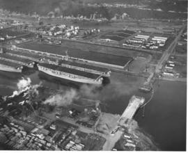
ca. 1953. This aerial view of the northeast section of the Tacoma tideflats from 1953 shows part of the Port of Tacoma, lower left, and the 185-acre Port Industrial Yard which was acquired by the Port in 1959. Five mothballed WWII baby flattops are moored in the Port Industrial Waterway. The incomplete Port Industrial Waterway bridge, later named the Blair Bridge, can be seen at the right. The bridge opened for traffic on November 14, 1953. The bridge is 712 feet long with a 40 foot roadway and 5 feet of sidewalk on one side only. It has a clearance at high tide of 12 feet. There is a 150 foot channel between the main piers for the passage of shipping vessels. The two main channel piers are 45 x 55 foot and house the operating machinery, counterweights and electrical equipment for opening and closing the span drawbridge. They are the equivalent in height, measured both above & below the water, to a seven story building. The cost of the bridge was $1,600,000. (TNT 11/13/1953, special section #D)


Aerial photographs; Port of Tacoma (Tacoma)--1950-1960; Aircraft carriers--Tacoma--1950-1960; Harbors--Tacoma; Aerial views; Blair Bridge (Tacoma); Port Industrial Waterway Bridge (Tacoma); Vertical lift bridges;
WO 146126-A

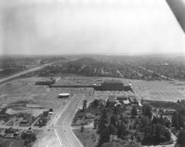
The Bon Marche was no longer the only occupant of the Tacoma Mall Shopping Center on the south side of Tacoma in October,1965 when this aerial photograph was taken. A full-line J.C. Penney's had opened at the southeast end of the large building complex and many smaller specialty stores had joined the two large department stores. Acres of free parking proved to be a major draw, and the enclosed mall design kept customers out of the wind and rain. The National Bank of Washington's circular building is prominent near the Mall; I-5 freeway, providing easy access to the Mall, runs along the photograph's left side. The Wapato Lake area is southeast of the Mall to the left of I-5, near the horizon. Most of the residential development surrounding the Mall has been converted over the years into commercial property.


Aerial photographs; Shopping centers--Tacoma; Bon Marche (Tacoma); National Bank of Washington (Tacoma); J.C. Penney Co. (Tacoma);

WO 148797-A

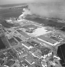
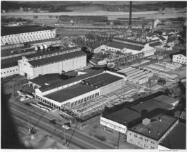
Smoke could be seen day and night billowing from the St. Regis Paper Co. facility on Tacoma's industrial Tideflats. Aerial view taken in late June, 1966, shows that the area continued to grow with new construction. St. Regis was located conveniently between the Puyallup and St. Paul Waterways. Photograph ordered by St. Regis Paper Co.


Aerial photographs; St. Regis Paper Co. (Tacoma)--1960-1970; Smoke--Tacoma;

RD23-3

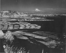
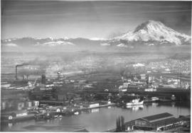
ca. 1943. Mount Rainier rises ghostlike above the Hylebos Waterway in this test photograph with the new infrared film. Log booms make designs in the water leading up to the Tideflats. Foliage has an eerie white glow. The photograph is believed to have been taken from the vicinity of the Cliff House.


Aerial photographs; Hylebos Waterway (Tacoma);

G55.1-092

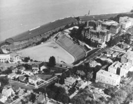
ca. 1971. This is an aerial view of the Stadium district as photographed circa 1971. Stadium Bowl is in the center with Stadium High School on the right and the Washington State Historical Society Museum on the left. Stadium Bowl, built in 1909, has been renovated circa 1980 and been subjected to several damaging mudslides in 1932, 1949, and 1981. It now has a modern capacity of 15,000, downsized from its original seating capacity of 23,486. Stadium Bowl was originally designed by Tacoma architect Frederick Heath. BU-11652


Aerial photographs; Aerial views; Neighborhoods--Tacoma--1970-1980; Stadium Bowl (Tacoma); Stadium High School (Tacoma); Washington State Historical Building (Tacoma);

A41825-3

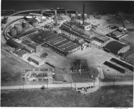
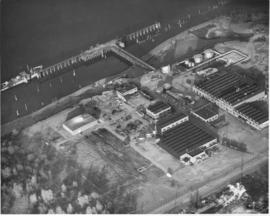
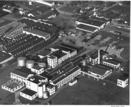
Pennsylvania Salt manufactured the following chemicals: chlorine, caustic soda, sodium hypochlorite, bleaching powder, hydrogen, sodium arsenate, dairy and poultry germicides, special chemical cleaners and laundry and dry cleaning products. Frederick C. Shanaman was the President and General Manager of the company. Aerial view of the Tacoma plant, located at 2901 Taylor Way, in Tacoma's tideflats, near the Turning Basin, which is now known as the Hylebos Basin.


Chemical industry--Tacoma--1940-1950; Chemicals; Industrial facilities--Tacoma; Aerial photographs; Aerial views; Waterfronts; Pennsylvania Salt Manufacturing Co. of Washington (Tacoma);

A41825-5

Aerial view of Pennsylvania Salt Manufacturing Company facilities in Portland, Oregon. President Fred C. Shanaman reported that with the addition of the new facilities for manufacture of chlorine, caustic soda and technical DDT, production at the Portland plant increased substantially in 1947.


Chemical industry--Oregon--Portland; Chemicals; Industrial facilities--Oregon--Portland; Aerial photographs; Aerial views; Waterfronts; Pennsylvania Salt Manufacturing Co. (Portland, Or.);

A45518-4

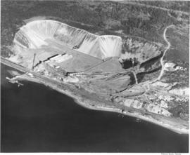
This aerial photograph of the Pioneer Sand and Gravel Company gravel pit was taken in November of 1949. The large gravel pit was located in Steilacoom adjacent what is now University Place; their offices were in Seattle, at 901 Fairview Avenue North. The company specialized in sand, gravel, building materials and "Tru-Mix" concrete. Some years later the pit and the land surrounding it became part of Chambers Creek Properties. In June of 2007 the $21 million Chambers Bay Golf Course opened on this site. TPL-10540


Industry--Steilacoom; Sand--Steilacoom; Digging--Steilacoom; Waterfronts; Harbors--Steilacoom; Sandstone quarrying--Steilacoom; Industrial facilities--Steilacoom; Aerial views; Pioneer Sand & Gravel Co. (Steilacoom);

A43866-30

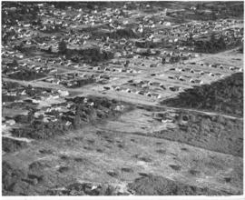
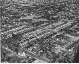
Studio stock negatives. An aerial view of new housing developments. Uncleared land abruptly abuts the housing development. Across the road in the foreground are a few small homes set on what looks like pasture land.


Aerial photographs; Land; Land use--Tacoma--1940-1950; Housing developments--Tacoma--1940-1950;

A43866-31

Studio stock negatives. An aerial view of new housing developments in Tacoma during the late 1940's.


Aerial photographs; Land; Land use--Tacoma--1940-1950; Housing developments--Tacoma--1940-1950;

A43866-27

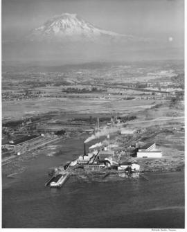
Studio stock negatives. A view from over Commencement Bay, the Tacoma tideflats with the St. Regis Dock and St. Regis Company with Mount Rainier looming in the distance.


Aerial photographs; Land; Land use--Tacoma--1940-1950; St. Regis Paper Co. (Tacoma)--1940-1950; Rainier, Mount (Wash.);

D43866-22

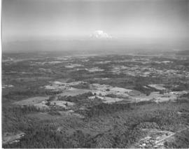
Studio stock negatives. An aerial view of rural Pierce County with open and wooded areas. Small groupings of buildings are dotted over the area. Mount Rainier is seen above the mist.


Aerial photographs; Land; Rainier, Mount (Wash.);

D43866-25

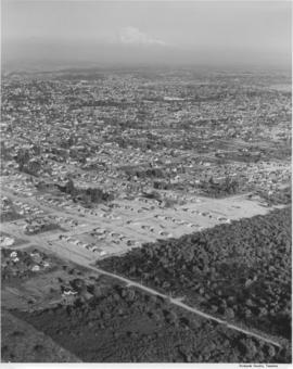
Studio stock negatives. An aerial view of residential neighborhoods in Pierce County. New housing developments with no or few trees are in the foreground.


Aerial photographs; Land; Land use--Tacoma--1940-1950; Housing developments--Tacoma--1940-1950;

D43866-15

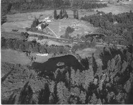
Studio stock negatives. An aerial photograph of a rural area with a highway running across it. A woods and lake are seen on the lower half while several buildings around a cleared area are seen above.


Aerial photographs; Land;

D43866-26

Studio stock negatives. Aerial view of new housing tract development.


Aerial photographs; Land; Land use--Tacoma--1940-1950; Housing developments--Tacoma--1940-1950;

D43302-1

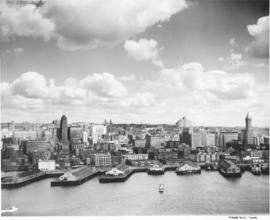
Aerial of Seattle skyline taken from above Elliott Bay. Piers jut into the bay with warehouses on them. Smith Tower is the taller building on the right. TPL-4749


Aerial photographs; Cityscapes; Skyscrapers--Seattle; Piers & wharves--Seattle; Harbors--Seattle; Smith Tower (Seattle);

A52678-1

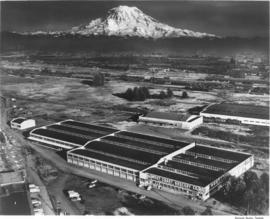
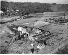
This aerial view of part of the sprawling St. Paul & Tacoma Lumber Company complex with Mount Rainier in the background dates from September of 1950. St. Paul & Tacoma with its many buildings, smokestacks and burners was located in the southwest section of the Tacoma tideflats near the Puyallup River; their headquarters were at 1220 Saint Paul Avenue. The white bridge near the center of the image crossing the channelized Puyallup River is the Lincoln Avenue bridge. Two railroad bridges and the Pacific Highway (U.S. Hwy 99) bridge can be seen further up the river.


Aerial photographs; St. Paul & Tacoma Lumber Co. (Tacoma); Cityscapes; Lumber industry--Tacoma--1950-1960;

C50632-1

Copy of aerial view of West Coast Grocery Company with Mount Rainier in the background. West Coast Grocery was an outlet for national and local brand foods to be shipped throughout the Pacific Northwest, Hawaii and Alaska. The company had served Tacoma and Alaska since 1887. Their brand name, Amocat (Tacoma spelled backwards), was a guide to shoppers to quality food products. Ordered by West Coast Grocery, Chet Chumington. (TNT, 2/13/1951, p.C-2)


Aerial photographs; Commercial facilities--Tacoma; West Coast Grocery Co. (Tacoma); Business enterprises--Tacoma--1950-1960; Storehouses--Tacoma; Rainier, Mount (Wash.); Mountains;

A50135-3

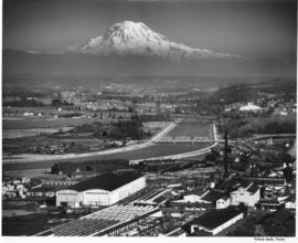
Scenic view of Mount Rainier beyond the Tacoma tideflats. City Waterway (later renamed Foss Waterway) lies in the foreground with Centennial Flouring Mills on the lower side of it and Uion Oil with their "76" storage tanks, Shell Oil, Northwest Door Company, and Richfield Oil lining the opposite side. The Puyallup River zig-zags into the distance beyond the smokestacks of St. Paul & Tacoma Lumber Company. This photograph was taken using an aerial camera. TPL-9862


Aerial photographs; Rainier, Mount (Wash.); Storage tanks--Tacoma; Tacoma Tideflats (Tacoma); Industrial facilities--Tacoma--1940-1950; Waterfronts--Tacoma;

D50606-2

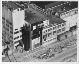
An aerial view of the Feltrok Insulation Manufacturing Company taken at 7 p.m. June 9, 1950. The company was located on the Tacoma tideflats. Pennsylvania Salt Manufacturing Company is seen on the right. Feltrok was purchased by the American Rock Wool Corporation in 1952. About 35 persons were employed in the Tacoma operation at that time. (Tacoma Reporter, 7/21/1952, p.3)


Aerial photographs; Feltrok Insulation Manufacturing Co. (Tacoma); Industrial facilities--Tacoma--1950-1960; Pennsylvania Salt Manufacturing Co. of Washington (Tacoma);

D50612-1

An aerial view of St. Paul and Tacoma Lumber Company. Colonel Chauncey Griggs, Addison Foster, Henry Hewitt, Jr. and Charles Hebard Jones purchased 83,000 acres of timber in 1888 from the Northern Pacific Raillroad company in the largest purchase of timberland in the nineteenth century. Then they built a giant sawmill on "The Boot", a low island off the main tideflats, bordered by branches of the Puyallup River and Commencement Bay. They built the first standard-guage logging railroad and introduced the band-saw to Pacific Northwest lumber operations. They built the St. Paul & Tacoma Lumber Company. (The Mill on the Boot, Murray Morgan)


Aerial photographs; Lumber industry--Tacoma--1950-1960; St. Paul & Tacoma Lumber Co. (Tacoma);

A49811-7

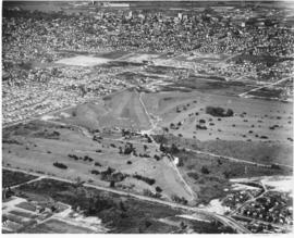
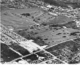
An aerial view of Allenmore Golf Course that includes the residential neighborhoods around the golf course. In the background can be seen the taller buildings of the Tacoma business district and beyond that, Commencement Bay.


Allenmore Golf Club (Tacoma); Golf--Tacoma--1950-1960; Sports & recreation facilities--Tacoma; Aerial photographs; Land use--Tacoma;

A49811-2

Aerial view of Allenmore Golf Course. The club house is seen in the middle of the large, newly landscaped golf course. The fairways are seen switch back style through the foreground and far background. New housing sub-divisions are seen across So. 19th Street.


Allenmore Golf Club (Tacoma); Golf--Tacoma--1950-1960; Sports & recreation facilities--Tacoma; Aerial photographs; Land use--Tacoma;

A53195-8

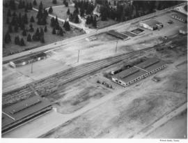
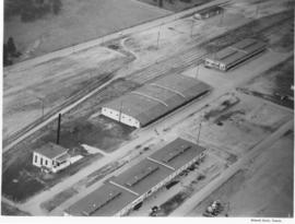
ca. 1950. Aerial view of the Lakewood Navy Yard, formally known as the Pacific Naval Advance Base; photograph taken probably in the fall of 1950. Rectangular one story buildings are scattered throughout the naval yard. Mountain View Cemetary lies across the street on Steilacoom Blvd.


Pacific Naval Advance Base (Lakewood); Lakewood Navy Yard (Lakewood); Aerial photographs; Mountain View Memorial Park (Lakewood);

A53023-1

Aerial view shows progress being made on new construction for the St. Regis Paper Company in September, 1950. Established as a company in 1899, St. Regis was open for business in Tacoma in 1928. Rebuilt and modernized in 1936, St. Regis bought additional acreage from the St. Paul Tacoma Lumber Company in 1947 to add a paper mill and multi wall bag plant. According to the St. Regis 1950 annual report, Tacoma's expansion of their pulp mill would enlarge the pulp capacity from 115,000 to 135,000 tons a year. The new capacity will be in production in 1951.


St. Regis Paper Co. (Tacoma)--1950-1960; Paper industry--Tacoma--1950-1960; Factories--Tacoma--1950-1960; Progress photographs--1950-1960; Aerial photographs;

A53024-1

Aerial view, 1000 foot elevation, of Sumner manufacturing division of Fleischmann's Yeast taken in September, 1950. Photograph taken at 5 p.m.; evening shadows start to creep over the large plant. Fleischmann's Yeast was part of Standard Brands, Inc., and is still sold in grocery stores today. Photograph ordered by Standard Brands' New York City office.


Fleischmann's Yeast (Sumner); Standard Brands, Inc. (Sumner); Aerial photographs;

A53195-1

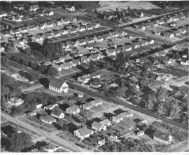
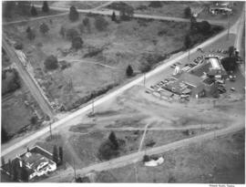
ca. 1950. This aerial view was taken probably in the fall of 1950. The Little Church on the Prairie is shown in the left hand corner; Lakewood Community Center is several hundred feet away to the right. Both structures came into existence roughly the same time; the Little Church on the Prairie was converted from a grocery store to a community church in 1938 while Norton Clapp founded the Lakewood Center in 1937, one of the country's first planned shopping centers.


Little Church on the Prairie (Lakewood); Lakewood Community Center (Lakewood); Aerial photographs; Aerial views;

A53468-131

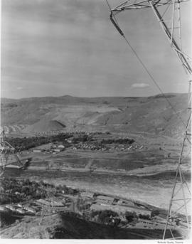
Scenic views from Eastern Washington. An aerial view of the town on the far side of the river and Grand Coulee Dam plant facilities in the foreground. A tower for delivering electric power from the plant is seen on the right as others climb the hill from below. Electrical energy generated at the power plant at 13,800 volts is stepped up to 230,000 volts for long distance transmission by groups of transformers. High tension lines from the transformers are carried on steel towers over the powerhouse and up the canyon walls to a switchyard, where facilities are provided for interconnecting generating units and transmission lines. (Grand Coulee from "Hell to Breakfast", Fred O. Jones)


Aerial photographs; Columbia River (Wash.); Utility poles; Hydroelectric power;

A53195-7

ca. 1950. Aerial photograph of the Pacific Naval Advance Base in Lakewood taken probably in the fall of 1950. Lakewood Navy Yard was the more familiar name used for the base. The U.S. Navy acquired the land to build its naval base in 1944; previously the land had been home to the Tacoma Speedway and the Tacoma Municipal Airport. Nearly twenty years later, Clover Park Vocational-Technical Institute opened their doors on part of the site. A glimpse of Mountain View Cemetery can be seen at the top of the photograph. TPL-9284


Aerial photographs; Pacific Naval Advance Base (Lakewood); Lakewood Navy Yard (Lakewood); Mountain View Memorial Park (Lakewood); Clover Park Vocational-Technical Institute (Lakewood);

A53195-13

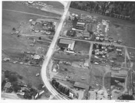
ca. 1950. Aerial view of Steilacoom Blvd. near South Tacoma Way was taken probably in the fall of 1950. Although houses and businesses dot the landscape, there was still plenty of room for expansion.


Aerial photographs; Commercial streets--Tacoma--1950-1960; Land--Tacoma--1950-1960;

Results 1 to 30 of 824