Identity elements
Reference code
Name and location of repository
Level of description
Item
Title
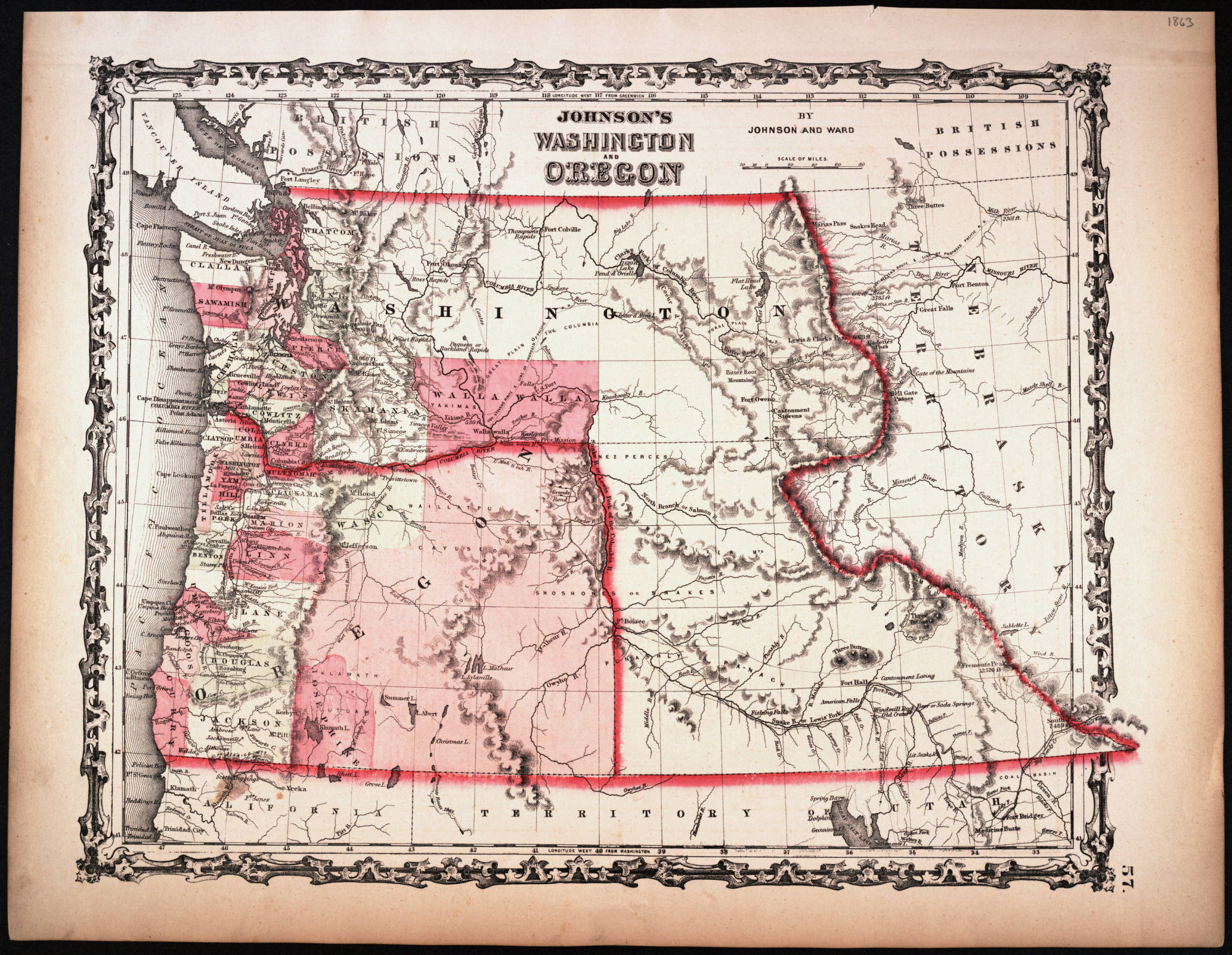
Johnson's Washington and Oregon, 1863
Date(s)
- 1863 (Creation)
Extent
Content and structure elements
Scope and content
New York: Johnson and Ward
1 map : hand col. ; 32 x 40 cm. Relief shown by hachures. Shows counties, cities, locations of native American tribal groups, and proposed railroad. Scale ca. 1:3,500,000 On verso: portion of "Historical and Statistical View of the United States, 1860", tables for Vermont, Virginia and Washington. In lower right margin: 57. Decorative border. Oregon counties Jackson and Josephine have been interchanged.
System of arrangement
Conditions of access and use elements
Conditions governing access
Technical access
Conditions governing reproduction
Languages of the material
Scripts of the material
Language and script notes
Finding aids
Acquisition and appraisal elements
Custodial history
Immediate source of acquisition
Appraisal, destruction and scheduling information
Accruals
Existence and location of originals
Existence and location of copies
Related archival materials
Related descriptions
Notes element
General note
Digitized by Washington State University, 2002.