Identity elements
Reference code
Name and location of repository
Level of description
Item
Title
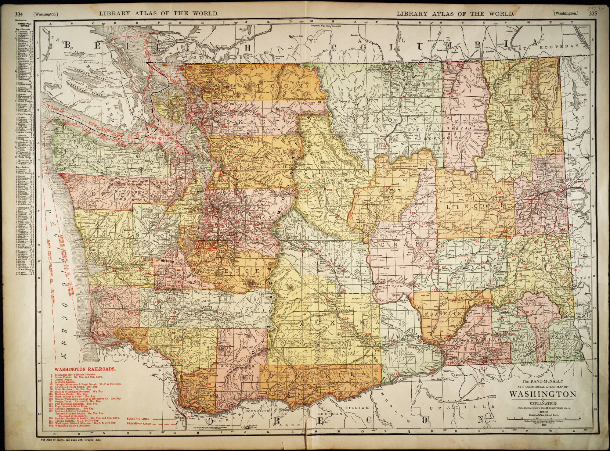
Rand McNally New Commercial Atlas Map of Washington, 1912
Date(s)
- 1912 (Creation)
Extent
Content and structure elements
Scope and content
Chicago : Rand McNally.
1 map : col. ; 48 x 66 cm. State capitals and County seats identified by symbols. A key to Railroads is located in the lower left. Shows Railroads and Steamship lines. Includes index of cities with a population of 1,000 or more. At top: "Library atlas of the world." Relief shown by hachures and spot highlights. Scale 1 in. = 15 miles [ca. 1:950,400].