Print preview Close

Showing 784 results

Collections
Richards Studio Photographs Aerial Photography Image With digital objects
Advanced search options
Print preview View:

D161890-3

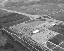
Aerial view of Kent-based Convoy Co. taken on May 1, 1972. Massive parking lot with hundreds of cars, easy access to major roadways. Railroad cars parked next to facility, many loaded with automobiles. Convoy Co. was located in Kent at 27430 - So. 72nd. Photograph ordered by the Convoy Co.


Aerial views; Convoy Co. (Kent); Automobiles--Kent;

D161273-27

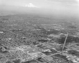
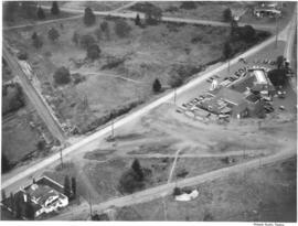
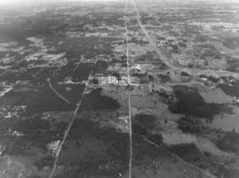
Aerial view of relatively unpopulated 112th & Meridian area, showing location of the future South Hill Mall. Abundance of trees cover the land, much of which was later developed. Hwy. 512 is curving road parallel to 112th. Photograph ordered by Puget Sound National Bank.


Aerial views; Neighborhoods--Puyallup--1970-1980;

D161273-4

Aerial view of the 112th & Meridian neighborhood in January of 1972. Much of this land has now been developed, particularly since the construction of the South Hill Mall in 1988. Photograph ordered by Puget Sound National Bank.


Aerial views; Neighborhoods--Puyallup--1970-1980;

D160364-10

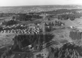
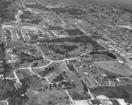
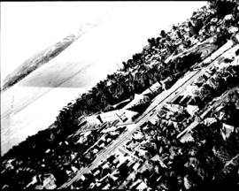
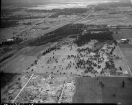
A series of aerial photographs were taken of the city's north end for Puget Sound National Bank in early June of 1971. This is the Pearl Street area in the north end; Pearl is the long street running rather diagonally from top to right. The North End tower, about N. 30th St., is near top. The area filled with trails may be part of the Highland Hill golf course. The drive-in with large lot is the Auto View Drive-In in the 1200 block of North Pearl; complex of buildings close by are the Polynesian Apartments.


Aerial views; Auto View Drive-In (Tacoma); Polynesian Apartments (Tacoma); Neighborhoods--Tacoma--1970-1980;

D160611-12

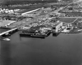
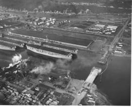
Aerial of Martinolich Shipbuilding facilities and industrial Tideflats. According to the 1971 City Directory, the shipyard was located at 1112 Alexander Avenue. This view on June 29, 1971, shows E. 11th St. intersecting with Alexander with the shipyard in the foreground. Martinolich Shipbuilding was on the Blair Waterway (formerly Port Industrial Waterway) at the site of the former Sprotsman's Marina. Anthony C. Martinolich was listed as the firm's president.


Aerial views; Martinolich Shipbuilding Corp. (Tacoma); Boat & ship industry--Tacoma--1970-1980;

D160364-21

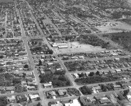
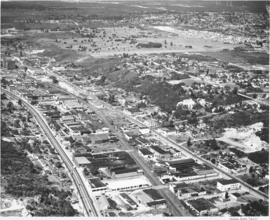
Point Defiance School and vicinity. This is the view looking east of the North 45th & Pearl St. area in June of 1971. 46th is the long street running from top to bottom on the left. 45th St. is to its right. The Point Defiance Elementary School is at 6002 North 45th with Pearl St. horizontal to the school (center of photograph). The Piggly Wiggly supermarket is at 4502 North Pearl, between 46th and 45th, with the long dark roof. Photograph ordered by Puget Sound National Bank.


Aerial views; Neighborhoods--Tacoma--1970-1980; Point Defiance School (Tacoma); Piggly Wiggly (Tacoma); Baltimore Park (Tacoma);

D160364-12

North 21st St. neighborhood by air. This is the north end neighborhood around North 21st St. in the summer of 1971. North 21st is the street with the power towers lower center. It lies between Orchard St. at far left and Stevens on the right. Mason Gulch is the wooded area upper center with Puget Park the other large forested space to its right. Photograph ordered by Puget Sound National Bank.


Aerial views; Neighborhoods--Tacoma--1970-1980; Puget Park (Tacoma); Mason Gulch (Tacoma);

D160364-2

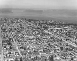
It was a hazy day on June 2, 1971, when the above aerial view of the city's populous north end was taken by a Richards Studio photographer. The snowy tip of Mount Rainier can faintly be seen. In the photograph's foreground are Wilson High School (near bottom center) at N. 12th & Orchard. The Auto View Drive-In is close by at 1202 N. Pearl. Pearl St. intersects with Sixth Ave. and then angles off to become Bantz Blvd. Photograph ordered by Puget Sound National Bank.


Aerial views; Neighborhoods--Tacoma--1970-1980; Woodrow Wilson High School (Tacoma); Auto View Drive-In (Tacoma); Rainier, Mount (Wash.);

RD23-3

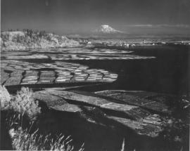
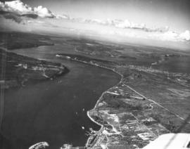
ca. 1943. Mount Rainier rises ghostlike above the Hylebos Waterway in this test photograph with the new infrared film. Log booms make designs in the water leading up to the Tideflats. Foliage has an eerie white glow. The photograph is believed to have been taken from the vicinity of the Cliff House.


Aerial photographs; Hylebos Waterway (Tacoma);

WO 148797-A

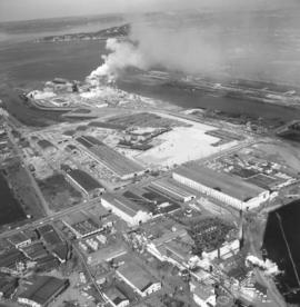
Smoke could be seen day and night billowing from the St. Regis Paper Co. facility on Tacoma's industrial Tideflats. Aerial view taken in late June, 1966, shows that the area continued to grow with new construction. St. Regis was located conveniently between the Puyallup and St. Paul Waterways. Photograph ordered by St. Regis Paper Co.


Aerial photographs; St. Regis Paper Co. (Tacoma)--1960-1970; Smoke--Tacoma;

WO76034-A

ca. 1953. This aerial view of the northeast section of the Tacoma tideflats from 1953 shows part of the Port of Tacoma, lower left, and the 185-acre Port Industrial Yard which was acquired by the Port in 1959. Five mothballed WWII baby flattops are moored in the Port Industrial Waterway. The incomplete Port Industrial Waterway bridge, later named the Blair Bridge, can be seen at the right. The bridge opened for traffic on November 14, 1953. The bridge is 712 feet long with a 40 foot roadway and 5 feet of sidewalk on one side only. It has a clearance at high tide of 12 feet. There is a 150 foot channel between the main piers for the passage of shipping vessels. The two main channel piers are 45 x 55 foot and house the operating machinery, counterweights and electrical equipment for opening and closing the span drawbridge. They are the equivalent in height, measured both above & below the water, to a seven story building. The cost of the bridge was $1,600,000. (TNT 11/13/1953, special section #D)


Aerial photographs; Port of Tacoma (Tacoma)--1950-1960; Aircraft carriers--Tacoma--1950-1960; Harbors--Tacoma; Aerial views; Blair Bridge (Tacoma); Port Industrial Waterway Bridge (Tacoma); Vertical lift bridges;
D7232-6

Aerial view of North End Tacoma showing Annie Wright Seminary, surrounding neighborhood and Commencement Bay.


Aerial photographs; Private schools--Tacoma; Annie Wright Seminary (Tacoma)--Buildings;

D8245-1

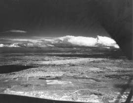
ca. 1939. Aerial view from the Narrows of Tacoma's West End with downtown and the Tideflats beyond. Running down the center of the photograph is Sixth Ave. as it veers off to Titlow Beach in the lower right hand. It is crossed by Pearl Street, where the excavation for (what is believed to be) a planned Tacoma airport forms a pattern on the ground. The area is largely undeveloped. Construction on the Narrows Bridge (Galloping Gertie) had begun but was far from completion. For a 1961 aerial view of the same location, see D129800, images 43 & 131. TPL-9156


Aerial photographs;

D8245-13

Associated Oil Company aerial view of west side cement plant and construction of west pier for first Narrows Bridge. Ordered by George Martinac, North Pacific Bank Note.


Aerial photographs; Tacoma Narrows Bridge (Tacoma); Bridges--Tacoma;

D8245-22

ca. 1939. Associated Oil Company aerial view of west side cement plant and construction of west pier for first Narrows Bridge. Ordered by George Martinac, North Pacific Bank Note. TPL-6712


Aerial photographs; Tacoma Narrows Bridge (Tacoma); Bridges--Tacoma;

D8245-7

ca. 1939. Associated Oil Company aerial view of Tacoma West End from Day Island to Point Defiance and beyond. Piers for first Narrows Bridge under construction. Ordered by George Martinac, North Pacific Bank Note.


Aerial photographs; Tacoma Narrows Bridge (Tacoma); Bridges--Tacoma;

1013-1

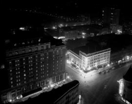
ca. 1920. View of 9th and Broadway taken from the roof of the Medical Arts Building. Night scene showing the Winthrop Hotel (773 Broadway), left, and an illuminated Pantages Theater (901 Broadway) building.


Aerial photographs; Hotel Winthrop (Tacoma); Hotels--Tacoma--1920-1930; Pantages Theater (Tacoma);

D9334-7

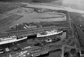
In this aerial photograph from January 1940, two white Navy transport ships sit at dock in Slip No. One of the Port Industrial Waterway waiting to take on soldiers from Fort Lewis. On Friday January 13th, 7,500 soldiers boarded three transport ships to be carried to California to take part in the largest Army-Navy "war games" exercise ever held on U.S. soil, to that date. When the ships pulled out Saturday morning, Fort Lewis was virtually deserted; only a maintenance staff of a few hundred men stayed behind. (T. Times 1/11/1940, pg. 1)


Aerial photographs; Bays--Washington (State); Commencement Bay (Wash.); Port of Tacoma (Tacoma)--1940-1950; Logs; Ships;

D11794-10

Aerial view of Northern Pacific property at Lakeview. Closer view of land seen in D11794, image 1. This time buildings can faintly be seen in this photograph taken on August 22, 1941. Part of series ordered by Raleigh-Hayward Company.


Aerial photographs; Land; Neighborhoods--Lakewood;

D11649-8

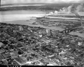
Aerial view of downtown Tacoma showing Central Business District and Port/Industrial areas. This view, looking east toward the bustling industrial Tideflats, was taken on July 20, 1941.


Aerial views; Aerial photographs; Cityscapes; Business districts--Tacoma--1940-1950; Commercial streets--Tacoma--1940-1950;

D31645-4

ca. 1947. An aerial photograph shows the College of Puget Sound campus lying between Union Avenue and Alder Street. Jones Hall is prominent in the center of the complex. TPL-6703


Aerial photographs; Universities & colleges--Tacoma; College of Puget Sound (Tacoma)--Buildings;

D25935-5

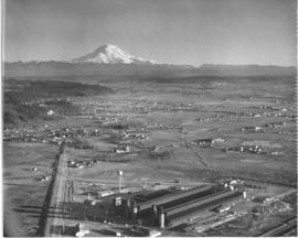
Aerial photos were taken for the Tacoma Times Business and Industry Review, an eighteen page supplement in the February 26, 1947 edition, highlighting many of Tacoma's industries and businesses. Housing, boat building, machinery manufacturing, chemicals, lumber, paper and pulp, grocery wholesale and fuel were some of the industries featured in the layout. Aerial view of industrial facility with majestic Mount Rainier in background. TPL-10569


Aerial views; Aerial photographs; Industrial facilities--Tacoma; Rainier, Mount (Wash.);

D34815-21

Aerial view of Tacoma, George Jacobson. Streets from left to right are South Tacoma Way, (Burlington Northern - Santa Fe Rail Road tracks) Center Street, and 25th Street. The large unimproved property, upper center, is Allenmore Golf Club. A new residential area is just across 19th Street from the golf course. The building in the upper center, left was a furniture factory. TPL-9318


Aerial photographs; Commercial streets--Tacoma--1940-1950; Railroad tracks--Tacoma--1940-1950; Allenmore Golf Club (Tacoma); Golf--Tacoma--1940-1950; Land use--Tacoma--1940-1950; Land--Tacoma--1940-1950; Hills--Tacoma;

D34612-1

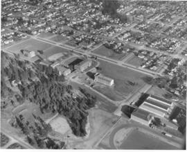
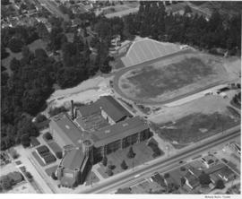
Aerial view of Tacoma's Lincoln High School and Lincoln Bowl; the bowl is expected to be completed by September 1948, photo ordered by Columbia Breweries. TPL-8134


Aerial photographs; Lincoln High School (Tacoma); Lincoln Bowl (Tacoma);

D34815-17

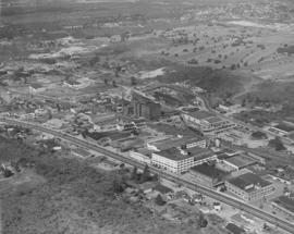
This is how the area around South Tacoma Way and Steele St. appeared in aerial photographs taken in August of 1948. Street near photograph's bottom is South Tacoma Way. The uniquely designed Java Jive (then called the Coffee Pot Restaurant) is on the left. Across the street is Lowrie Moving & Storage and the large Northwest Chair Co. plant at 2201 South Tacoma Way. To the left of Northwest Chair is the Johnson's Millwork firm at 2319 South Tacoma Way. At 2629 So. Steele St. is the big F.S. Harmon Mfg. Co. who bought the former Gregory Furniture Mfg. plant in 1945. Harmon's name is clearly labeled on the building's exterior.


Aerial views; Aerial photographs; Java Jive (Tacoma); Coffee Pot Restaurant (Tacoma); F.S. Harmon Manufacturing Co. (Tacoma); Northwest Chair Co. (Tacoma); Johnson's Millwork, Inc. (Tacoma); Lowrie Moving & Storage (Tacoma);

D34612-17

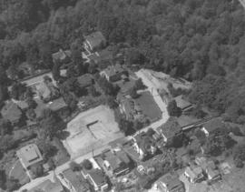
Another view of the Prospect Hill neighborhood by air in August of 1948. The spacious homes are bordered by a large forest. East Road is pictured here curving into North Road. A vacant lot, perhaps being readied for construction, is situated between homes at 74 East Road and 102 East Road. 76 East Road is directly across the street from the empty lot. 14 North Road with covered patio is on the left side of North Road.


Aerial views; Neighborhoods--Tacoma--1940-1950;

A60604-6

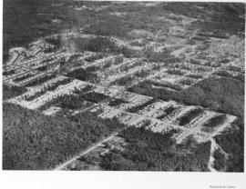
Aerial photographs of Mountlake Terrace in August, 1951, show the growing development of the neighborhood near Seattle. Surrounded by heavily forested land, city streets are gradually being laid out and homes built. Developers managed to retain many of the trees while building the new homes. Photograph commissioned by Budget Homes, Inc.


Aerial photographs; Housing developments--Mountlake Terrace;

A53195-1

ca. 1950. This aerial view was taken probably in the fall of 1950. The Little Church on the Prairie is shown in the left hand corner; Lakewood Community Center is several hundred feet away to the right. Both structures came into existence roughly the same time; the Little Church on the Prairie was converted from a grocery store to a community church in 1938 while Norton Clapp founded the Lakewood Center in 1937, one of the country's first planned shopping centers.


Little Church on the Prairie (Lakewood); Lakewood Community Center (Lakewood); Aerial photographs; Aerial views;

A63168-4

An aerial view of the Narrowmoor Addition, a subdivision west of Jackson Avenue between Sixth and 19th Avenues. The Narrows portion of Puget Sound is below, to the west. The ferry dock at the base of Sixth Avenue can be seen on the left. Ordered by Burton W. Lyon, Jr., Puget Sound Bank Building.


Aerial photographs; Housing developments--Tacoma; Land subdivision--Tacoma; Land use--Tacoma; Real estate development--Tacoma;

A63233-1

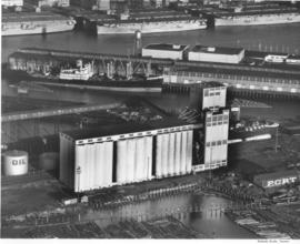
16 new elevators have been added to the existing elevators at the Port of Tacoma. The project added 500,000 bushels to the Port's capacity. Baby flattops (smaller aircraft carriers) are seen across the Port Industrial Waterway. The grain elevators had a 2 million bushel capacity by 1954. They could receive up to 100 cars per day, with 3 receiving legs. Two shipping legs provided shop delivery at a maximum rate of 30,000 bushels per hour. Rail facilities provided for 50 cars to be at the unloading track. There was also a 50 ton hydraulic automatic grain truck dumper. The first pier behind the elevators was Pier 1 and the next one (with a docked ship) was Pier 2. The Port Industrial Waterway was renamed the Blair Waterway in 1970, in honor of past Port of Tacoma Commissioner A.E. Blair. (Tacoma brochure: "Port of Tacoma...Invitation to Industry") (pier identification provided by a reader)


Aerial photographs; Port of Tacoma (Tacoma)--1950-1960; Grain elevators--Tacoma--1950-1960; Aircraft carriers--Tacoma--1940-1950; Harbors--Tacoma; Marine terminals--Tacoma--1940-1950; Shipping--Tacoma--1940-1950;

Results 721 to 750 of 784