Showing 824 results

Collections
Aerial Photography Image With digital objects
Print preview View:

D164908-4C

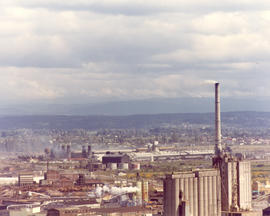
Kaiser Aluminum plant. This aerial view of the Kaiser Aluminum plant was taken on June 10, 1974. The plant was located in Tacoma's tideflats at 3400 Taylor Way. The wisps of smoke emerging from the plant's 500-foot stack appear to blend into the heavy cloud formation. Color photograph ordered by Kaiser Aluminum.


Aerial photographs; Kaiser Aluminum & Chemical Corp. (Tacoma); Industrial facilities--Tacoma--1970-1980; Aluminum industry--Tacoma--1970-1980;

D164600-104C

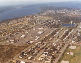
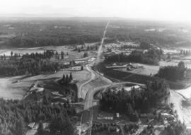
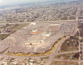
1974 Richards stock footage. A look at the Tacoma Mall by air in the spring of 1974 shows that the Mall continues to grow with the building of the new Liberty House/Rhodes department store at the Mall's extreme west end. The store was scheduled to open that fall. I-5 runs nearly vertically at the photograph's right, allowing easy access to the shopping center. The wooded area east of the freeway would eventually be dotted with new homes; businesses would also take the place of the homes located at the bottom of the photograph.


Aerial views; Aerial photographs; Tacoma Mall Shopping Center (Tacoma); Shopping centers--Tacoma--1970-1980; Neighborhoods--Tacoma--1970-1980; Express highways--Tacoma--1970-1980;

D165802-35

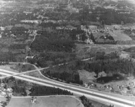
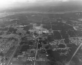
On March 27, 1975, several aerial photographs were taken by the Richards Studio of the area between 320th in Federal Way, North Puyallup, Pacific Highway South and Valley Ave. for Puget Sound National Bank. Most of the series shown the abundance of wooded areas and undeveloped property with smaller neighborhoods scattered on the landscape. The aerials also noted the many roadways, including freeways, in the area.


Aerial views; Express highways--Wash;

D165187-A

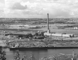
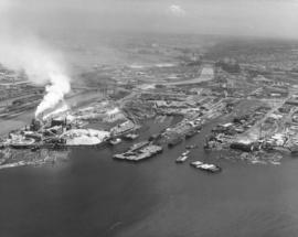
ca. 1974. Aerial photograph of Kaiser Aluminum plant in industrial tideflats area of Tacoma, probably taken during the summer of 1974. The plant's 500-foot stack dominates the landscape. A ship is docked nearby taking on shipments of logs. Photograph ordered by Kaiser Aluminum.


Aerial views; Kaiser Aluminum & Chemical Corp. (Tacoma); Industrial facilities--Tacoma--1970-1980; Aluminum industry--Tacoma--1970-1980; Smokestacks--Tacoma; Logs; Shipping--Tacoma--1970-1980;

D166903-8C

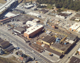
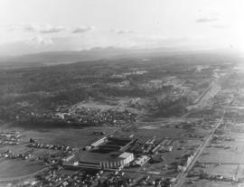
ca. 1976. Atlas Foundry by air in 1976. Established in 1899, Atlas's sprawling plant in the 3000 block of South Wilkeson was bordered by South Tacoma Way as well as Wilkeson (on right). Center St. is near the top. The Sprague Ave. overpass is in upper left corner along with offramp leading to Hwy 16. The plant's original buildings are near Wilkeson St. Atlas Foundry has been known as Atlas Castings & Technology since 2002. Photograph ordered by Atlas Foundry & Machine Co.


Aerial views; Aerial photographs; Atlas Foundry & Machine Co. (Tacoma); Foundries--Tacoma--1970-1980; Industrial facilities--Tacoma--1970-1980; Steel industry--Tacoma--1970-1980;

D166000-94C

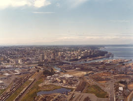
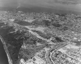
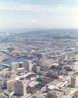
1975 Richards color stock footage. Aerial view of downtown Tacoma and industrial Tideflats on July 24, 1975. Major banks, stores and office buildings are separated from factories and mills by the City (now Thea Foss) Waterway.


Aerial views; Aerial photographs; City Waterway (Tacoma); Business districts--Tacoma--1970-1980;

D166000-118C

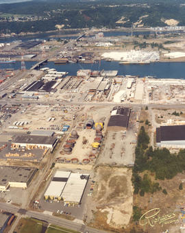
ca. 1975. 1975 Richards color stock footage. Aerial view of Tacoma Tideflats. The view above is believed to be Concrete Technology's property on the Port of Tacoma Rd. The area was bordered by E. 11th St. and Lincoln Ave. The body of water below is believed to be the Blair Waterway (formerly Port Industrial Waterway). The Puyallup River is near the top of the photograph.


Aerial views; Aerial photographs; Industrial facilities--Tacoma--1970-1980;

D166700-85C

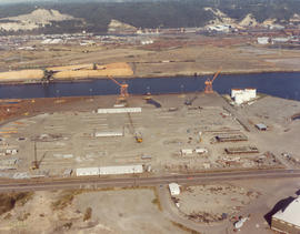
1976 Richards color stock footage. Industrial tideflats by air on October 4, 1976. Waterway is believed to be the Blair (formerly Port Industrial) Waterway.


Aerial views; Aerial photographs; Industrial facilities--Tacoma--1970-1980;

D166000-123C

1975 Richards color stock footage. View by air of northeastern section of Tacoma's industrial area, the Tideflats, in late summer of 1975. Waterway closest to the top of photograph is the Hylebos; the Blair (formerly Port Industrial) Waterway is the other body of water shown above. Plant pictured is believed to be Concrete Technology Corporation.


Aerial views; Aerial photographs; Industrial facilities--Tacoma--1970-1980; Hylebos Waterway (Tacoma); Blair Waterway (Tacoma);

D166000-193C

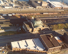
ca. 1975. 1975 Richards color stock footage. Shadows are creeping up on the venerable Union Station, 1717 Pacific Ave., in this 1975 aerial view. By 1975, the magnificent structure was showing its age. A proposed $14,000,000 shopping center/transportation complex sought to restore the station to its former splendor. "Depot Galleria" hoped to add two large buildings to the north and south of the station which would house department stores or perhaps include a major hotel. The Union Station interior would have had a remodeled "Gay '90s" look with the glass dome skylight admitting light to central atrium gardens. Three parking levels would provide parking for 1500 cars. The station would continue to serve as an Amtrak passenger terminal. These ambitious plans by Malls North and BNL Development Corporation (subsidiary of Burlington Northern) would not be realized. (TNT 2-23-75, A-1 article)


Aerial views; Aerial photographs; Union Station (Tacoma); Railroad stations--Tacoma--1970-1980;

D168104-9C

Series of aerials around the vicinity of South 19th & Pearl Sts. taken on behalf of Mueller Investment Co. on October 3, 1977. This view is believed to be a bit further north, near the Westgate Shopping Center and the North End water tower and reservoir.


Aerial photographs; Aerial views; Water towers--Tacoma; Reservoirs--Tacoma;

D160364-5

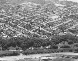
Aerial view on June 2, 1971, of Tacoma's north end. Standing tall in the trees at lower center is one of the Cushman towers. Vassault Park is positioned between Vassault and Pearl Streets in the center of the photograph. The curving roadway, intersected by both Vassault and Pearl, is the Narrows which will become North 26th St. Along North 30th, above Pearl, is the North End water tower and reservoir. Commencement Bay is at top of photograph; ASARCO smelter is along its shoreline. Photograph ordered by Puget Sound National Bank.


Aerial views; Neighborhoods--Tacoma--1970-1980; Vassault Park (Tacoma); Water towers--Tacoma; Reservoirs--Tacoma; Electric lines--Tacoma; Commencement Bay (Wash.); Smelters--Tacoma;

D160364-28

Aerial photograph of Burlington Northern railroad tracks around North 48th St. on June 2, 1971. The curved street through the trees that passes under the railroad tracks is North 48th St. The spurline to Ruston is in the right corner edge. Photograph ordered by Puget Sound National Bank.


Aerial views; Railroad tracks--Tacoma--1970-1980; Neighborhoods--Tacoma--1970-1980;

D160622-1

Aerial views of industrial Tideflats and waterways. On June 25, 1971, a Richards Studio photographer took a series of photographs of some of Tacoma's waterways. With Mount Rainier barely visible amidst fog, the landscape is clearer at the mouths of the waterways. From L-R are the long Puyallup Waterway, St. Paul Waterway, and Middle Waterway. Smoke is shown billowing from the St. Regis facility. Photograph ordered by Foss Tug & Barge.


Aerial views; Rainier, Mount (Wash.); Puyallup Waterway (Tacoma); St. Paul Waterway (Tacoma); Middle Waterway (Tacoma); St. Regis Paper Co. (Tacoma)--1970-1980;

C160915-1C

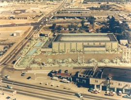
ca. 1971. Aerial view of former Tacoma Sports Arena with artist's rendering of possible architectural changes. Ben's Truck Parts had purchased the Tacoma Sports Arena (known prior as the Tacoma Ice Palace) on September 3, 1971. The company had commissioned the Richards Studio to take several aerial photographs of the Arena and vicinity. This aerial view shows possible architectural changes to the building and site with shimmering pools facing So. 38th St. and a profusion of trees and shrubs added. The exterior of the building would also change with walls apparently extended and a changed roofline. The location was easily accessible by traveling on So. 38th St. (now one of the city's busiest streets due to the close proximity to the Tacoma Mall), South Tacoma Way, and from the north, Union Ave. Color photograph ordered by Ben's Truck Parts.


Aerial views; Renderings; Tacoma Sports Arena (Tacoma); Tacoma Ice Palace (Tacoma);

D161273-15

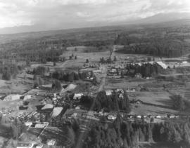
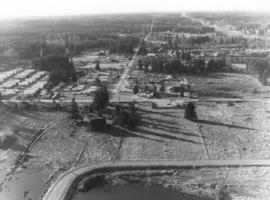
This aerial view of the Puyallup neighborhoods near 112th & Meridian was taken by the Richards Studio on January 2, 1972, on behalf of Puget Sound National Bank. Sand and gravel pit on the left; sprinkling of homes and businesses nearby.


Aerial views; Neighborhoods--Puyallup--1970-1980;

D161273-2

Another in a series of aerials of the area around 112th & Meridian in early 1972. In the late 1980s, the South Hill Mall would be built about this location. Photograph ordered by Puget Sound National Bank.


Aerial views; Neighborhoods--Puyallup--1970-1980;

D161273-24

This is what the 112th & Meridian area looked like in early 1972. The South Hill Mall would be built 16 years later on Meridian. What is noticeable is the large amount of woods and relatively few homes. Aerial photograph ordered by Puget Sound National Bank.


Aerial views; Neighborhoods--Puyallup--1970-1980;

D159700-243C

1971 color Richards stock footage. Aerial northeast view of downtown Tacoma overlooking City (now Thea Foss) Waterway and industrial Tideflats. The snowy tip of Mount Rainier is barely visible through the haze. Wheeler-Osgood Waterway is the small waterway on the left which leads into the City Waterway. Major buildings of note in downtown area include Tacoma and Perkins Buildings flanking the 11th Street Bridge (now Murray Morgan Bridge); the cluster of buildings on Pacific including Washington and Rust Buildings, Puget Sound National Bank, the new Bank of Washington Plaza, and Schoenfelds Furniture to the right. Neighborhoods seen in the distance to the center and right of photograph are part of East Tacoma.


Aerial views; City Waterway (Tacoma); Wheeler-Osgood Waterway (Tacoma); Tacoma Building (Tacoma); Perkins Building (Tacoma); Washington Building (Tacoma); Rust Building (Tacoma); Puget Sound National Bank (Tacoma); 11th Street Bridge (Tacoma);

D159700-244C

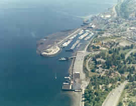
1971 color Richards stock footage. Aerial view of Point Defiance and vicinity. The Point Defiance Park is on the right with the Boathouse prominently displayed. The ferry landing and Tacoma Yacht Club and mooring are in the upper center. ASARCO (American Smelting & Refining Co.) is near the top with a glimpse of the giant smokestack along the right upper edge.


Aerial views; Point Defiance Park (Tacoma); Parks--Tacoma--1970-1980; Boathouses--Tacoma; Boats; Tacoma Yacht Club (Tacoma); Mooring; American Smelting & Refining Co. (Tacoma); Smelters--Tacoma--1970-1980;

D161273-5

The 112th & Meridian neighborhoods as seen by air in January of 1972. At that time there was an abundance of wooded acreage and not many homes. Photograph ordered by Puget Sound National Bank.


Aerial views; Neighborhoods--Puyallup--1970-1980;

D161273-20

Closer view of Puyallup neighborhood about 9th Ave. S.W. and Meridian South with Western Washington Fairgrounds in lower center. This photograph, one of a series, was taken on January 2, 1972, on behalf of Puget Sound National Bank.


Aerial views; Neighborhoods--Puyallup--1970-1980; Western Washington Fair (Puyallup);

D9334-5

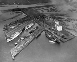
This aerial view, taken January 13, 1940, shows the Port of Tacoma piers with two docked, white transport ships. Three transport ships, the Hunter Liggett, Leonard Wood and St. Mihiel, were in Commencement Bay to transport over 7,500 soldiers from Fort Lewis to the biggest war games in US history. This is the biggest passenger embarkation in the history of the Tacoma port. The troops will invade the California coast from the sea. They will strike at an undisclosed location somewhere on the 400 mile coast between San Francisco and Santa Barbara. This will be the major offensive of the war games to be held January 15-22nd. Also in the photograph are the Co-op's white grain elevators; the waterway is crowded with log booms. The two other cargo vessels pictured are believed to be the South American freighter Coya and the Japanese freighter Koei Maru. ( T. Times 1-3-40, p. 1-article; 1-11-40, p.1-article; 1-13-40, p.1-article)


Aerial photographs; Bays--Washington (State); Commencement Bay (Wash.); Port of Tacoma (Tacoma)--1940-1950; Logs; Ships; Piers & wharves--Tacoma--1940-1950;
D9927-2

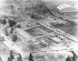
This aerial view of McChord Field from June of 1940 shows the U.S. Army's Northwest airbase shortly before it was dedicated on July 3rd. The massive building in the center is the new enlisted men's barracks which could house 1,200 men. In the upper right corner are two of the six-story tall hangers that housed the base's fleet of 24 Douglas B-18A "medium" bombers. The Army had already spent $7 million building the airbase, and millions more would be needed before it was completed. (T.Times 7/1/1940 p.1)


Aerial photographs; McChord Field (Tacoma);

D7232-2

Aerial view of Tacoma General Hospital with Wright Park and surrounding neighborhoods.


Aerial photographs; Tacoma General Hospital (Tacoma); Wright Park (Tacoma);

D8245-12

ca. 1939. Associated Oil Company aerial view of west side cement plant for first Narrows Bridge construction. Ordered by George Martinac, North Pacific Bank Note.


Aerial photographs; Tacoma Narrows Bridge (Tacoma); Bridges--Tacoma;

D11794-1

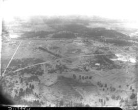
Aerial view of Northern Pacific Rail property at Lakeview which was taken on August 22, 1941. Land is dotted with trees in foreground with thicker forests toward the top of the photograph. Few, if any, homes in sight. Ordered by Raleigh -Hayward Company.


Aerial photographs; Neighborhoods--Lakewood; Land;

D22153-7

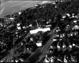
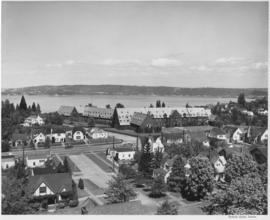
Annie Wright Seminary was a college preparatory school for girls. Miss Ruth Jenkins was the headmistress of the school. Aerial view of Annie Wright Seminary, Commencement Bay in background.


Educational facilities--Tacoma; Private schools--Tacoma; Aerial photographs; Annie Wright Seminary (Tacoma)--Buildings;

D11649-15

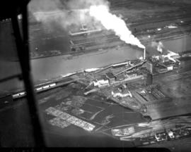
Aerial view of industrial section of Tacoma as seen on July 20, 1941. Log booms in foreground.


Aerial views; Aerial photographs; Logs;

D11649-19

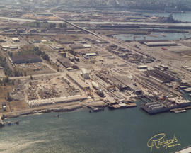
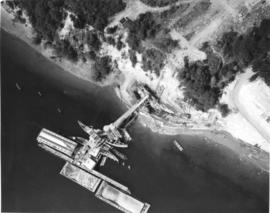
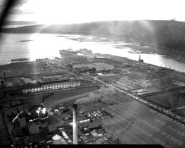
1941 Aerial view of Sea-Tac Shipyard with Peterman Manufacturing Company in foreground, looking west. The Peterman Co. manufactured fir doors and veneer panels. It was forced to vacate the property in June of the following year as the Shipyard needed space to build the many ships under contract.


Aerial views; Aerial photographs; Seattle-Tacoma Shipbuilding Corp. (Tacoma); Boat & ship industry--Tacoma--1940-1950; Peterman Manufacturing Co. (Tacoma);
Results 241 to 270 of 824