Mountaineers Scrapbook, 1912 to 1916, p. 85
- Item
- 1912-07-20 - 1916-04-02
Part of The Tacoma Mountaineers Records
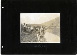
The Mountaineers Summer Outing, July 20, 1912-August 10, 1913 Scrapbook, pg. 85. From captions, clockwise: Wash day
190 results with digital objects Show results with digital objects
Mountaineers Scrapbook, 1912 to 1916, p. 85
Part of The Tacoma Mountaineers Records
The Mountaineers Summer Outing, July 20, 1912-August 10, 1913 Scrapbook, pg. 85. From captions, clockwise: Wash day
Mountaineers Scrapbook, 1912 to 1916, p. 89
Part of The Tacoma Mountaineers Records
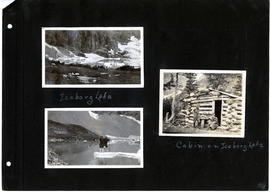
The Mountaineers Summer Outing, July 20, 1912-August 10, 1913 Scrapbook, pg. 89. From captions, clockwise: Iceberg Lake, Cabin on Iceberg Lake.
Mountaineers Scrapbook, 1912 to 1916, p. 101
Part of The Tacoma Mountaineers Records
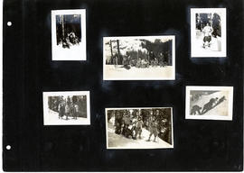
The Mountaineers Summer Outing, July 20, 1912-August 10, 1913 Scrapbook, pg. 101.
Mountaineers Scrapbook, 1912 to 1916, p. 102
Part of The Tacoma Mountaineers Records
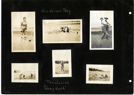
The Mountaineers Summer Outing, July 20, 1912-August 10, 1913 Scrapbook, pg. 102. From captions, clockwise: Henderson Bay. The elusive "Goeyduck"
Tacoma Mountaineers Topographic Maps Book
Part of The Tacoma Mountaineers Records
Oversized book of topographic maps (edition dates range from c. 1900-c. 1923, with reprint dates from c. 1920- c. 1925) and geological records provided by the U.S. Department of the Interior. Maps include the following: Washington State Index, Mt. Baker District, Mount Vernon, Stillaguamish, Glacier Peak, Stehekin, Methow, Okanogan, Sultan, Skykomish, Chiwaukum. Chelan, Tacoma, Cedar Lake, Snoqualmie, Mount Stuart, Wenatchee, Chehalis, Mount Aix, Ellensburg, Mount St. Helens, Mount Adams, Mount Hood (Ore.), Snohomish, Crater Lake National Park (Ore.), Mount Rainier National Park.
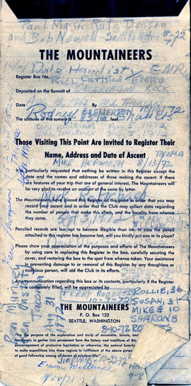
Summit Registry Book, 1971-1972
Part of The Tacoma Mountaineers Records
The Mountaineers Summit Registry Book with member signatures, address and date of ascent, 1971-1972
Part of The Tacoma Mountaineers Records
Black and white image of snowy mountains on a cloudy day.
Part of The Tacoma Mountaineers Records
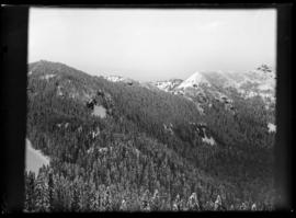
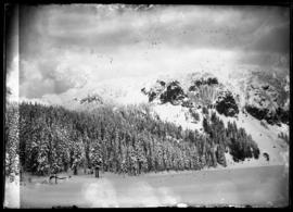
Black and white image of a snowy forested mountain range.
Part of The Tacoma Mountaineers Records
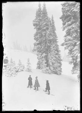
Black and white winter scene image of Paradise Park with three people hiking.
Part of The Tacoma Mountaineers Records
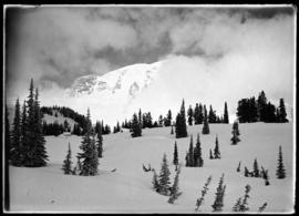
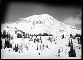
Black and winter image of a snowy Mount Rainier.
Part of The Tacoma Mountaineers Records
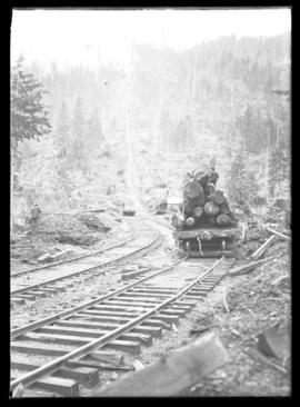
Black and white image of logging and railroads at Spray Park.
Part of The Tacoma Mountaineers Records
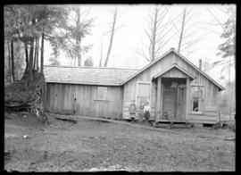
Black and white image of a wooden house in Spray Park with three children infront.
Part of The Tacoma Mountaineers Records
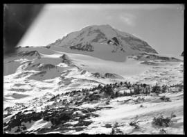
Black and white winter scene of Mount Rainier.
Part of The Tacoma Mountaineers Records
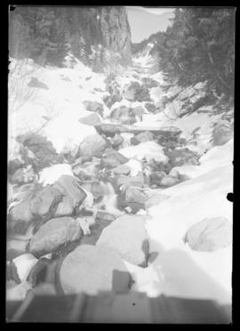
Black and white winter scene of a frozen stream.
Part of The Tacoma Mountaineers Records
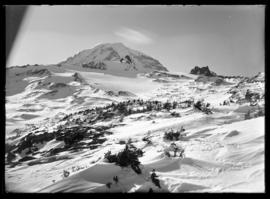
Black and white image a snow covered mountain.
Part of The Tacoma Mountaineers Records
Black and white image a snow covered mountain.
Part of The Tacoma Mountaineers Records
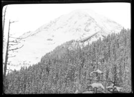
Black and white winter scene of Mount Rainier.
Part of The Tacoma Mountaineers Records
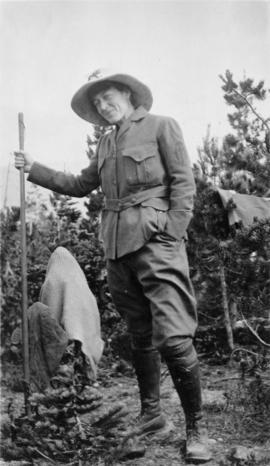
Alma Wagen at Mount St. Helens ca. 1921.
Photographs and Diaries of the Scholes Sisters, Josephine and Stella
Part of The Tacoma Mountaineers Records
Photographs, some with captions "Stella Scoles on Mt. Aix", "Howard Wright on Mt. Aix", "Garda Fogg", "Ida Rose Kratsch", "YMCA Party, August 1912", negatives labelled "Mt Aix", and three small notebooks containing diary entries by Josephine Scholes of outings.
Photograph Album, Catherine Seabury
Part of The Tacoma Mountaineers Records
Photographs collected and captioned by Catherine Seabury, numerous outings, mostly Mount Rainier
Photograph Album, Catherine Seabury
Part of The Tacoma Mountaineers Records
Part of The Tacoma Mountaineers Records
Part of The Tacoma Mountaineers Records
Labelled "1st slides I took and Mscl." Includes old court house 1949, Brown's Point Salmon Barbeque August 1952,and Daffodil Parade 1953.
Photograph Album, Clarence Garner unbound
Part of The Tacoma Mountaineers Records
Includes Mountaineer Outings, Glacier National Park, a Stinson Tri-Motor airplane, the St. Regis Kraft plant, and the Forest Theater production of Sleeping Beauty, 1938.
Photograph Album, Clarence Garner unbound
Part of The Tacoma Mountaineers Records
Includes Mountaineer Outings to Mt. Olympus and Mt. Hood, Glacier National Park, and the Forest Theater productions.
Photographs by Clarence Garner in color
Part of The Tacoma Mountaineers Records
Depicts Narrows Bridge construction, downtown Tacoma, people, mountains, trees, flowers
Clarence Garner related materials
Part of The Tacoma Mountaineers Records
Includes photographs of Clarence Garner, Christmas cards, memorial service program, pin-back badge and patch
Photographs by Clarence Garner
Part of The Tacoma Mountaineers Records
Includes panoramas, mountain scenes, some in color, some captioned
Part of The Tacoma Mountaineers Records
Individually captioned slides, catagorized as Mt. Rainer NW, Mt. Rainier East side, Rainier South, Rainier West side, Animals and Flowers, Mt. Baker, Trail trip up Carbon River near Carbonado, Vashon Is, Point of Arches
Part of The Tacoma Mountaineers Records
Slides, some individually captioned, catagorized as Wright Park Rhododendrons, Mountains, Orchestras, Slides of friends.