Showing 824 results

Collections
Aerial Photography Image With digital objects
Advanced search options
Print preview View:

D137300-531

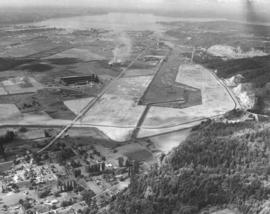
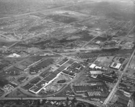
September 18, 1963, aerial of I-5 freeway in vicinity of Tacoma Mall under construction. The light colored flat area towards the top center is the future location of the Tacoma Mall shopping center. Easy freeway access and ample free parking would draw thousands to the mall for shopping. The Tacoma Mall would have its official opening in October, 1965.


Aerial photographs; Express highways--Tacoma--1960-1970; Shopping centers--Tacoma;

D137300-499

ca. 1963. Aerial photograph of 11th St. heading in an easterly direction ca. 1963. Waterway is believed to be the Puyallup Waterway; the East 11th St. Bridge is located midway. Many industrial facilities packed in this section of the Tideflats. Large log booms rest in the protected waterways until they are needed by various mills.


Aerial photographs; Logs; Industrial facilities--Tacoma--1960-1970; Bridges--Tacoma--1960-1970;

D137300-529

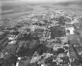
Aerial view of the Fircrest area taken in September, 1963. The City of Fircrest is nestled among trees towards the center of the photograph. The Narrows Bridge can be seen towards the upper portion of the picture. Point Defiance Park and vicinity is at top center; the ASARCO smelter appears pencil-thin not far away. Vashon Island is large island above the smelter. Lakewood area is towards the left edge of picture. TPL-9301


Aerial photographs; Neighborhoods--Fircrest; Tacoma Narrows Bridge (Tacoma);

D137300-530

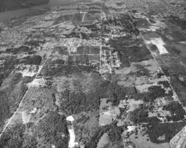
Closer aerial view of heavily forested Fircrest area on September 18, 1963. Fircrest is located east of University Place, west of Tacoma. Its population in the early 1960's was about 3600. The Narrows Bridge can be spotted toward the top left corner of the photograph.


Aerial photographs; Neighborhoods--Fircrest; Tacoma Narrows Bridge (Tacoma);

D137300-104

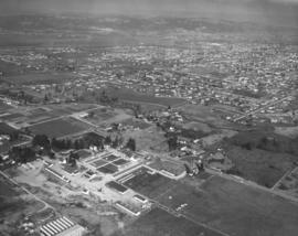
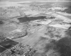
ca. 1963. Looking toward the east, this aerial photograph taken in 1963 shows part of Puyallup. River Road is upper portion of photo; Pioneer is in middle of photograph. Western Washington Experiment Station is at the bottom of the photograph. (Additional information provided by Rick Oliver)


Aerial photographs; Neighborhoods--Puyallup--1960-1970;

D137300-90

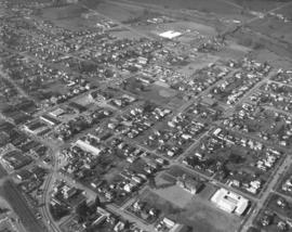
ca. 1963. Aerial view of residential and business areas of Puyallup taken in 1963. Busy River Road and Meridian intersect near the top of the photograph.


Aerial photographs; Neighborhoods--Puyallup--1960-1970;

D137300-98

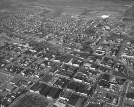
ca. 1963. Aerial view of densely packed city scene, identified as part of the city of Puyallup, in 1963. Business areas span across the center portion of the photograph; residential areas appear to be in upper section. White square at the top right of the photograph is the Hi Ho Shopping Center. The big empty lot at the bottom left is Pioneer Park. The street running vertically to the right of both landmarks is Meridian. (Additional information provided by a reader)


Aerial photographs; Neighborhoods--Puyallup--1960-1970; Hi-Ho Market (Puyallup); Shopping centers--Puyallup; Pioneer Park (Puyallup); Streets--Puyallup;

D137300-52

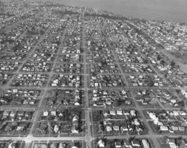
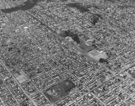
ca. 1963. Aerial views of neatly laid out neighborhood streets of north Tacoma, taken in 1963. The trees toward the upper portion of the photograph are part of Puget Park. Running horizontally a few blocks below the park is No. 21st St. with its towers and the Cushman power substation. Large building near top of photograph but below park is believed to be the Mason Methodist Church on No. 28th St. TPL-9300


Aerial photographs; Neighborhoods--Tacoma--1960-1970;

D137300-54

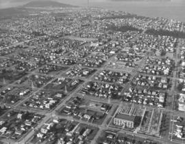
This March 2, 1963, aerial photograph shows more closely the Cushman substation and its various towers. The substation is located on No. 21st. near Proctor. The Proctor District offered many businesses and services to those residing in its neighborhoods, including a library, schools, and churches. The heavily wooded Puget Park is located nearby. TPL-3802


Aerial photographs; Neighborhoods--Tacoma--1960-1970;

D137300-43

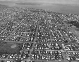
March, 1963, aerial photographs of Tacoma's populous northend and view of Commencement Bay. Located on right side with trees is the University of Puget Sound. Jefferson Park is on the left lower portion of photograph, with Proctor St. on its right and No. 9th St. above. No. 21st St. runs horizontally near the top of the photograph; the street is marked with towers and the Cushman Power Station.


Aerial photographs; Neighborhoods--Tacoma--1960-1970; Jefferson Park (Tacoma); University of Puget Sound (Tacoma)--1960-1970;

D137615-6

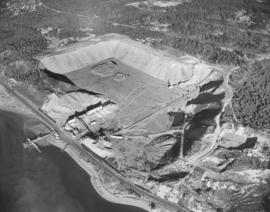
Closer view by helicopter of gravel operations at the Pioneer Sand & Gravel Co. pit north of Chambers Creek near Steilacoom. Railroad cars may be waiting to be filled with sand and gravel. Barges are docked to transport gravel by water. Photograph ordered by Seattle office of Pioneer Sand & Gravel Co.


Aerial photographs; Pioneer Sand & Gravel Co. (Tacoma); Sandstone--Steilacoom; Sand--Steilacoom;

D137300-95

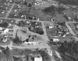
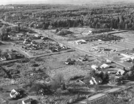
ca. 1963. Milton in 1963 was a rural community of about 2300 people. Aerial photographs of the area taken by the Richards Studio show a few homes dotting the landscape. Situated beside a two-lane highway is the Milton Light & Power department with its large lettering.


Aerial photographs; Signs (Notices); Neighborhoods--Milton;

D137612-2

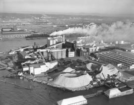
Aerial photograph of St. Regis Paper Co.'s Tacoma kraft mill in action. This February 9, 1963, photograph focuses on the large outdoor piles of pulp-mill chips and chip-barge unloading facilities. Tacoma's mill had been buying chips from nearby sawmills and plywood mills for many years. In the early 1960's, however, the mill looked further away and started purchasing, in large volumes, chips from waterside suppliers as far away as British Columbia. These chips would be transported by barge, two of which are shown in the above photograph. St. Regis would also continue to receive chips by truck and rail from its local suppliers. Photograph ordered by Malcolm McGhie, industrial consultant, New York. (1963 St. Regis Annual Report, p. 11)


Aerial photographs; St. Regis Paper Co. (Tacoma)--1960-1970; Paper industry--Tacoma--1960-1970;

D137300-139

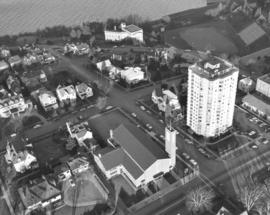
ca. 1963. Swooping down on Tacoma's north end to display Vista Manor Apartments and Central Lutheran Church, both on Tacoma Avenue North with Washington State Historical Museum Building on Stadium Way overlooking Stadium Bowl. Portions of Commencement Bay are visible at top of this 1963 aerial photograph. The church was constructed of reinforced concrete and brick in 1957; it was approved as a fallout shelter in 1962. The 25' cross, painted white, on the tower of the church revolved four times each minute. The steel cross was lighted at night. It was given by the congregation in memory of the late Dr. William Rosenbladt. Across the street at 319 Tacoma Avenue No. were the Vista Manor Apartments; the 16-story building was also approved as a fallout shelter in 1962. (TNT 12-23-62, A-5)


Aerial photographs; Stadium Bowl (Tacoma); Washington State Historical Building (Tacoma); Washington State Historical Society (Tacoma); Neighborhoods--Tacoma--1960-1970; Central Lutheran Church (Tacoma); Vista Manor Apartments (Tacoma);

D137300-94

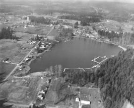
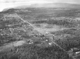
ca. 1963. Aerial photograph taken in 1963, looking west over Surprise Lake. Milton water tower in upper left of photograph. The large lake, located in the community of Milton, was a popular resort area. There were designated swimming areas as well as room for boating. TPL-9276


Aerial photographs; Surprise Lake (Milton); Lakes & ponds--Milton;

D138106-3

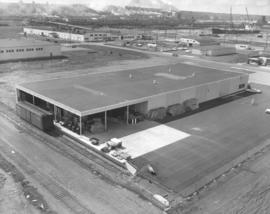
Closer aerial view of loading dock belonging to Georgia-Pacific Corp. on the Tideflats. This April 9, 1963, photograph shows that convenient rail transportation made delivery and pickup of wood products an easier process for the dealer in wholesale plywood. Tracks run just a few feet away from the loading dock with a detached container standing by.


Aerial photographs; Georgia-Pacific Corp. (Tacoma); Railroad tracks--Tacoma--1960-1970; Railroad freight cars--Tacoma--1960-1970;

A138537-1

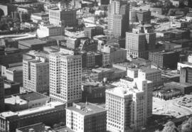
Aerial photograph taken in the spring of 1963 of portion of downtown Pacific Avenue; it features the Bank of California sign recently installed on top of the Washington Building. The Bank of California is the much smaller building adjacent to the Washington Building. It had been situated on Pacific Avenue since 1928. Bank officials confirmed that a move would be made in early 2005 into the historic Waddell Building at 15th & Commerce.


Aerial photographs; Signs (Notices); Bank of California National Association (Tacoma); Washington Building (Tacoma); Commercial streets--Tacoma--1960-1970;

D139204-1

Browns Point is the extension of land near the top of this late August, 1963, photograph. Aerial views of Tacoma's industrial areas also show 11th St. running horizontal with Lincoln Ave. below. The Hylebos Waterway is the most easterly of Tacoma's waterways; gravel pit to its right. Buildings with dark roofs are believed to be part of the Educators Mfg. plant. Photograph ordered by Port of Tacoma.


Aerial photographs; Hylebos Waterway (Tacoma);

D139204-18

Aerial view of Tacoma Tideflats focusing on area close to the Hylebos Waterway. In this late August, 1963, photograph, the waterway appears clogged with silt. The narrow strip that leads into the Hylebos is Hylebos Creek. Gravel pit to the far right; large dark-roofed building in left center is possibly Educators Mfg. Long vertical road is Taylor Ave.; Marine View Drive is believed to be semi-circular road. Houses at the bottom of the photograph are believed to be in Fife neighborhoods. Photograph ordered by Port of Tacoma.


Aerial photographs; Hylebos Waterway (Tacoma);

D140600-428

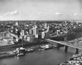
Aerial of Tacoma city skyline. Stock footage, 1964. Only one car appears to be traveling across the 11th Street Bridge heading towards the industrial Tideflats area on this bright day in October, 1964. It has apparently passed through the Tacoma business district of Pacific Ave. and A Street. Prominent structures on these streets include the (Old) City Hall, Puget Sound National Bank, Rust Building, Washington Building, Tacoma Building and Perkins Building. Portions of Central School, County-City Building and the Tacoma Public Library can be spotted on Tacoma Ave. So., further in the background. TPL-2314


Aerial photographs; Commercial streets--Tacoma--1960-1970; 11th Street Bridge (Tacoma); Bridges--Tacoma;

D140600-429

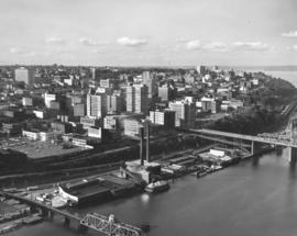
Angled view of Tacoma city skyline taken on October 17, 1964, by air. Schuster Parkway has yet to be built through part of the wooded area shown. 11th Street Bridge leading to the Tideflats from the business district is first bridge towards right-center. ASARCO smelter in distance; glimpses of Stadium district including high school to the right top, (Old) City Hall on Commerce St. and its replacement, the County-City Building a few blocks away on Tacoma Ave. So., venerable Central School in upper center. City Waterway (now Thea Foss) is tranquil body of water shown. TPL-9654


Aerial photographs; Commercial streets--Tacoma--1960-1970; 11th Street Bridge (Tacoma); Bridges--Tacoma; City Waterway (Tacoma);

D140189-11

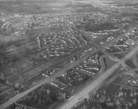
Aerial of Lakewood's Tyee Park neighborhood with focus on I-5 & Bridgeport Way interchange. Clover Park Vocational can be seen in the upper section of this December 10, 1963, aerial. Clover Creek is in the foreground. Hwy 99 and I-5 run parallel to each other with Bridgeport Way intersecting. Photograph ordered by Puget Sound National Bank. TPL-9302


Aerial photographs; Neighborhoods--Lakewood--1960-1970; Express highways--Lakewood;

D140600-34

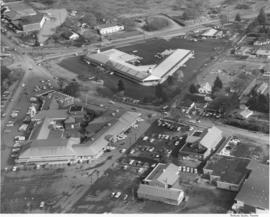
Stock footage, February, 1964, of aerials of So. 38th St., Center St. & Union Ave. Center St. runs horizontally at bottom of page where it intersects with Union Ave. Tacoma Mall with its sole occupant on this date, the Bon Marche, is at upper center of photograph with I-5 nearby. 38th St. is running almost horizontally in the center.


Aerial photographs; Shopping centers--Tacoma--1960-1970;

A94417-2

This aerial view of the Lakewood Center was taken in November of 1955 on behalf of the Lakewood Development Co., who operated the community center. Norton Clapp had originally built the Lakewood Community Center in 1937 as one of the nation's first one-stop shopping centers. Clapp, known as the founder of Lakewood, nurtured the idea of a growing suburban community and realized that it would need additional businesses and services to help it grow. The Lakewood Center underwent several expansions in the 1950's. In November, 1955, it reopened to celebrate a new addition, the modernized Colonial in an open triangle shape on the east side of the center. One 285-ft. leg faced Gravelly Lake Dr., the other 235-ft leg faced Mt. Tacoma Dr. with the "open" side to Bridgeport Way. Fourteen new businesses, including Sprouse-Reitz variety store, Lakes Realty, Andrews Women's Apparel, Lou Johnson, Selden's, Tacoma Savings and Loan, and Lakewood Record and Book Shop, took occupancy in the new building. (TNT 11-16-55, C-14)


Aerial photographs; Lakewood Community Center (Lakewood); Shopping centers--Lakewood--1950-1960; Lakewood Development Co. (Lakewood);
D157046-8

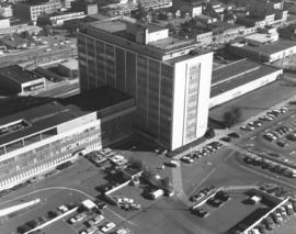
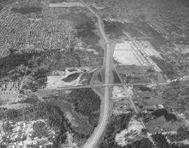
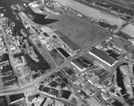
October 4, 1969, aerial view of County-City Building, location of city, county, police and court systems. This view captures the rear portion of the County-City Building and shows the large parking lot available. Somewhat resembling an airplane with extended wings, the County-City Building was formally dedicated in April of 1959. It occupied land between So. 9th & So. 11th Street on Tacoma Ave. So. The old Gothic-styled Pierce County Courthouse had been demolished and services transferred to the new building; parking for the County-City Building would take its place. Although the County-City Building was only ten years old in 1969, it was already bursting at its seams. Supporters had proposed to the City Council in late September, 1969, that an $8 million dollar bond issue for a new 5-story wing be considered. The courts needed more space so that trials could proceed without delays. Horace J. Whitacre of Whitacre Engineers gave a detailed projection of the County-City Building's future space needs. Photograph ordered by Whitacre Engineers. (TNT 9-23-69 , p. 10- article)


Aerial views; County-City Building (Tacoma); Parking lots--Tacoma--1960-1970;

D157837-23

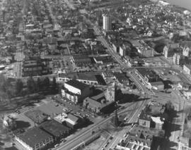
Closer aerial view of Stadium District in February of 1970. The Neo-classic Washington State Historical Society building overlooks Stadium Bowl and adjacent Stadium High School at the right edge of the photograph. Other prominent landmarks in the area are the Romanesque First Presbyterian Church at 20 Tacoma Ave. So. (lower center) and the white tower of the Vista Manor Apartments at 319 Tacoma Ave. No. (near top of photograph). Across the street from the Vista Manor is the Central Lutheran Church with its white steel 25-foot revolving cross. A segment of Wright Park is toward the left edge. Photograph ordered by Puget Sound National Bank.


Aerial views; Neighborhoods--Tacoma--1970-1980; Stadium High School (Tacoma); Stadium Bowl (Tacoma); Washington State Historical Society Building (Tacoma); First Presbyterian Church (Tacoma); Vista Manor Apartments (Tacoma);

D157837-3

Aerial photograph in a series of North end neighborhoods on February 20, 1970. The University of Puget Sound is located on 97 wooded acres in the populous North end. It can be seen in the center of the photograph, in the 1500 block of North Warner. Jefferson Park is close by at North 9th & Monroe, near the bottom of the picture. Photograph ordered by Puget Sound National Bank.


Aerial views; University of Puget Sound (Tacoma)--1970-1980; Jefferson Park (Tacoma); Neighborhoods--Tacoma--1970-1980;

D155022-10

Aerial views of Northeast Tacoma/Federal Way. Small section of businesses on right side includes a Richfield service station and an automotive parts store with large parking lot. This particular October, 1968, photograph focuses on a small shopping center which is actually on 21st Ave. S.W. in Federal Way. The businesses included National Auto Parts, Walkley's Pharmacy, Mosier's Enco Service Station and where 21st Ave. turns into S.W. 356th St., Blaser's Richfield Service Station. Photograph ordered by Puget Sound National Bank probably for bank expansion.


Aerial views; Aerial photographs; Neighborhoods--Tacoma--1960-1970; Neighborhoods--Federal Way--1960-1970; National Auto Parts (Federal Way); Mosier's Enco Service Station (Federal Way); Blaser's Richfield Service Station (Federal Way);

D155022-11

This view of northeast Tacoma near the border with King County dates from October of 1968. The road cutting through the image from top left to bottom right is 29th Street N.E. Northeast Tacoma Elementary School at 5412 29th St. N.E. is just visible near the upper left corner. Much of the area is still heavily wooded, but a small, new shopping center, featuring National Auto Parts, Walkley's Pharmacy and Mosier's Enco Service Station, is located mid-center on 21st Ave. S.W. in Federal Way.


Aerial views; Aerial photographs; Neighborhoods--Tacoma--1960-1970; Neighborhoods--Federal Way--1960-1970; Northeast Tacoma School (Tacoma); National Auto Parts (Federal Way); Mosier's Enco Service Station (Federal Way);

D155600-75C

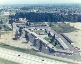
1969 Richards stock footage. Closer look by air at the 7-month-old Aladdin Apartments, located in the city's south end at 2112 So. 90th St. The upscale apartment complex, built by developer Oscar Hokold, was opened in September of 1968. Residents of the one and two bedroom units enjoyed such amenities as spacious bedrooms, wall-to-wall carpeting, soundproofing and dishwashers. All had views of the landscaped greens and swimming pool area.


Aerial views; Aladdin Apartments (Tacoma); Housing developments--Tacoma--1960-1970;

Results 121 to 150 of 824