- 9.15-GRIFFIN-G708
- Item
- 1927
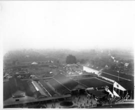
Part of Washington State Fair Collection
Aerial photo of grounds showing midway and barns, Grandstand at far right.
Part of Washington State Fair Collection
Aerial photo of grounds showing midway and barns, Grandstand at far right.
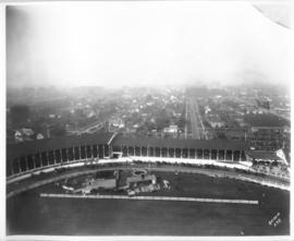
Part of Washington State Fair Collection
Aerial photo of Grandstand full of spectators.
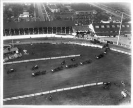
Part of Washington State Fair Collection
Aerial view of full Grandstand, wagon teams parading around interior.
Part of Richards Studio Photographs
The Bon Marche was no longer the only occupant of the Tacoma Mall Shopping Center on the south side of Tacoma in October,1965 when this aerial photograph was taken. A full-line J.C. Penney's had opened at the southeast end of the large building complex and many smaller specialty stores had joined the two large department stores. Acres of free parking proved to be a major draw, and the enclosed mall design kept customers out of the wind and rain. The National Bank of Washington's circular building is prominent near the Mall; I-5 freeway, providing easy access to the Mall, runs along the photograph's left side. The Wapato Lake area is southeast of the Mall to the left of I-5, near the horizon. Most of the residential development surrounding the Mall has been converted over the years into commercial property.
Aerial photographs; Shopping centers--Tacoma; Bon Marche (Tacoma); National Bank of Washington (Tacoma); J.C. Penney Co. (Tacoma);
Part of Richards Studio Photographs
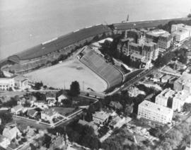
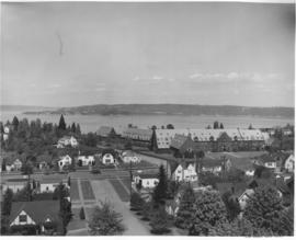
ca. 1971. This is an aerial view of the Stadium district as photographed circa 1971. Stadium Bowl is in the center with Stadium High School on the right and the Washington State Historical Society Museum on the left. Stadium Bowl, built in 1909, has been renovated circa 1980 and been subjected to several damaging mudslides in 1932, 1949, and 1981. It now has a modern capacity of 15,000, downsized from its original seating capacity of 23,486. Stadium Bowl was originally designed by Tacoma architect Frederick Heath. BU-11652
Aerial photographs; Aerial views; Neighborhoods--Tacoma--1970-1980; Stadium Bowl (Tacoma); Stadium High School (Tacoma); Washington State Historical Building (Tacoma);
Part of Richards Studio Photographs
Associated Oil Company aerial view of Tacoma from The Narrows looking east. Ordered by George Martinac, North Pacific Bank Note Company.
Aerial photographs;
Part of Richards Studio Photographs
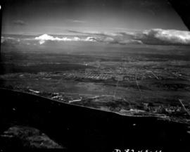
ca. 1939. Associated Oil Company aerial view of Tacoma, West End to Downtown, tideflats and beyond. Piers for first Narrows Bridge under construction. Ordered by George Martinac, North Pacific Bank Note.
Aerial photographs; Tacoma Narrows Bridge (Tacoma); Bridges--Tacoma;
Part of Richards Studio Photographs
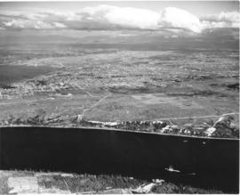
ca. 1939. Associated Oil Company aerial view of Tacoma West End showing area above Titlow Beach and Day Island. Photograph taken circa 1939. Ordered by George Martinac, North Pacific Bank Note Company.
Aerial photographs; Titlow Park (Tacoma);
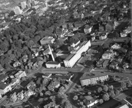
Part of Richards Studio Photographs
Aerial view of North End Tacoma showing Annie Wright Seminary, surrounding neighborhood and Commencement Bay.
Aerial photographs; Private schools--Tacoma; Annie Wright Seminary (Tacoma)--Buildings;
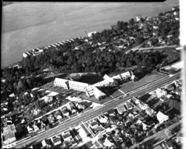
Part of Richards Studio Photographs
ca. 1938. Aerial view of Tacoma General Hospital and surrounding neighborhood including Wright Park as pictured circa 1938.
Aerial photographs; Tacoma General Hospital (Tacoma); Wright Park (Tacoma);
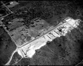
Part of Richards Studio Photographs
Aerial view of cleared property above The Narrows showing sparse development in the area east of subject site. Ordered by Mr. Wiborg.
Aerial photographs; Real estate development--Tacoma--1940-1950; Clearing of land--Tacoma--1940-1950; Land subdivision--Tacoma--1940-1950;
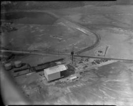
Part of Richards Studio Photographs
Aerial view of Ferro-Alloys plant on Tideflats. [Also dated 08-01-1941]
Aerial Photographs - Pierce County - Tacoma - Port IndustrialIndustries - Metal Industries
Part of Richards Studio Photographs
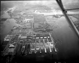
Sea-Tac Shipyard, aerial view of facilities. Docks, buildings, equipment and water as photographed in October of 1941.
Aerial photographs; Seattle-Tacoma Shipbuilding Corp. (Tacoma); World War, 1939-1945--Economic & industrial aspects--Tacoma; Boat & ship industry--Tacoma--1940-1950;
Part of Richards Studio Photographs
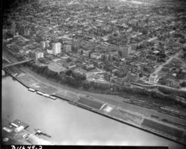
Aerial view of downtown Tacoma including waterfront warehouses and half-moon railroad yards. This July of 1941 photograph, looking westward, shows the densely packed business districts of Tacoma as well as outlying residential areas. The waterway is the City (now Thea Foss) Waterway with the 11th St. Bridge (now Murray Morgan Bridge) in view.
Aerial views; Aerial photographs; Cityscapes; City Waterway (Tacoma); Business districts--Tacoma--1940-1950; Commercial streets--Tacoma--1940-1950;
Part of Richards Studio Photographs
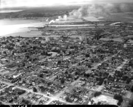
1941 Aerial view of downtown Tacoma showing the Central Business District, Port/Industrial, and Central residential areas. The 11th St. Bridge (now Murray Morgan Bridge) leads traffic over the City (now Thea Foss) Waterway over to the industrial Tideflats.
Aerial views; Aerial photographs; Cityscapes; City Waterway (Tacoma); Business districts--Tacoma--1940-1950; Commercial streets--Tacoma--1940-1950; 11th Street Bridge (Tacoma);
Part of Richards Studio Photographs
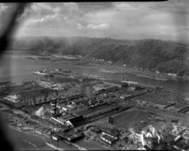
Aerial view of Sea-Tac Shipyard taken on July 20, 1941. Even before the U.S. entered WWII, the Seattle-Tacoma Shipyard was busy with building tankers and C-3 freighters for the government.
Aerial views; Aerial photographs; Seattle-Tacoma Shipbuilding Corp. (Tacoma); Boat & ship industry--Tacoma--1940-1950;
Part of Richards Studio Photographs
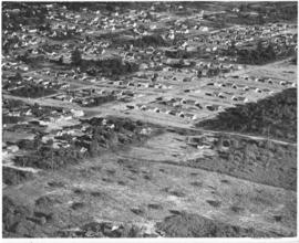
Studio stock negatives. An aerial view of new housing developments. Uncleared land abruptly abuts the housing development. Across the road in the foreground are a few small homes set on what looks like pasture land.
Aerial photographs; Land; Land use--Tacoma--1940-1950; Housing developments--Tacoma--1940-1950;
Part of Richards Studio Photographs
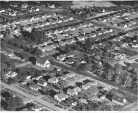
Studio stock negatives. An aerial view of new housing developments in Tacoma during the late 1940's.
Aerial photographs; Land; Land use--Tacoma--1940-1950; Housing developments--Tacoma--1940-1950;
Part of Richards Studio Photographs
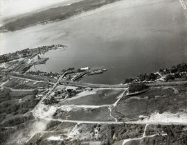
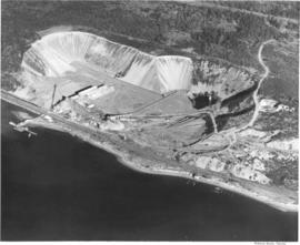
This aerial photograph of the Pioneer Sand and Gravel Company gravel pit was taken in November of 1949. The large gravel pit was located in Steilacoom adjacent what is now University Place; their offices were in Seattle, at 901 Fairview Avenue North. The company specialized in sand, gravel, building materials and "Tru-Mix" concrete. Some years later the pit and the land surrounding it became part of Chambers Creek Properties. In June of 2007 the $21 million Chambers Bay Golf Course opened on this site. TPL-10540
Industry--Steilacoom; Sand--Steilacoom; Digging--Steilacoom; Waterfronts; Harbors--Steilacoom; Sandstone quarrying--Steilacoom; Industrial facilities--Steilacoom; Aerial views; Pioneer Sand & Gravel Co. (Steilacoom);
Part of Richards Studio Photographs
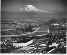
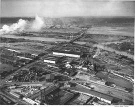
This aerial view of part of the sprawling St. Paul & Tacoma Lumber Company complex with Mount Rainier in the background dates from September of 1950. St. Paul & Tacoma with its many buildings, smokestacks and burners was located in the southwest section of the Tacoma tideflats near the Puyallup River; their headquarters were at 1220 Saint Paul Avenue. The white bridge near the center of the image crossing the channelized Puyallup River is the Lincoln Avenue bridge. Two railroad bridges and the Pacific Highway (U.S. Hwy 99) bridge can be seen further up the river.
Aerial photographs; St. Paul & Tacoma Lumber Co. (Tacoma); Cityscapes; Lumber industry--Tacoma--1950-1960;
Part of Richards Studio Photographs
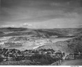
Scenic views from Eastern Washington. An aerial view of the housing area across the Columbia River from the utility facilities at Grand Coulee Dam. Mason City was built on one side of the river during the dam construction and Engineer's Town grew on the opposite side. This view shows the land forms above the river into the distance.
Columbia River (Wash.); Land; City & town life;
Part of Richards Studio Photographs
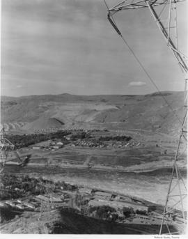
Scenic views from Eastern Washington. An aerial view of the town on the far side of the river and Grand Coulee Dam plant facilities in the foreground. A tower for delivering electric power from the plant is seen on the right as others climb the hill from below. Electrical energy generated at the power plant at 13,800 volts is stepped up to 230,000 volts for long distance transmission by groups of transformers. High tension lines from the transformers are carried on steel towers over the powerhouse and up the canyon walls to a switchyard, where facilities are provided for interconnecting generating units and transmission lines. (Grand Coulee from "Hell to Breakfast", Fred O. Jones)
Aerial photographs; Columbia River (Wash.); Utility poles; Hydroelectric power;
Part of Richards Studio Photographs
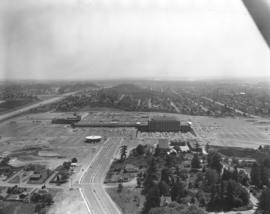
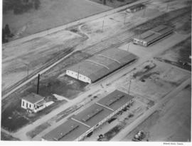
ca. 1950. Aerial photograph of the Pacific Naval Advance Base in Lakewood taken probably in the fall of 1950. Lakewood Navy Yard was the more familiar name used for the base. The U.S. Navy acquired the land to build its naval base in 1944; previously the land had been home to the Tacoma Speedway and the Tacoma Municipal Airport. Nearly twenty years later, Clover Park Vocational-Technical Institute opened their doors on part of the site. A glimpse of Mountain View Cemetery can be seen at the top of the photograph. TPL-9284
Aerial photographs; Pacific Naval Advance Base (Lakewood); Lakewood Navy Yard (Lakewood); Mountain View Memorial Park (Lakewood); Clover Park Vocational-Technical Institute (Lakewood);
Part of Richards Studio Photographs
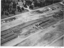
ca. 1950. Aerial view of the Lakewood Navy Yard, formally known as the Pacific Naval Advance Base; photograph taken probably in the fall of 1950. Rectangular one story buildings are scattered throughout the naval yard. Mountain View Cemetary lies across the street on Steilacoom Blvd.
Pacific Naval Advance Base (Lakewood); Lakewood Navy Yard (Lakewood); Aerial photographs; Mountain View Memorial Park (Lakewood);
Part of Richards Studio Photographs
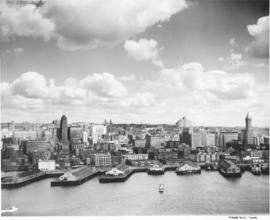
Aerial of Seattle skyline taken from above Elliott Bay. Piers jut into the bay with warehouses on them. Smith Tower is the taller building on the right. TPL-4749
Aerial photographs; Cityscapes; Skyscrapers--Seattle; Piers & wharves--Seattle; Harbors--Seattle; Smith Tower (Seattle);
Part of Richards Studio Photographs
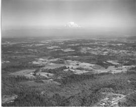
Studio stock negatives. An aerial view of rural Pierce County with open and wooded areas. Small groupings of buildings are dotted over the area. Mount Rainier is seen above the mist.
Aerial photographs; Land; Rainier, Mount (Wash.);
Part of Richards Studio Photographs
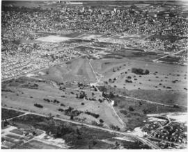
An aerial view of Allenmore Golf Course that includes the residential neighborhoods around the golf course. In the background can be seen the taller buildings of the Tacoma business district and beyond that, Commencement Bay.
Allenmore Golf Club (Tacoma); Golf--Tacoma--1950-1960; Sports & recreation facilities--Tacoma; Aerial photographs; Land use--Tacoma;
Part of Richards Studio Photographs
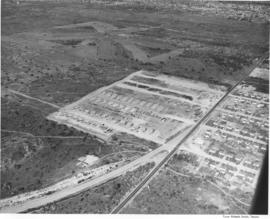
Ponder Sales & Service Inc. sold diesel stove and heavy fuel oils. They were located at 764 Commerce Street. Aerial view ordered by Ponder Sales and Service Co.
Aerial photographs; Aerial views; Roads; H.M. Ponder Oil Sales & Service Co. (Tacoma);
Part of Richards Studio Photographs
Annie Wright Seminary was a college preparatory school for girls. Miss Ruth Jenkins was the headmistress of the school. Aerial view of Annie Wright Seminary, Commencement Bay in background.
Educational facilities--Tacoma; Private schools--Tacoma; Aerial photographs; Annie Wright Seminary (Tacoma)--Buildings;
Part of Richards Studio Photographs
Aerial view of West Coast Grocery, St. Paul and Tacoma lumber and Tacoma Iron and Steel. A view of the Tacoma tideflats and some of the industry built on it looking north.
Tacoma Tideflats (Tacoma); Aerial photographs; Industry--Tacoma--1940-1950;