Identity elements
Reference code
Name and location of repository
Level of description
Item
Title
A113921-8
Date(s)
- 1958-04-22 (Creation)
Extent
Name of creator
Content and structure elements
Scope and content
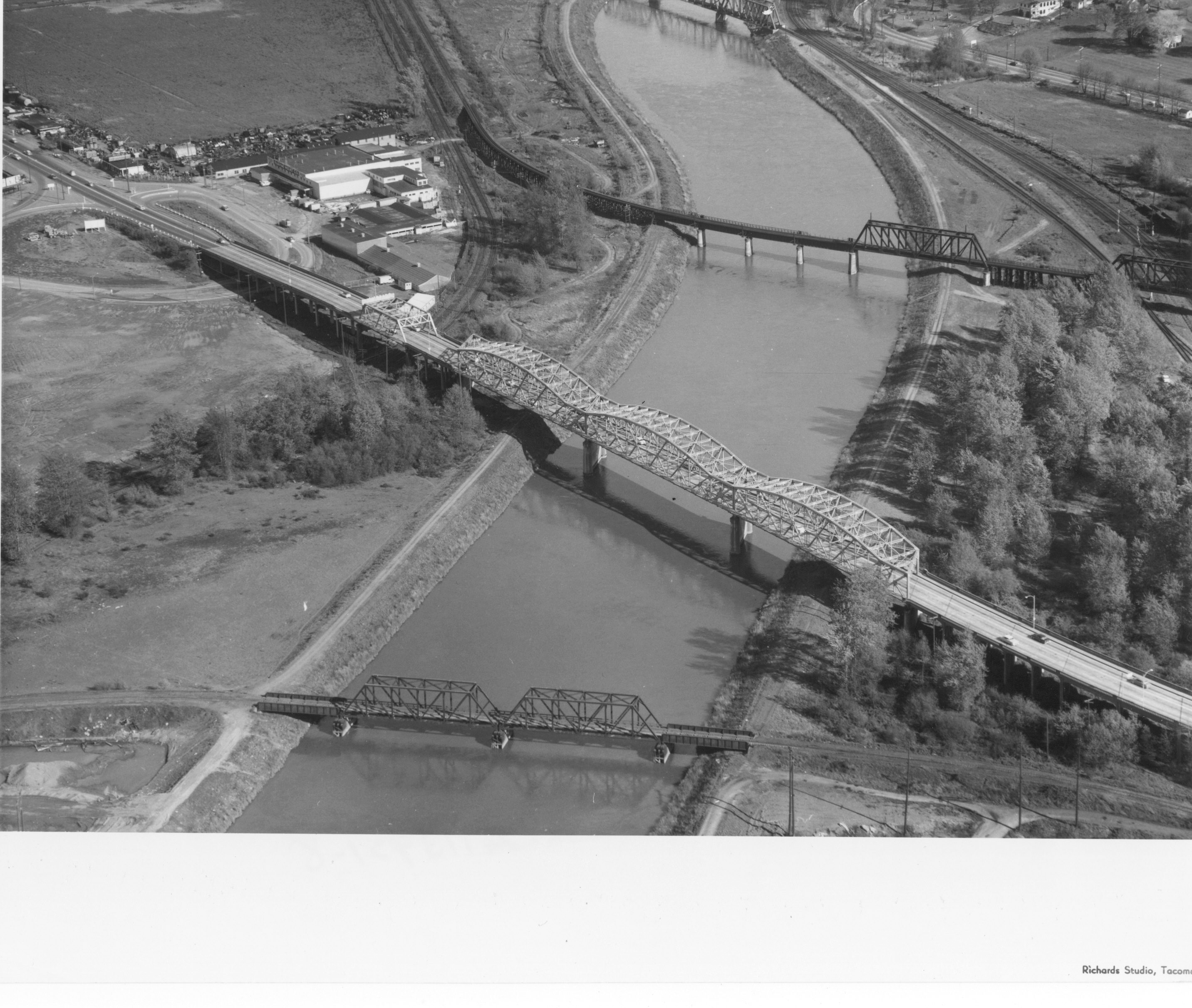
Another view of the bridges crossing the Puyallup River was taken via air by Richards Studio on April 22, 1958. Water levels indicate that the river had not overflooded its borders. There are no buildings directly on the river's edge because of the flooding potential. The white or light gray colored bridge has been identified as the Eells St. bridge looking south. From above it appears to have an open geometric design; the curvature on top is reminiscent of a roller coaster track. It connected Pacific Highway and Fife to the left and Puyallup Ave. and Tacoma to the right. The other two bridges were railroad bridges and still there some fifty years later. (Additional identification provided by a reader)
Aerial photographs; Bridges--Tacoma--1950-1960; Railroad bridges--Tacoma; Eells St. State Highway Bridge (Tacoma); Puyallup River (Wash.);