Identity elements
Reference code
Name and location of repository
Level of description
Item
Title
A116230-1
Date(s)
- 1958-08-14 (Creation)
Extent
Name of creator
Content and structure elements
Scope and content
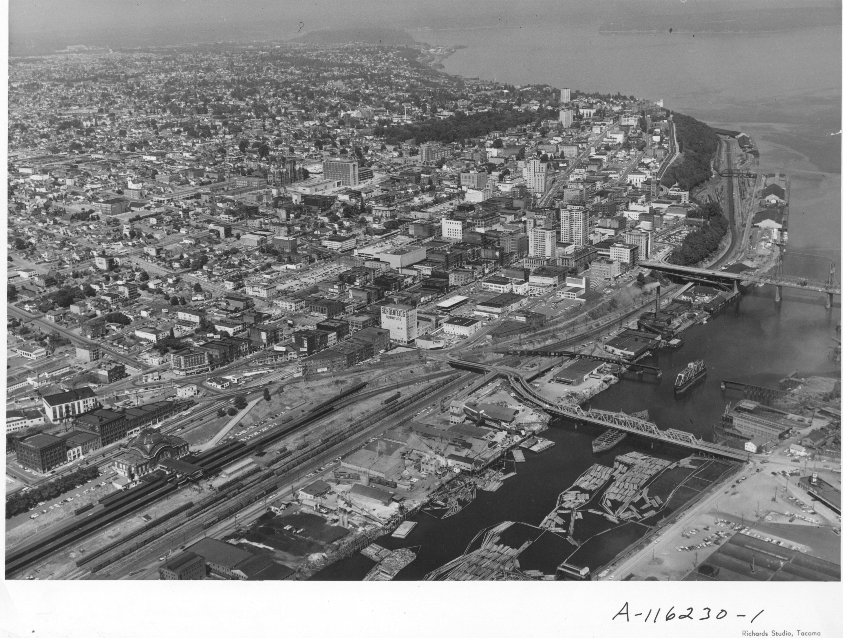
Aerial photographs taken on an overcast August 14, 1958, show the bustling downtown area and beginnings of the Tideflats. The 11th and 15th St. bridges cross the City (now Thea Foss) Waterway leading to the city's industrial area. The new County-City Building and soon-to-be demolished Courthouse are clearly evident toward the center of the picture. Wright Park is the wooded area nearby. Schoenfelds enormous lettering always captures the camera's eye as it wanders along Pacific Avenue, with Puget Sound National Bank and the Washington Building further up the road. Shuster Parkway is not yet built but its pathway can be imagined near the wooded area close to the 11th St. bridge. The area around 24th & Pacific, including Jefferson, and other portions of downtown Tacoma, were scheduled for an urban renewal project in the late '50's. That area is near the lower left corner by the Union Station. This downtown area would be the home of the future University of Washington-Tacoma campus. TPL-8158
Aerial photographs; Commercial streets--Tacoma--1950-1960;