D11798-2A

Open original Digital object

Identity elements

Reference code

Name and location of repository

Level of description

Item

Title

D11798-2A

Date(s)

  • 1941-07 (Creation)

Extent

Name of creator

Content and structure elements

Scope and content

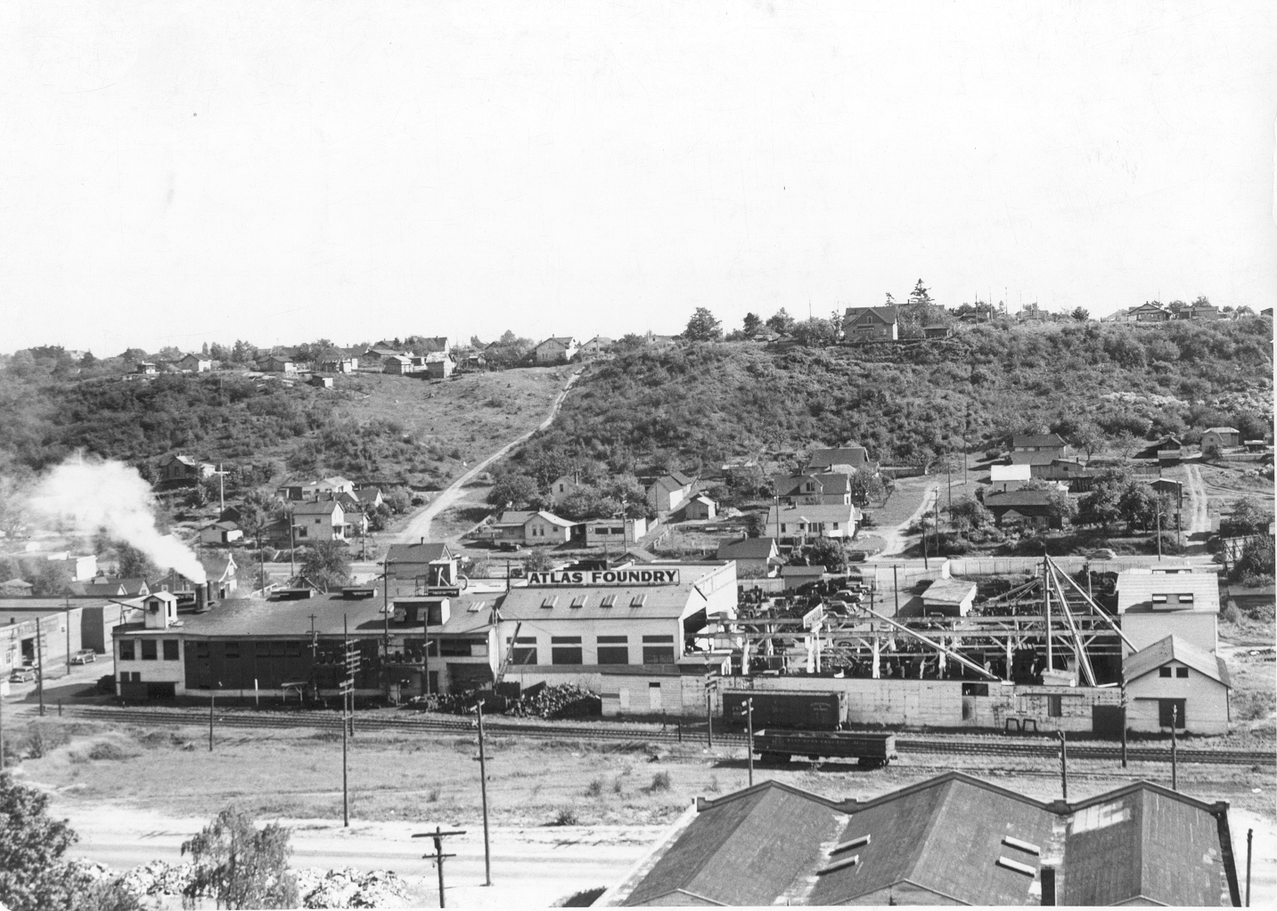
By July of 1941, when this photograph was taken, the sprawling Atlas Foundry had already been located at South 30th and Wilkeson Streets for almost 40 years. Their complex of buildings was located between Center Street (the road showing at the bottom) and South Tacoma Way in the Center Street Industrial District at the east end of "Nalley's Valley". The Atlas Foundry was built right next to the Northern Pacific Rail Road tracks which ran past their north side. The dirt road going up the hill at left-center is Wilkeson Street. [Also dated 08-26-1941]


Atlas Foundry & Machine Co. (Tacoma); Foundries--Tacoma--1940-1950;

System of arrangement

Conditions of access and use elements

Conditions governing access

Technical access

Conditions governing reproduction

Languages of the material

Scripts of the material

Language and script notes

Finding aids

Acquisition and appraisal elements

Custodial history

Immediate source of acquisition

Appraisal, destruction and scheduling information

Accruals

Existence and location of originals

Existence and location of copies

Related archival materials

Related descriptions

Notes element

Specialized notes

Alternative identifier(s)

Rules or conventions

Sources used

Access points

Subject access points

Place access points

Name access points

Genre access points

Digital object metadata

Digital object (Master) rights area

Digital object (Reference) rights area

Digital object (Thumbnail) rights area

Accession area

Related people and organizations

Related genres