Identity elements
Reference code
Name and location of repository
Level of description
Item
Title
D129800-131
Date(s)
- 1961-04-05 (Creation)
Extent
Name of creator
Content and structure elements
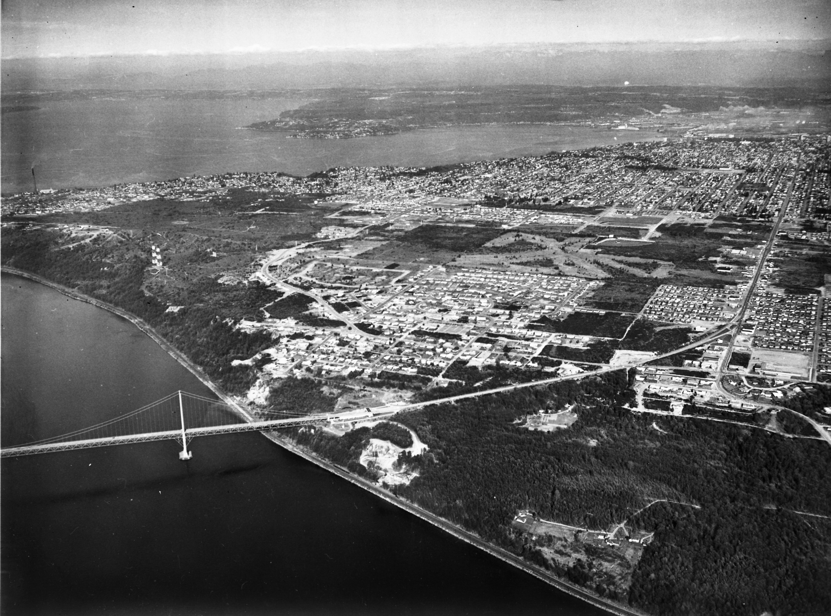
Scope and content
Aerial view from the Narrows of Tacoma's West End with downtown, the Tideflats and Browns Point beyond. Sixth Avenue runs down the right side of the photograph, veering left to form the entranceway for the second Narrows Bridge. Pearl Street crosses Sixth about 2/3 up, with the area allotted for the Tacoma airport still undeveloped. The area between where Sixth leads to the bridge and Titlow Beach (off the photo at right) is mostly undeveloped. The smokestack for the ASARCO plant can be seen on the far left, surrounded by the city of Ruston. For an older view of this same area (ca. 1939), see D8245 image 1. TPL-9158
Aerial photographs; Neighborhoods--Tacoma--1960-1970; Streets--Tacoma--1960-1970; Tacoma Narrows Bridge (Tacoma); Bridges--Tacoma--1960-1970; Suspension bridges--Tacoma;