D75943-16

Open original Digital object

Identity elements

Reference code

Name and location of repository

Level of description

Item

Title

D75943-16

Date(s)

  • 1953-07-02 (Creation)

Extent

Name of creator

Content and structure elements

Scope and content

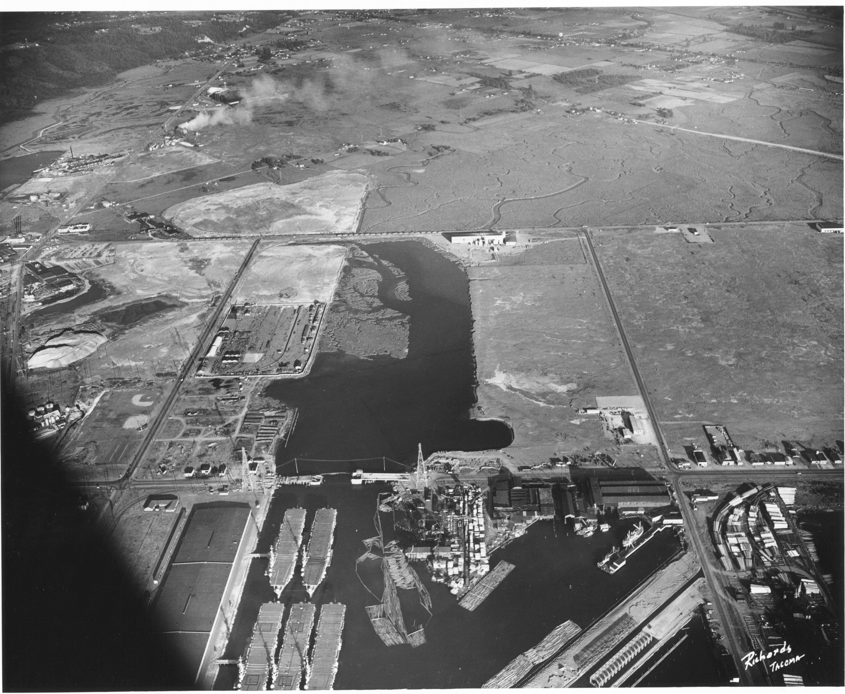
Aerial view of the Tacoma tideflats and Port of Tacoma. High tide. The road about halfway up the picture is East 11th Street as it crosses the Port Industrial Waterway. The partially completed bridge that opened in November of 1953 can be seen. In the left foreground of the picture are the baby flattops constructed for WWII and then stored here after the war. The Port of Tacoma Pier 1 lies to the right. Port of Tacoma Rd. runs from the Port to Lincoln Ave. The city of Tacoma had plans for all of the vacant land. They planned to fill it where needed and sell it to industries that needed deep water ports. TPL-2257


Aerial views; Port of Tacoma (Tacoma)--1950-1960;

System of arrangement

Conditions of access and use elements

Conditions governing access

Technical access

Conditions governing reproduction

Languages of the material

Scripts of the material

Language and script notes

Finding aids

Acquisition and appraisal elements

Custodial history

Immediate source of acquisition

Appraisal, destruction and scheduling information

Accruals

Existence and location of originals

Existence and location of copies

Related archival materials

Related descriptions

Notes element

Specialized notes

Alternative identifier(s)

Rules or conventions

Sources used

Access points

Subject access points

Place access points

Name access points

Genre access points

Digital object metadata

Digital object (Master) rights area

Digital object (Reference) rights area

Digital object (Thumbnail) rights area

Accession area

Related subjects

Related people and organizations

Related genres

Related places