Showing 28 results

Collections
Aerial Photography With digital objects 128,000-132,000
Print preview View:

A128448-3

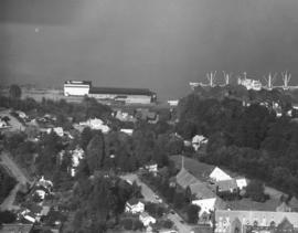
Aerial view of Annie Wright Seminary and north end neighborhood surrounding the school, taken on October 4, 1960. The private school's tennis courts and playing field are visible with thick forest acting as buffer. Also included is portion of Commencement Bay with large ship docked.


Aerial photographs; Annie Wright Seminary (Tacoma)--1960-1970;

A128445-2

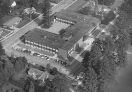
Aerial view of newly completed Pacific Lutheran University administration building taken in early October, 1960. Designed by architects Lea, Pearson & Richards, the two-story U-shaped modern structure was dedicated on October 14, 1960. It had 55,000 square feet of floor space. Initially called the Tacoma-Pierce Administration Building, it was later re-named after Philip E. Hauge, Dean of the University who had spent 45 years with the school. (TNT 10-12-60, C-10)


Aerial photographs; Universities & colleges--Parkland--1960-1970; Pacific Lutheran University (Parkland) --1960-1970;

D129800-69

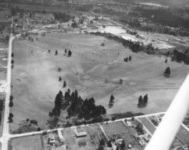
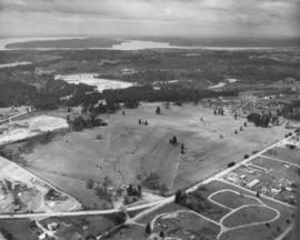
ca. 1961. Scenic views and stock footage, 1961. A closer aerial look at the Meadow Park Golf Course at 7108 Lakewood Dr. W. shows newly planted trees along with older firs and oaks. Meadow Park is now run under the auspices of Metro Parks. Shortly before Christmas, 1960, the wooden clubhouse at the golf course was destroyed by fire. According to Lakewood Fire Chief Bruce White, the loss totaled $50,000.


Aerial photographs; Meadow Park Golf Course (Lakewood); Golf--Lakewood--1960-1970;

D129800-64

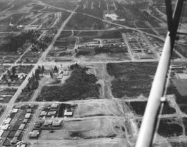
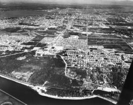
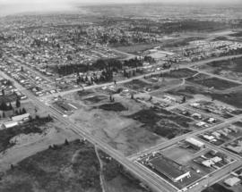
ca. 1961. Scenic views and stock files, 1961. Aerial photograph of city's north end including the Sixth Avenue, Orchard and Bantz Blvd (now Hwy. 16) areas. Cheney Stadium in upper left corner. Horizontal center street is Sixth Avenue with Orchard running vertically. Bantz Blvd. (now part of Hwy 16) is upper portion of photo, intersecting with Orchard. Thickly wooded terrain on Sixth Avenue is now (2004) filled with shopping malls, Kmart is across the street. Building near Sixth & Orchard is believed to be the First Christian Church directly across the street from Busch's Drive -In.


Aerial photographs; Neighborhoods--Tacoma--1960-1970; Streets--Tacoma--1960-1970;

D129800-42

Scenic views and stock footage, 1961. Tacoma Airport is in center. Aerial photograph of Day Island with connecting bridge that leads to South 27th St. and showing fast growing University Place community. In February, 1961, the Day Island Yacht Club spent $30,000 in a moorage and dredging project. There would be moorage spaces for 80 boats for the club established in 1950. The project would consist of building of a bulkhead, dredging, and driving of piling. (TNT 2-16-61, A-2)


Aerial photographs; Neighborhoods--University Place--1960-1970; Neighborhoods--Day Island--1960-1970;

D129800-130

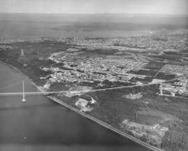
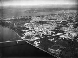
ca. 1961. Stock footage, 1961. Air view of the Tacoma Narrows Bridge in 1961; the second Narrows Bridge was eleven years old at that point. Much of the wooded area in the photograph has been replaced by homes 40 years later.


Aerial photographs; Tacoma Narrows Bridge (Tacoma); Suspension bridges--Tacoma; Bridges--Tacoma--1960-1970;

A129800-156

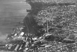
ca. 1961. Scenic view and stock footage, 1961. Smoke billowing, the American Smelting & Refining Co. (better known as ASARCO)'s smokestack was once the largest smokestack in the world at 571 feet when completed in 1917. Repairs shortened it to 562 feet twenty years later. ASARCO was a major employer in Tacoma for decades; it closed in 1985 due to economic and environmental reasons. The smelter stack was demolished on January 17, 1993.


Aerial photographs; American Smelting & Refining Co. (Tacoma); Smelters--Tacoma--1960-1970; Smokestacks--Tacoma; Industrial facilities--Tacoma;

A129800-111

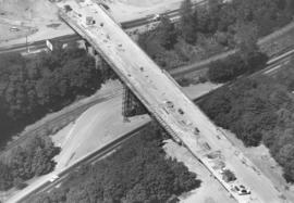
ca. 1961. Stock footage, 1961. Aerial view of Yakima Avenue Bridge under construction in 1961. Northern Pacific railroad tracks below. The $1,300,000 bridge was scheduled to be completed by late spring and opened to traffic in April or May. The Yakima Avenue Bridge would give Tacoma a new route to the city's South End. (TNT 12-11-60, A-1)


Aerial photographs; Bridge construction--Tacoma--1960-1970; Bridges--Tacoma--1960-1970; Yakima Avenue Bridge (Tacoma);

A129800-112

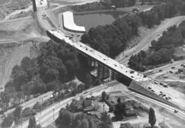
ca. 1961. The $1,300,000 Yakima Avenue Bridge was scheduled to be completed by late April or early May 1961. It was part of Tacoma's six-year capital improvement program which began in 1959. This aerial view of the bridge while under construction clearly shows the Hood Street Reservoir (top center) to the southwest of the bridge, South Tacoma Way (bottom left to top right), and Center Street. (TNT 12-11-60, A-1)


Aerial photographs; Bridge construction--Tacoma--1960-1970; Bridges--Tacoma--1960-1970; Yakima Avenue Bridge (Tacoma); Streets--Tacoma--1960-1970; Reservoirs--Tacoma; Hood Street Reservoir (Tacoma);

C130947-1

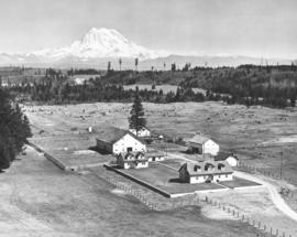
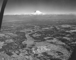
ca. 1961. Aerial photograph of Rocky Ridge Ranch. Snow-capped Mount Rainier in background. There are at least two houses on the ranch with four outbuildings, two of them barns. Photograph ordered by Harold Allen Co. on May 16, 1961.


Aerial photographs; Ranches; Rainier, Mount (Wash.);

D128560-2

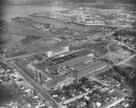
Aerial photograph of Bethlehem Steel plant. A Richards Studio photographer in a SeaTac Helicopter flew over the Bethlehem Steel nut and bolt plant on October 12, 1960 and took several shots of the facility located at Spokane & West Marginal Way in Seattle. The large plant appears nestled in a mixed residential/industrial neighborhood with easy access to highways and water transportation. Photograph ordered by Bethlehem Pacific Coast Steel Corp.


Aerial photographs; Bethlehem Pacific Coast Steel Corp. (Seattle); Industrial facilities--Seattle;

D129800-186

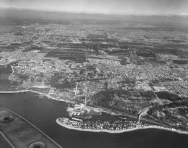
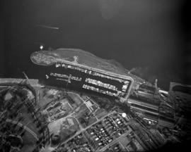
ca. 1961. Circa 1961 aerial view of Tacoma Yacht Club, ASARCO smelter, Point Defiance Park and Ruston. The large, long buildings to center left belong to the copper smelter ASARCO. To the right of ASARCO is the Tacoma Yacht Club and its mooring. Above the Yacht Club is the outline of Pt. Defiance's amusement park Funland. To the upper right hand of the photograph is the pond garden in the Bowl area entrance to Point Defiance. To the upper center is the city of Ruston.


Aerial photographs; Boathouses; Boats; Tacoma Yacht Club (Tacoma); Mooring; American Smelting & Refining Co. (Tacoma); Smelters--Tacoma--1950-1960; Funland (Tacoma); Point Defiance Park (Tacoma); Amusement parks--Tacoma--1930-1940;

A129800-158

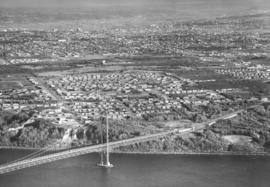
Traffic was flowing smoothly in this November 1961 aerial photograph of the Tacoma Narrows Bridge. The camera was looking east toward the rapidly developing west end of Tacoma. The graceful lines of the suspension bridge span nearly one-half mile, making it the 5th longest suspension bridge in the US. This was the second Narrows Bridge, dedicated in 1950; the first collapsed in high winds on November 7, 1940, only four months after its dedication. The 1950 bridge was designed to carry 60,000 cars a day. When area population growth increased that number by half, a third bridge was added; parallel to and south of the 1950 bridge. The third Narrows bridge was dedicated in July of 2007 and carries east bound traffic, leaving all lanes of the 1950 bridge open for west bound traffic. (www.wsdot.wa.gov)


Aerial photographs; Tacoma Narrows Bridge (Tacoma); Suspension bridges--Tacoma; Bridges--Tacoma--1960-1970; Neighborhoods--Tacoma--1960-1970;

D129800-3

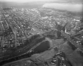
ca. 1961. Scenic views and stock file, 1961. Aerial view heading north toward the water showing site of Yakima Avenue Bridge under construction with Hood St. Reservoir as large body of water to the lower center. Holy Rosary Church is structure with tall steeple near Tacoma Avenue South. Downtown businesses at top center with busy industrial Tideflats across waterways at right.


Aerial photographs; Bridge construction--Tacoma--1960-1970; Bridges--Tacoma--1960-1970; Yakima Avenue Bridge (Tacoma); Holy Rosary Church (Tacoma);

D129737-2

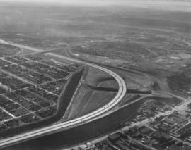
This aerial view of Tacoma, taken from 1,200 feet, shows I-5 and the 38th Street cloverleaf as they appeared in January of 1961. The simple curve of the highway had not yet been complicated by the addition of the Highway 16 interchange. The houses to the left are surrounded on the north and west by I-5 and on the south by 38th Street. The buildings at the bottom, right are on South Tacoma Way.


Aerial photographs; Express highways--Tacoma--1960-1970;

D129800-68

ca. 1961. Aerial photograph of the Meadow Park Golf Course, taken for 1961 stock footage. Located at 7108 Lakewood Drive West, the Meadow Park Golf Course now offers 27 holes of golf on a well developed course lined with fir and oak trees.


Aerial photographs; Meadow Park Golf Course (Lakewood); Golf--Lakewood--1960-1970;

D129800-34

Airborne view of George Barclay's Mayfair Estates, 1961. Local builder George Barclay constructed many homes in his 90-acre Mayfair Estates located in the E. 138th St. area of Parkland. Aerial photograph shows homes would have splendid views of Mount Rainier. Tree stands dot the landscape. One of Barclay's homes at 1312 E. 138th St. was selected as the 1960 Idea Home for Better Homes & Garden magazine.


Aerial photographs; Neighborhoods--Parkland;

D129383-15

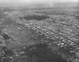
Large sections of wooded terrain are interspersed with neatly laid out streets in aerial photographs taken by the Richards Studio on December 15, 1960. Looking northwest, South Tacoma railroad shops are on the left; flat bare land upper center is location of future Tacoma Mall. Photograph taken on behalf of North Pacific Bank.


Aerial photographs; Neighborhoods--Tacoma--1960-1970;

D129800-131

Aerial view from the Narrows of Tacoma's West End with downtown, the Tideflats and Browns Point beyond. Sixth Avenue runs down the right side of the photograph, veering left to form the entranceway for the second Narrows Bridge. Pearl Street crosses Sixth about 2/3 up, with the area allotted for the Tacoma airport still undeveloped. The area between where Sixth leads to the bridge and Titlow Beach (off the photo at right) is mostly undeveloped. The smokestack for the ASARCO plant can be seen on the far left, surrounded by the city of Ruston. For an older view of this same area (ca. 1939), see D8245 image 1. TPL-9158


Aerial photographs; Neighborhoods--Tacoma--1960-1970; Streets--Tacoma--1960-1970; Tacoma Narrows Bridge (Tacoma); Bridges--Tacoma--1960-1970; Suspension bridges--Tacoma;

D129800-43

Aerial view from Commencement Bay of Tacoma's West End with downtown and the Tideflats beyond. Running down the center of the photograph is Sixth Ave, which veers left to serve as the entrance for the second Narrows bridge. The portion that veers to the right travels to Titlow Park. In the lower right hand corner the Park's swimming pool and the natural salt water lagoon can be seen. The area around the Narrows is still largely undeveloped. Crossing Sixth Ave. at about the center of the picture is Pearl Street. The Tacoma Auto View Theater is at 1202 North Pearl. To the left of the Auto View and below, an abandoned excavation looks like pattern against the ground. For an older view of this same area (ca. 1939), see D8245 image 1. TPL-9157


Aerial photographs; Neighborhoods--Tacoma--1960-1970; Streets--Tacoma--1960-1970; Titlow Park (Tacoma);

D129800-80

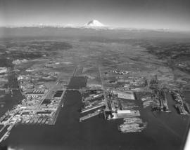
ca. 1961. Stock footage and scenic views, 1961. Port of Tacoma industrial landscape with Mount Rainier in background. Hylebos bridge extending over the Hylebos; 11th St. extends over the Port Industrial, Sitcum, Milwaukee and Puyallup Waterways. Log dumps near and in the Sitcum Waterway, probably for use by Tacoma Boatbuilding. TPL-10517


Aerial photographs; Port of Tacoma (Tacoma); Rainier, Mount (Wash.);

D129800-75

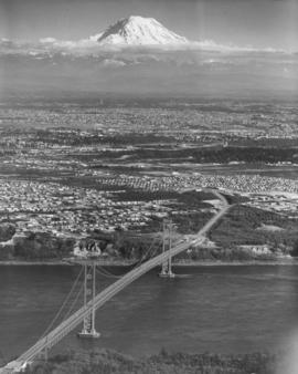
ca. 1961. Tacoma-side view of the second Narrows Bridge; stock aerial footage, 1961. Mount Rainier rises majestically in the background overlooking the Narrows Bridge. Henry F. Hunt Junior High (now Middle School) with its unique mushroom-shaped cafeteria lies off the Sixth Avenue approach to the bridge on So. 10th St. Permission was granted to the Washington Pilots Assn. to reproduce this photograph in conjunction with its 1963 convention.


Aerial photographs; Tacoma Narrows Bridge (Tacoma); Suspension bridges--Tacoma; Henry F. Hunt Junior High School (Tacoma);

A129800-113

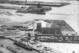
ca. 1961. Scenic view and stock footage, 1961. Aerial view of busy Port of Tacoma in 1961on Sitcum and Port Industrial Waterways; building in the center is the port's own grain elevators along with loading dock and storage buildings. The two buildings above the granary are terminals and warehouse #1 belonging to the Chicago, Milwaukee, St. Paul & Pacific RR. Ships are docked waiting to load plywood and other lumber products. Log dumps located nearby.


Aerial photographs; Port of Tacoma (Tacoma);

D130081-2

Tacoma's landscape in the 1960's would slowly be changing as nearly all of the vacant land and woods near the Sixth Avenue and Orchard area would be occupied by new homes and businesses. The tip of Cheney Stadium can be seen in the upper right hand corner. Busch's Drive-In is the long building with dark roof towards the center of the photograph; the bare area next door would become part of Kmart in the future. Boulevard Texaco service station is next to Busch's at the intersection of Sixth & Orchard. Across Sixth Avenue from Busch's is the relocated First Christian Church which was dedicated on February 19, 1961. The church had originally been located in downtown Tacoma since 1906; a new building was constructed at 6th & Orchard for $400,000. The large rectangular building with dark roof near the bottom right of the picture is believed to be Stebner's Inc, located at 5510 Sixth Ave. Stebner's was located two blocks west of Busch's and had celebrated its grand opening at that location on November 17, 1960. Photograph ordered by Busch's Sixth Avenue Drive-In.


Aerial photographs; Neighborhoods--Tacoma--1960-1970; Busch's Sixth Avenue Drive-In Restaurant (Tacoma); Boulevard Texaco (Tacoma); First Christian Church (Tacoma); Stebner's, Inc. (Tacoma);

D129752-1

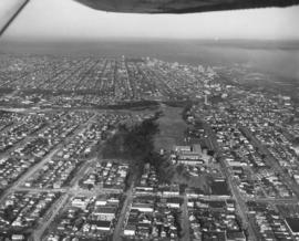
Looking northward, the Lincoln district in 1961. Lincoln High School is group of buildings near the center of the photograph; street to its right is South G. South 38th St. runs horizontally near bottom. Large trees are part of Lincoln Park. Holy Rosary Church with tall steeple is less than a mile away from the school. Photograph ordered by Lincolnian, Lincoln High School's yearbook. TPL-9695


Aerial photographs; Lincoln High School (Tacoma); Public schools--Tacoma; Neighborhoods--Tacoma--1960-1970;

D129800-60

ca. 1961. This aerial photograph from 1961 shows the area immediately west of Orchard Street, and south of 6th Avenue. Starting at the corner of 6th and Orchard (lower left), the main buildings on 6th Ave. are: Boulevard Texaco, 5102 6th Ave.; Busch's 6th Ave. Drive In, 5114 6th Ave., the new First Christian Church, 602 North Orchard (across the street from Busch's), and Stebner's furniture and floor covering, 5510 6th Ave. (near the right edge). The First Christian Church was dedicated February 19, 1961. The road cutting across the photograph at an angle from left to right is Bantz Blvd. with China Lake just above it. The open land next to Busch's is now occupied by the 6th Ave. Kmart. TPL-8788


Aerial photographs; Neighborhoods--Tacoma--1960-1970; Busch's Sixth Avenue Drive-In Restaurant (Tacoma); First Christian Church (Tacoma); Stebner's, Inc. (Tacoma); Boulevard Texaco (Tacoma);
D129800-33

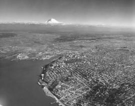
ca. 1961. Scenic views and stock footage, 1961. The tip of Mount Rainier rises in the background in this aerial 1961 photograph of Tacoma's industrial areas, downtown, and north end landscape. The wooded area near downtown is Wright Park; waterway is the City (now Thea Foss) Waterway, and the noticeable arched street the location of the Tacoma Lawn Tennis Club.


Aerial photographs; Rainier, Mount (Wash.);

A131465-1

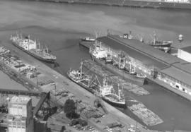
Aerial photographs taken on June 21, 1961, of the Port of Tacoma show several boats docked, awaiting possible loading of the logs stacked on shore or in log dumps. This particular waterway was not identified. Photograph ordered by Export Pacific, Inc., 900 Milwaukee Waterway.


Aerial photographs; Port of Tacoma (Tacoma); Boats--Tacoma; Logs;