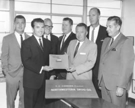
- Item
- 1966-02
Part of Richards Studio Photographs
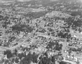
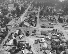
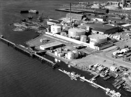
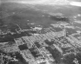
Aerials requested by Puget Sound National Bank. This February, 1966, aerial shows the land and water features just into King County. The large lake in the center of the photograph is Mirror Lake. The road running by it is SW 312th St. 1st Ave. S. is long vertical roadway extending into the trees at the left. The curving road intersecting with 1st Ave. S. is Dash Point Rd. Lakota Jr. High School are buildings located near the upper right adjoining Dash Point Rd. Looking southwesterly toward the top of the photo is the Tideflats industrial area; Hylebos Waterway is visible to the right upper corner.
Aerial photographs; Mirror Lake (Wash.);