- Item
- 1964-07
Part of Richards Studio Photographs
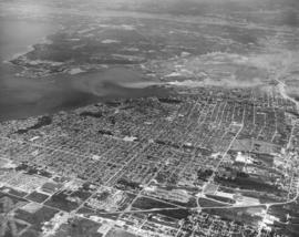
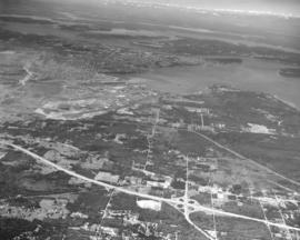
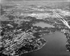
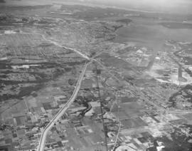
Aerial photograph requested by Puget Sound National Bank and taken in July, 1964, of the Tacoma tideflats area and Port of Tacoma and surrounding neighborhoods. Looking in a northwesterly direction, Gig Harbor and the Peninsula are at the top. Widely channelized Puyallup River is in the center. I-5 freeway runs from the center to the right side of the photograph.
Aerial photographs; Puyallup River (Wash.); Express highways--Tacoma--1960-1970;