Showing 824 results

Collections
Aerial Photography Image With digital objects
Print preview View:

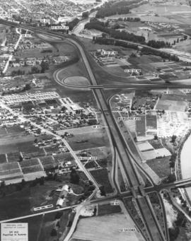
C153566-1

Copy of customer copy. Aerial view of SR410, Puyallup to Sumner, with major state routes and roads clearly marked, ca. January, 1968. Visible are SR 161, 512, 167 and 410. Photograph ordered by Ward Smith, Inc., on February 20, 1968.


Aerial photographs; Express highways--Wash.;

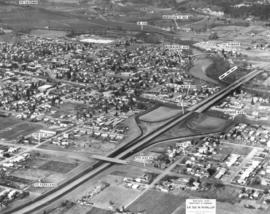
C153566-3

Copy of customer's print. Photograph by air of SR 512 in Puyallup dated December, 1967. Major streets in Puyallup including 10th St. SE, Main Ave., Pioneer and Milwaukee, are clearly labeled as well as SR410 and directions to neighboring cities of Tacoma, Sumner and Parkland. The proposed Puyallup Valley freeway's effect on Puyallup is shown in the above mockup by the State Department of Highways. The system should be operable by late 1970. It was expected to cost $16 million dollars. Photograph ordered by Ward Smith, Inc., on February 20, 1968. (TNT 3-26-68, p. 8)


Aerial photographs; Express highways--Wash.;

D154000-28C

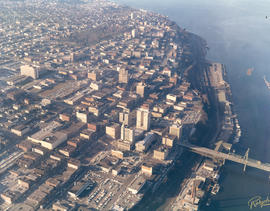
1968 Richards stock footage. Colorful aerial view of downtown Tacoma business district and 11th St. Bridge crossing the City (now Thea Foss) Waterway, taken on February 13, 1968. Stradling 11th St. near the bridge are the Tacoma Bldg. and Perkins Bldg. To the right is the Art-Deco styled Medical Arts Bldg., 747 Market St. County-City Building, near 11th & Tacoma Ave. So., is center-left. Woods are part of Wright Park.


Aerial views; 11th Street Bridge (Tacoma); Tacoma Building (Tacoma); Perkins Building (Tacoma); Medical Arts Building (Tacoma); County-City Building (Tacoma); Commercial streets--Tacoma--1960-1970; Wright Park (Tacoma);

D154000-268

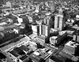
Closer view of the downtown business district as seen by air on September 4, 1968. Facing Pacific Ave. is the Puget Sound National Bank Bldg. with its familiar spire. The empty lot across it would soon be home to a 300+-spot parking lot. Behind the bank is the Federal Building (1102 A Street) where the federal courts were located (until 1992) and the Main branch of the U.S. Postal Service. The Rust Building (950 Pacific) and the 17-story Washington Building (1019 Pacific) are less than a block away. In the far background, near top of the photograph, are the County-City Building (930 Tacoma Ave. So.) and Central School (601 So. 8th St.)


Aerial views; Aerial photographs; Business districts--Tacoma--1960-1970; Puget Sound National Bank (Tacoma); Washington Building (Tacoma); Federal Building (Tacoma); County-City Building (Tacoma); Central School (Tacoma);

D154000-274

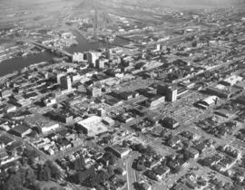
1968 Richards stock aerial footage. The downtown area was still considered the city's center of commercial business. Major banks and stores were in close proximity to the industrial Tideflats with easy access via the 11th Street Bridge. This September, 1968, view shows several easily identifiable landmarks: the U-shaped with tower Central School, the winged-shaped County-City Building, and Tacoma Public Library all on Tacoma Ave. approximately in the center of the photograph. The Art-Deco Medical Arts Building on 7th & Market is on left center. Puget Sound National Bank's unique spire is at 11th & Pacific, relatively close to the City (now Thea Foss) Waterway.


Aerial views; Commercial streets--Tacoma--1960-1970; Central School (Tacoma); County-City Building (Tacoma); Tacoma Public Library (Tacoma); Medical Arts Building (Tacoma); Puget Sound National Bank (Tacoma); 11th Street Bridge (Tacoma);

D154000-86

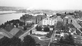
1968 Richards aerial stock footage. Stadium High School, portion of Stadium Bowl. Stadium High School, which is currently undergoing extensive remodeling in 2005, resembles a French chateau. It has a magnificent view of Commencement Bay. Built but never completed as a hotel, it converted to a high school in 1905. A small portion of Stadium Bowl, including rows of bleachers, is visible lower left corner. Originally the bowl had a seating capacity of nearly 24,000; however, after numerous mudslides, it has a reduced modern capacity of 15,000. TPL-10144


Aerial views; Stadium High School (Tacoma); Public schools--Tacoma--1960-1970; Stadium Bowl (Tacoma);
BOLAND-B23717

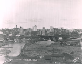
Aerial view looking toward Tacoma's City Center. This May, 1931, view shows many prominent Tacoma landmarks including the Tacoma Building and Perkins Building flanking the 11th Street Bridge (now Murray Morgan Bridge); the newly completed 17-story Medical Arts Building (at center-right); the towering Washington Building at center; Puget Sound National Bank with spire (center-left) and the Pierce County Courthouse with tower in the far left background. TPL-1347; G8.1-021


Cityscapes; Aerial photographs; Aerial views; 11th Street Bridge (Tacoma); Tacoma Building (Tacoma); Medical Arts Building (Tacoma); Washington Building (Tacoma); Puget Sound National Bank (Tacoma); Pierce County Courthouse (Tacoma);

TPL-835

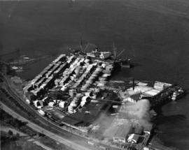
ca. 1938. Dickman Lumber, 2423 Ruston Way. This aerial view, taken circa 1938, shows vast stacks of lumber ready to be loaded onto ships. Dickman Lumber was located just south of the present Old Town dock. It was purchased in 1922 by Leonard Howarth and Ralph L. Dickman, Sr. Dickman Lumber was closed in September of 1977 and its mill destroyed by fire in January of 1979.


Aerial photographs; Dickman Lumber Co. (Tacoma); Lumber industry--Tacoma--1930-1940; Shipping--Tacoma--1930-1940;

G9.1-085

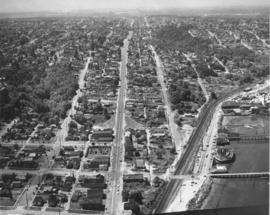
ca. 1958. Aerial view of No. 30th Street and Ruston Way. The largest street running vertically in the photograph is No. 30th Street. The street running along side of the water is Ruston Way. Just below the bottom of the picture is the intersection with Starr Street. The next street (that crosses the railroad tracks) is McCarver. The businesses running along Ruston Way (from the bottom up) are the Ocean Fish Mart, the Top of the Ocean nightclub, a small office building, Tacoma Boat Mart and the Dickman Lumber Mill (the largest group of buildings.) TPL-8657


Aerial photographs--Tacoma--1950-1960; Ocean Fish Mart (Tacoma); Top of the Ocean (Tacoma); Dickman Lumber Mill (Tacoma);

G9.1-112

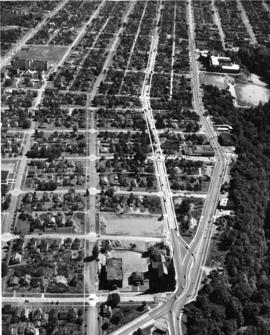
ca. 1961. Aerial looking south by Oswald Flying Service of the neighborhoods including the Lincoln district circa 1961. Lincoln High School (701 So. 37th) and Lincoln Bowl are near the top right adjacent to So. "G" St. Cartozian & Sons Rug Co., in the large old Bye Thompson Motors building at 3320 So. "G," is further north. The massive stand of trees is part of Lincoln Park. The street to the left of "G" is Tacoma Avenue. The big building in the upper center on Tacoma Avenue is the St. Joseph Catholic Church, at the corner of So. 34th & Tacoma Ave. Holy Rosary Catholic Church, school and rectory (in the 500 block of So. 30th) are near the bottom center of the photograph. Delin St. is at the very bottom of the picture. At the upper left corner of the photograph is Pacific Avenue. Mountain View General Hospital (later renamed Puget Sound General Hospital in 1969) is at 3572 Pacific Ave., the large set of buildings near the upper left corner. G9.1-112


Aerial photographs; Neighborhoods--Tacoma--1960-1970; Streets--Tacoma--1960-1970; Holy Rosary Church (Tacoma); Lincoln High School (Tacoma); Lincoln Bowl (Tacoma); Cartozian & Sons Rug Co. (Tacoma); St. Joseph's Catholic Church (Tacoma);

BOWEN TPL-672

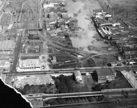
ca. 1929. Head of Commencement Bay while Sullivan Service at 101 Puyallup Ave. (lower left) was under construction. This aerial view was taken circa 1929. Visible landmarks and streets included: the Union Station at upper left corner; Albers Bros. Milling Co. at upper center (large darker building) ; Northwest Woodenware Co. at center along waterway; Wheeler-Osgood Co.'s saw mill at right center. The Sullivan Service was being built at this time facing Puyallup Ave. at left. Puyallup Ave., which runs horizontally left to right, also had the Independent Paper Stock Co. kitty-corner from Sullivan's at 132 Puyallup Ave. The Washington Gas & Electric Co. was also on the same side of Puyallup Ave. as the Independent Paper Stock Co., at 212-216, and was the large building near right. The street at lower bottom running left to right is South 25th St. E. (photograph torn at left corner)

BOWEN TPL-7624

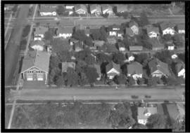
ca. 1935. This is an aerial view of South 43rd and "L" Sts. circa 1935. South "L" runs horizontally in front of the Engine House No. 8 (4301 South "L"). The fire station was built in 1909, replacing the original which had moved to 4102 South "M." Neighboring lots appear small with many trees. BU-2125

BOLAND-B15239

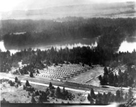
View by air in July of 1926 of the 146th Field Artillery camp at Camp Lewis. G69.1-137


Aerial views; Aerial photographs; Camp Lewis (Wash.);

Results 811 to 824 of 824