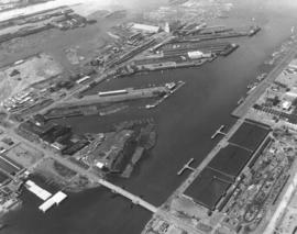
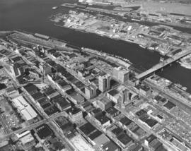
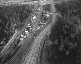
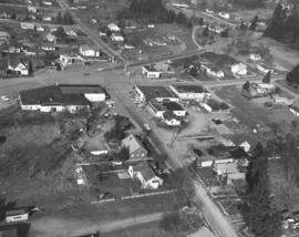
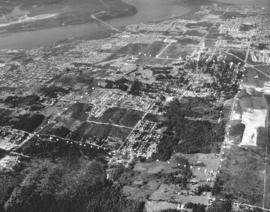
Showing 824 results

Collections
Aerial Photography With digital objects
Print preview View:

D156236-5

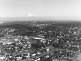
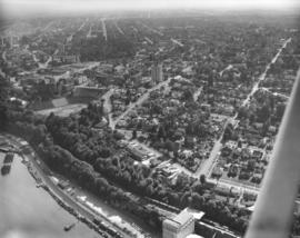
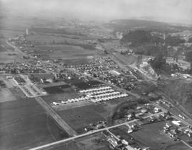
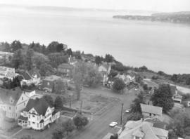
Aerial photograph of the North end neighborhood about No. 4th & "D" in June of 1969. Homes in this area would have exquisite views of Commencement Bay. A large vacant lot on the northwest corner of No. 4th & "D" might be ready for building soon. Home with treed lot in rear of the vacant lot is 401 No. "E;" empty lot is actually 402-08 No. "D;" and home with portico across the street from lot is 401 No. "D." Photograph ordered by award winning architect Robert Billsbrough Price.


Aerial views; Neighborhoods--Tacoma--1960-1970; Houses--Tacoma; Commencement Bay (Wash.);

D156922-7

Mount Rainier peeks over the University Place neighborhood of 27th & Bridgeport Way W. in the fall of 1969. University Place water tower can be seen left-center in the midst of trees in this aerial view. Safeway's large supermarket (center of photograph) is at 7520 - 27th St. W. in a small shopping center. Also located there are Thrifty Drugs and Value Stores. Photograph ordered by Jack Baty & Associates.


Aerial views; Neighborhoods--University Place--1960-1970; Safeway Stores, Inc. (University Place);

D156904-3

Aerial photographs of the City of Olympia in the fall of 1969. View of the Port of Olympia. Olympia, the state capital, had a population then of about 23,000. As the above aerial indicates, there was still plenty of room for growth with acres of uncut timber. Located about 30 miles south of Tacoma, Olympia was named provisional territorial capital in 1853 by Isaac Stevens, Washington's first territorial governor. The name of the city was chosen by local resident Isaac Ebey to commemorate the view of the majestic Olympic Mountains. (www.ci.olympia.wa.us/information/history) Photograph ordered by Puget Sound National Bank.


Aerial views; Port of Olympia (Olympia);

D133300-19

ca. 1962. Aerial views, 1962 stock footage, of Tacoma Avenue South and vicinity. County-City Building is in center of photograph, new Tacoma Public Library Main branch along with Cargenie Library to its left. Central School is the eight-story Gothic structure to the County-City Building's right. Washington State Armory is behind parking lot (formerly location of the Pierce County Courthouse) of the County-City Building). TPL-8253


Aerial photographs; County-City Building (Tacoma); Tacoma Public Library (Tacoma); Central School (Tacoma); State Armory (Tacoma); Commercial streets--Tacoma--1960-1970;

D133300-25

ca. 1962. Southwest view of County-City Building with Hilltop area in distance taken via plane in 1962, stock footage. Tacoma Public Library Main branch with Carnegie Library on left side. Central School is on edge of right side. Chevron station between the Central School and the County-City Building will later become location of McDonald's. Tacoma Vocational Technical Institute (Bates) is across from the State Armory on So. 11th St.


Aerial photographs; County-City Building (Tacoma); Tacoma Public Library (Tacoma); Central School (Tacoma); State Armory (Tacoma); Tacoma Vocational School (Tacoma);

D133276-6

ca. 1961. Photograph of Tacoma's industrial area, the Tideflats, taken by plane in late 1961. Large ponds are left of the Educators Manufacturing Co. building. Western Farmers Assn. feed mill is tall building in photo's middle section. Part of Browns Point can be seen beyond gravel pit.


Aerial photographs; Industrial facilities--Tacoma--1960-1970;

D133276-7

View of Educators Manufacturing Co. million dollar plant, with dark roof, and Western Farmers Assn. feed mill taken via plane on January 9, 1962. Area includes other Tideflats businesses in the Taylor/Lincoln Avenue vicinity. Hylebos Waterway runs along the side of the feed mill. Photograph was included in the studio's annual sample book. TPL-2955


Aerial photographs; Industrial facilities--Tacoma--1960-1970;

D133281-1

View by air of downtown Tacoma business district, City (now Thea Foss) Waterway and part of the industrial Tideflats in December, 1961. 11th St. Bridge and St. Regis Paper Co. facilities in distance. Photograph ordered by Malcolm McGhie, industrial consultant, New York.


Aerial photographs; Industrial facilities--Tacoma--1960-1970; Commercial streets--Tacoma--1960-1970; City Waterway (Tacoma);

D133276-1

ca. 1961. Aerial photograph of Tacoma Tideflats industrial area taken for inclusion in annual sample book. Clouds partially obscure Mount Rainier while heavy smoke pours over part of the Tideflats on a winter day in late 1961. Gravel pit on left with section of Browns Point in sight. Western Farmers Assn. feed mill is one of the tall buildings on left side of photograph alongside Hylebos Waterway.


Aerial photographs; Industrial facilities--Tacoma--1960-1970; Rainier, Mount (Wash.);

D133300-188

Aerial photograph of Stadium High School area, stock footage, September 7, 1962. Stadium Bowl is clearly evident toward left-center of photograph with Stadium High School overlooking the massive field. Schuster Parkway will later be built through part of the wooded area to the left edge of picture. Trains roll through on two tracks with Ruston Way between them. TPL-9465


Aerial photographs; Stadium Bowl (Tacoma); Stadium High School (Tacoma); Neighborhoods--Tacoma--1960-1970;

D137300-502

ca. 1963. Another in a series of aerial photographs taken of the Tacoma Tideflats in 1963; this features the Puyallup Waterway and 11th Street. The bridge on 11th over the Puyallup is called the East 11th St. Bridge.


Aerial photographs; Bridges--Tacoma--1960-1970; Puyallup Waterway (Tacoma) ; Industrial facilities--Tacoma--1960-1970;

D137300-112

ca. 1963. Closer view of downtown business district, City Waterway, and industrial Tideflats taken by air in 1963. The entrance to the 11th St. Bridge leading to the Tideflats separates the Tacoma and Perkins Buildings. Close by are Puget Sound National Bank's headquarters with its tall steeple, Peoples department store, Washington Building, Rust Building and the Bank of California. St. Regis' smokestacks in the Tideflats spew clouds of smoke as the plant performs around-the-clock operations.


Aerial photographs; Commercial streets--Tacoma--1960-1970; Tacoma Building (Tacoma); Perkins Building (Tacoma); Puget Sound National Bank (Tacoma); Peoples (Tacoma); Washington Building (Tacoma);

D137300-105

ca. 1963. In 1963 several aerial photographs were taken by the Richards Studio of Pierce County with attention placed on the Puyallup region. This particular scene focuses on the lush farmlands with neatly plowed fields and rows of crops. In the distance can be seen the encroaching city of Puyallup. Puyallup in 1963 had a population of approximately 14,000 and would more than double that figure in forty years.


Aerial photographs; Croplands--Puyallup;

D137300-83

ca. 1963. Aerial overview of the fertile lands of the Puyallup Valley area taken in 1963. The fields are neatly separated. Many of the products grown would probably have been exhibited at the annual Western Washington (Puyallup) Fair.


Aerial photographs; Croplands--Puyallup;

D137300-92

Aerial c.1963 photograph of new Seattle-Tacoma freeway with Milton area in background. Milton water tank can barely be seen. Milton Tavern can be seen in the low-right corner at the intersection of Porter Way and Highway 99. Additional information provided by patron.


Aerial photographs; Express highways;

D137300-101

ca. 1963. 1963 aerial view looking northeast across the Puyallup Valley from the west hills. The meandering creek on the left just above the large section of forest in lower foreground has been identified as Clarke's Creek. The current DeCoursey/Clarke's Creek Park is the cleared area between the hill and creek. The roadway with the dogleg in it is 18th St. S.W. Puyallup in 1963 was a growing city of approximately 14,000 people. There were still farmlands in the vicinity but more and more houses were being built. (Additional identification and information provided by a reader)


Aerial photographs; Forests--Puyallup; Neighborhoods--Puyallup--1960-1970; Clarke's Creek (Puyallup);

D137300-100

ca. 1963. This is believed to be part of the city of Milton, taken by air ca. 1963. Large church and associated buildings in lower center. Some of the same features, including the two service stations toward upper portion, can be seen at a different angle in D137300-97.


Aerial photographs; Neighborhoods--Milton;

D137300-97

ca. 1963. Milton, originally known as Milltown, was incorporated in August of 1907. This was how the small community appeared in 1963. The business and residential areas were intermingled. Two service stations, one possibly a Shell, were kitty-corner from one another. According to Richards Studio notes, the mayor's home may have been located in the upper portion of this photograph. Milton lies on the Pierce-King County line east of Tacoma. It was a stop on the former Puget Sound Electric Railway which ran from Tacoma to Seattle. A mill was built to provide lumber for the building of the track and tunnel, hence the name Milltown.


Aerial photographs; Neighborhoods--Milton;

D137300-78

ca. 1963. 1963 aerial view of Puyallup. Puyallup River at top of photograph. Football field at lower right corner.


Aerial photographs; Neighborhoods--Puyallup--1960-1970; Puyallup River (Wash.);

D137615-14

Another in a series of helicopter views of the sand and gravel operations belonging to the Pioneer Sand & Gravel Co. north of Chamber Creek near Steilacoom. This February 11, 1963, photograph shows the enormous gravel pit surrounded by acres of trees. The sand and gravel could be easily transported both by water with barges and by rail. Photograph ordered by Seattle office of Pioneer Sand & Gravel Co. TPL-9240


Aerial photographs; Pioneer Sand & Gravel Co. (Steilacoom); Sandstone--Steilacoom; Sand--Steilacoom;

D137300-172

Aerial view in March, 1963, of multiple stacks of plywood sheets ready for shipment. Richards Studio notes indicate this is a St. Paul & Tacoma site; it had merged with St. Regis Paper Co. to become an operating subsidiary in 1957. St. Paul & Tacoma, established in 1888, had a large sawmill with dry kilns and a planing mill. It operated the largest retail lumber yard in the state of Washington.


Aerial photographs; Plywood; St. Paul & Tacoma Lumber Co. (Tacoma); St. Regis Paper Co. (Tacoma)--1960-1970; Lumber industry--Tacoma--1960-1970;

D137300-102

ca. 1963. Mist obscures part of the background in this 1963 aerial photograph of the Puyallup Valley. Meridian is near the top portion of the picture and bridges the Milwaukee train tracks. The community of Edgewood is on the hill on the photograph's right side. North Puyallup is the community that lies inside the large "V" shaped by the Milwaukee tracks and Valley Avenue. (Additional information provided by a reader)


Aerial photographs; Streets--Puyallup;

D137300-88

ca. 1963. Aerial photographs taken in 1963 of rural Milton with its town water tank in background. One lane road running past several homes. Possible new home at bottom of picture as the road leading to it is still dirt.


Aerial photographs; Water tanks--Milton;

D137300-84

ca. 1963. Closer northbound-look at what is now the current city of Edgewood as it appeared in 1963. The lake to the right is Lake Chalet. The long road pictured above is Meridian. (Information provided by a reader)


Aerial views; Lake Chalet (Wash.); Neighborhoods--Edgewood; Streets--Edgewood;

D138106-2

Overhead view of Georgia-Pacific Corp. quarters on Ross Way. A few cars are parked outside Georgia-Pacific on April 9, 1963. One large truck appears to be in the process of loading boxes. Georgia-Pacific, dealers in wholesale plywood, had built a plant in the industrial Tideflats area near Thorne Rd. and E. 11th St.


Aerial photographs; Georgia-Pacific Corp. (Tacoma);

D139204-6

Closer view of Tacoma Tideflats area in late August, 1963, focusing on the Port Industrial Waterway and Blair Bridge. The waterway is wide enough for log booms to share space with docked ships and boathouses. At the top of the photograph, a small segment of the Puyallup River can be seen. Next are the Milwaukee and Sitcum Waterways. Photograph ordered by Port of Tacoma. TPL-10519


Aerial photographs; Logs; Port Industrial Waterway (Tacoma); Milwaukee Waterway (Tacoma); Sitcum Waterway (Tacoma);

D139403-1

Aerial view taken on September 18, 1963, of the City of Fircrest and vicinity. Surrounded by trees, Fircrest is pictured toward the center of the photograph. Pearl Street runs through Fircrest all the way to Point Defiance. Orchard Street runs parallel to Pearl to its right. Narrows Bridge is at the top. Ruston with the ASARCO smelter is at top right corner with forested Point Defiance to its left. A similar aerial view, taken on the same day, is at D137300-529. Photograph ordered by Puget Sound National Bank who may have asked that white dots be drawn on the photograph defining the approximate Fircrest boundaries. Puget Sound National Bank would open a new branch building in Fircrest two years later on November 6, 1965, at the Fircrest Village Square Shopping Center. Fircrest at the time had a population of 4,588.


Aerial photographs; Neighborhoods--Fircrest; Tacoma Narrows Bridge (Tacoma);

D140600-235

Stock footage; aerials of downtown Tacoma looking toward Tideflats, taken on June 23, 1964. At this height, the normally large looming buildings appear as small Monopoly structures. The 11th St. Bridge is pictured extending into the Tideflats. It is flanked near the City (now Thea Foss) Waterway by the Chicago-styled Tacoma Bldg. and Perkins Bldg. The Peoples Store, Washington and Rust Bldgs. are clearly visible. The towering building with steeple is the Puget Sound National Bank, at one time the tallest building on the West Coast. Toward the left center edge is the Medical Arts Building (now Municipal Bldg.), built in the Art Deco tradition, and the triangular-shaped Bostwick Block.


Aerial photographs; 11th Street Bridge (Tacoma); Bridges--Tacoma; Commercial streets--Tacoma--1960-1970; Tacoma Building (Tacoma); Perkins Building (Tacoma); Peoples (Tacoma); Washington Building (Tacoma); Rust Building (Tacoma);

D140189-8

Aerial southbound look at the Gov-Mart South building in the Ponders Corner area on December 10, 1963. It was sandwiched on land between I-5 and Hwy. 99, across from McChord Field. Many cars in parking lot with plenty of room for more. A full page ad in the News Tribune on March 18, 1964, proclaimed Gov-Mart to be the Northwest's first and finest membership department store. It was open to government employees, armed forces members, school district employees and labor union members. Gov-Mart was holding a special public-invited sale in March, 1964, to perhaps increase membership. Photograph ordered by Puget Sound National Bank. (TNT ad 3-18-64, B-1)


Aerial photographs; Gov-Mart South (Lakewood); Department stores--Lakewood--1960-1970;

D140189-1

Aerial photographs looking northeast taken on December 10, 1963, on behalf of Puget Sound National Bank. The above photograph features Hwy 99 /I-5 at Ponders Corner. Nyanza Park is in the heavily forested area on the left, and Porter Woods is the forested area to the right.


Aerial photographs; Neighborhoods--Lakewood--1960-1970; Express highways--Lakewood;

Results 91 to 120 of 824