- Item
- 1979
Part of Stephen Cysewski Photographs
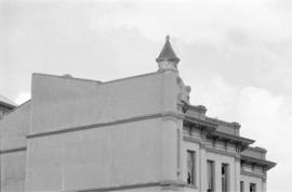
ca. 1979. Roof line of the Northern Pacific Headquarters Building, 621 Pacific Ave.
Public Safety Building (Tacoma);
Part of Stephen Cysewski Photographs
ca. 1979. Roof line of the Northern Pacific Headquarters Building, 621 Pacific Ave.
Public Safety Building (Tacoma);
Part of Stephen Cysewski Photographs
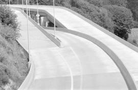
ca. 1979. Newly constructed Schuster Parkway, formerly Bayside Dr., circa 1979. Schuster Parkway is a 4-lane divided expressway connecting the end of I-705 to the older part of Tacoma. ("Old Town") Bayside Dr. was renamed Schuster Parkway in May of 1975 in honor of former Public Works head Gilbert M. Schuster who had died in June of 1974.
Parkways; Road construction--Tacoma--1970-1980;
Part of Stephen Cysewski Photographs
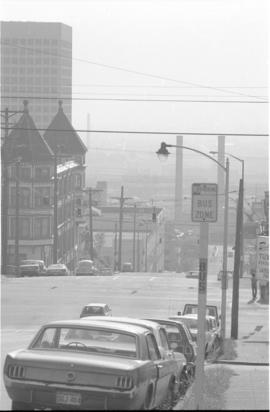
ca. 1979. The ornate outline of the Samson Hotel, 1152-56 Fawcett Ave., shows clearly against a more modern office building in this Cysewski picture from 1979. The Hotel was built in 1889 from a design by F.A. Sexton and was converted to apartments in 1928. After several fires, the building was demolished in 1989. The site, in 2007, is a vacant lot.
Samson Hotel (Tacoma); Apartment houses--Tacoma;
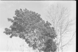
Part of Stephen Cysewski Photographs
ca. 1979. Trees, circa 1979.
Trees;
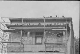
Part of Stephen Cysewski Photographs
ca. 1979. Pigeons roost on roof of an unidentified building with scaffolding, circa 1979.
Pigeons;
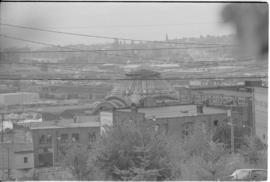
Part of Stephen Cysewski Photographs
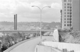
ca. 1979. Photograph taken from what is now the University of Washington, Tacoma campus, looking east toward the Tideflats. In the center is the dome of Union Station, 1717 Pacific Ave., and on the right is the side of the West Coast Grocery building, 1732-38 Pacific Ave.
Cityscapes--Tacoma--1970-1980; University of Washington (Tacoma);
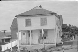
Part of Stephen Cysewski Photographs
ca. 1979. Unidentified house in Tacoma, circa 1979. The building next door looks like a church.
Houses--Tacoma--1970-1980;
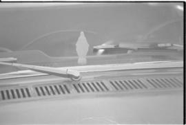
Part of Stephen Cysewski Photographs
ca. 1979. Religious figurine,viewed from the back, on the dashboard of a car, circa 1979.
Religious articles; Figurines;
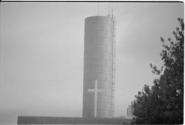
Part of Stephen Cysewski Photographs
ca. 1979. Image of a cross against the outline of the Light and Water Co. standpipe, circa 1979. The standpipe was completed in 1890 and is located near St. Joseph Hospital.
Water towers--Tacoma; Public utility companies--Tacoma; Water supply--Tacoma; Tacoma Dept. of Public Utilities, Water Division (Tacoma); J Street Standpipe (Tacoma);
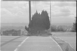
Part of Stephen Cysewski Photographs
ca. 1979. Trees at an unidentified Tacoma intersection; city view in background, circa 1979.
Trees; Cityscapes--Tacoma--1970-1980;
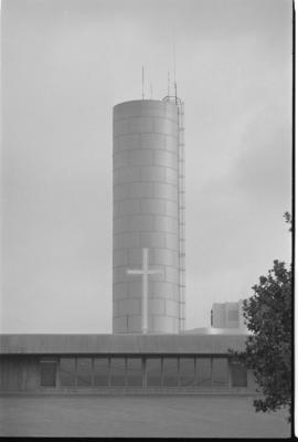
Part of Stephen Cysewski Photographs
ca. 1979. Image of a cross against the outline of the Light and Water Co. standpipe, circa 1979. The standpipe was completed in 1890 and is located near St. Joseph Hospital.
Water towers--Tacoma; Public utility companies--Tacoma; Water supply--Tacoma; Tacoma Dept. of Public Utilities, Water Division (Tacoma); J Street Standpipe (Tacoma);
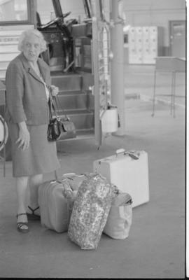
Part of Stephen Cysewski Photographs
ca. 1979. Unidentifed woman with luggage beside bus with an open door, circa 1979.
Bus travel; Luggage; Passengers--Tacoma;
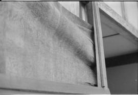
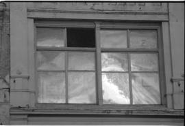
Part of Stephen Cysewski Photographs
ca. 1979. Unidentified architectural detail, possibly a window.
Architectural elements;
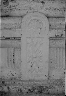
Part of Stephen Cysewski Photographs
ca. 1979. Architectural detail on unidentified building, circa 1979.
Architectural elements; Architectural decorations & ornaments;
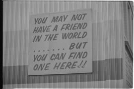
Part of Stephen Cysewski Photographs
ca. 1979. Sign on unidentified building, circa 1979, "You may not have a friend in the world....but you can find one here!!" This sign was along the front entrance of The old site of the Tacoma Rescue Mission as seen in image CYS-T344
Signs (Notices);
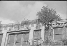
Part of Stephen Cysewski Photographs
ca. 1979. The focus for this 1979 photograph was the plants growing wildly from the crevices of the Commerce Street face of the structures located at, left to right, 1523 Broadway and 1519-21 Broadway. Both buildings have since been demolished and this is now the site of the Convention Center.
Commercial facilities--Tacoma--1970-1980; Building deterioration--Tacoma--1970-1980;
Part of Stephen Cysewski Photographs
ca. 1979. Broken window in an unidentified building, circa 1979.
Windows--Tacoma--1970-1980;
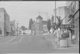
Part of Stephen Cysewski Photographs
ca. 1979. View from So. Jefferson Ave., looking toward the Swiss Hall, 1902-04 Jefferson Ave. (in the center of the photograph.) The entrance to the Carlton Hotel, 1552 Jefferson, can be seen in the front right. From the left side of the photo are the Dougan Block, 1721-25 Jefferson, and 1731-37 Jefferson, formerly the Tacoma Biscuit and Candy Shop, now home to the Spaghetti Factory.
Swiss Hall (Tacoma); Carlton Hotel (Tacoma); Cityscapes--Tacoma--1970-1980;
Part of Stephen Cysewski Photographs
ca. 1979. Crystal Palace Building, 1508-16 Jefferson Ave., circa 1979. The structure was built in 1889 from a design by F.S. Sexton. The building was originally brick with wooden store fronts, the stucco facade was added in the 1960's. Schoenfeld's Furniture, 1423 Pacific, can be seen in the background.
Crystal Palace Building (Tacoma);
Part of Stephen Cysewski Photographs
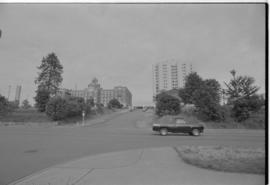
ca. 1979. View of Tacoma, circa 1979, showing, left to right, the J St. Standpipe (1923 So. J St.,) the old St. Joseph Hospital (1812 So. I St.) and the curved facade of the new St. Joseph Hospital (1718 So. I St.) The old hospital was built in 1914 and demolished in 1982; the newer hospital structure was built in 1974.
St. Josephs Hospital & School of Nursing (Tacoma); Hospitals--Tacoma--1970-1980; J Street Standpipe (Tacoma);
Part of Stephen Cysewski Photographs
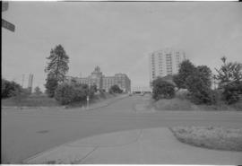
ca. 1979. View of Tacoma, circa 1979, showing, left to right, the J St. Standpipe (1923 So. J St.,) the old St. Joseph Hospital (1812 So. I St.) and the curved facade of the new St. Joseph Hospital (1718 So. I St.) The old hospital was built in 1914 and demolished in 1982; the newer hospital structure was built in 1974.
St. Josephs Hospital & School of Nursing (Tacoma); Hospitals--Tacoma--1970-1980; J Street Standpipe (Tacoma);
Part of Stephen Cysewski Photographs
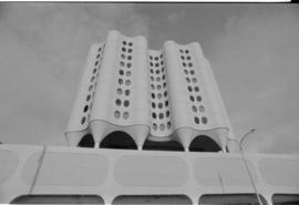
ca. 1979. The curved outline of the new (1974) St. Joseph's Hospital, circa 1979.
St. Josephs Hospital & School of Nursing (Tacoma); Hospitals--Tacoma--1970-1980;

Part of Stephen Cysewski Photographs
ca. 1979. View in the distance of the new (1974), sparkling white St. Joseph's Hospital, 1718 So. I St., circa 1979.
St. Josephs Hospital & School of Nursing (Tacoma); Hospitals--Tacoma--1970-1980;
Part of Stephen Cysewski Photographs
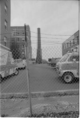
ca. 1979. View of the back portion of the old St. Joseph's Hospital, 1812 So. I St., circa 1979. The hospital was built in 1914 and demolished in 1982. The photograph is taken through a chain link fence, topped with barb wire, and includes a view of the emergency vehicles.
St. Josephs Hospital & School of Nursing (Tacoma); Hospitals--Tacoma--1970-1980;
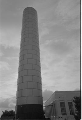
Part of Stephen Cysewski Photographs
ca. 1979. The J St. Standpipe, circa 1979, part of the Tacoma Department of Public Utilities Water Division. The standpipe was completed in 1890 and is located near St. Joseph Hospital.
Water towers--Tacoma; Tacoma Dept. of Public Utilities, Water Division (Tacoma); J Street Standpipe (Tacoma);
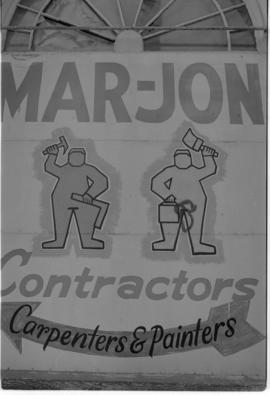
Part of Stephen Cysewski Photographs
ca. 1979. Sign for Mar-Jon Contractors, carpenters & painters, circa 1979.
Mar-Jon Contractors (Tacoma); Signs (Notices);
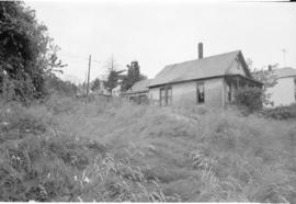
Part of Stephen Cysewski Photographs
ca. 1979. Unidentified house in weed filled lot, circa 1979.
Building deterioration--Tacoma--1970-1980; Weeds;
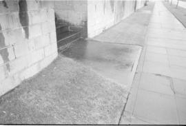
Part of Stephen Cysewski Photographs
ca. 1979. Sidewalk and stairs to unidentified building, circa 1979.
Stairways; Sidewalks;
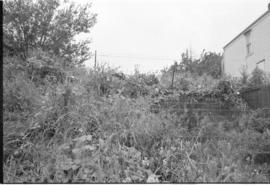
Part of Stephen Cysewski Photographs
ca. 1979. Weeds almost block the view of an overgrown staircase leading up to a vacant lot, circa 1979. Unidentified building in right background.
Weeds; Stairways;