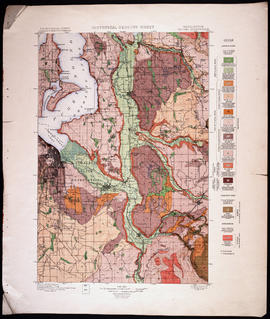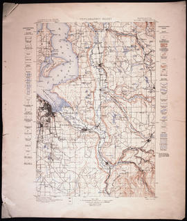
Topographic Sheet, Washington, Tacoma Quadrangle, 1898
- Item
- 1898
Part of Map Collection
Washington : Geological Survey
1 map : col. ; 45 x 31 cm. on sheet 56 x 47 cm. "Surveyed in 1894-95." Scale: 1:125,000 Contour interval 50 feet. Relief indicated by contours and spot heights. Datum is mean sea level. "Edition of Nov. 1898" Engraved April 1897 by U.S.G.S. Henry Gannett, Chief Topographer. R. U. Goode, Geographer in charge. Control by W.T. Griswold and U.S. Coast and Geodetic Survey. Topography by G.E. Hyde and R.H. McKee. Diagram depicts which topographers were responsible for which areas of the map.