Aerial Photography

Taxonomy

Code

Scope note(s)

Source note(s)

Display note(s)

Hierarchical terms

Aerial Photography

Equivalent terms

Aerial Photography

Associated terms

Aerial Photography

824 Collections results for Aerial Photography

824 results directly related Exclude narrower terms

D75872-77

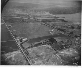
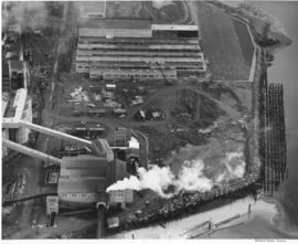
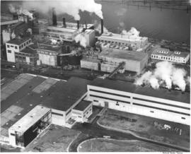
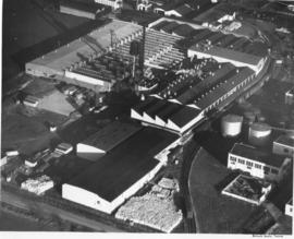
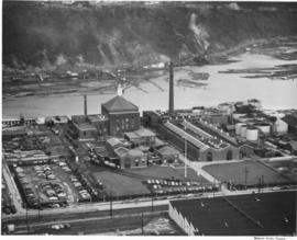
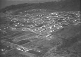
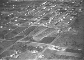
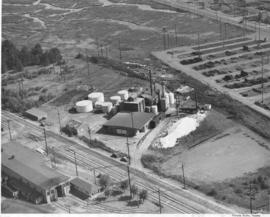
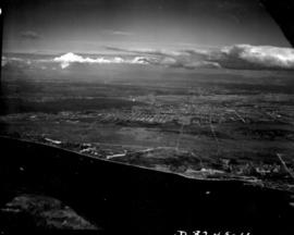
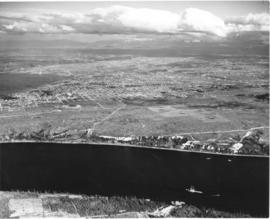
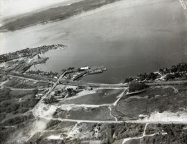
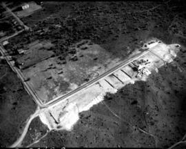
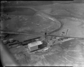
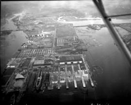
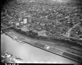
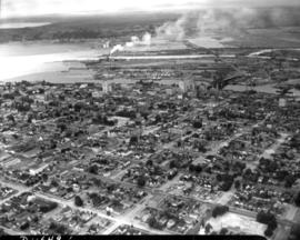
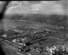
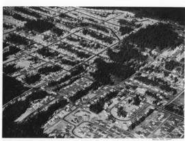
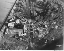
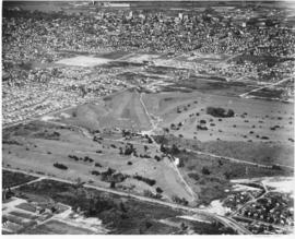
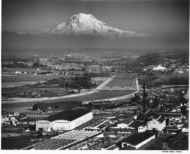
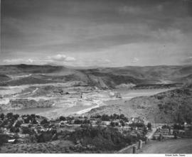
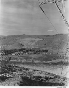
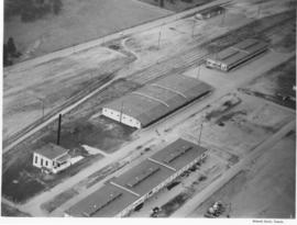
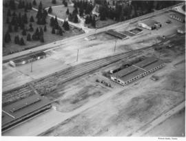
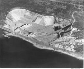
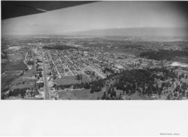
Aerial photographs. The wing of an airplane is visible as aerial photographs were taken of the South Tacoma and possibly other local areas on June 15, 1953. The photo appears to be looking north toward Vashon Island. There is a gravel pit to the right. There were still large areas of undeveloped and wooded land at this time in Tacoma's history. Photograph ordered by North Pacific Bank.


Aerial photographs; Neighborhoods--Tacoma--1950-1960;

D75943-14

Aerial view of the Tacoma tideflats and Port of Tacoma. Lincoln Ave. runs up the left hand side of the picture and East 11th Street with its partially completed bridge on the right. The smaller body of water in the foreground is the Port Industrial Waterway, the one in the back is Hylebos Waterway and the large body of water on the right is Commencement Bay. The stored baby flattops and the Port of Tacoma can be seen on the right by the bridge. The vacant area is 1500 acres of vacant industrial land that the city hoped would turn Tacoma into the industrial center of the West.


Aerial views; Port of Tacoma (Tacoma)--1950-1960;

D77321-6

Aerial of downtown Tacoma looking west from the Eleventh Street Bridge. The Dock Street Steam Plant can be seen at lower left. Railroad tracks and a green belt divide the commercial downtown area from the waterfront. The bridge crosses over the City Waterway into the industrial area.


Aerial photographs--1950-1960; Business districts--Tacoma--1950-1960;

D77321-1

This is an aerial of downtown Tacoma looking west from 11th and A street as it appeared in August of 1953. Beginning span of the 11th Street Bridge at lower right corner and smoke stacks from Dock Street Steam plant at lower left.


Aerial photographs--1950-1960; Business districts--Tacoma--1950-1960; 11th Street Bridge (Tacoma); Bridges--Tacoma--1950-1960; Commercial streets--Tacoma--1950-1960;

A64784-1

An aerial view of the new multiwall bag plant at St. Regis. The plant was completely equipped to produce a full range of multiwall bags. Equipment included six production lines, three printing presses, a complete art and engraving department and auxiliary equipment. This plant replaced a leased plant in Seattle. (TNT, 10/19/1952)


St. Regis Paper Co. (Tacoma)--1950-1960; Aerial photographs; Mills--Tacoma--1950-1960; Paper industry--Tacoma--1950-1960;

A64784-2

An aerial view on February 16, 1952, showing the new multiwall bag plant at St. Regis. St. Regis also had other bag plants on the Pacific Coast at Los Angeles and San Leandro, California. The company also maintained complete engineering and service facilities for automatic bag filling equipment, including a machine shop at Los Angeles, and packer sales and engineering offices at San Francisco and Seattle. The company was self-contained on the west coast. (TNT, 10/19/1952)


St. Regis Paper Co. (Tacoma)--1950-1960; Aerial photographs; Mills--Tacoma--1950-1960; Paper industry--Tacoma--1950-1960;

A64784-3

An aerial view of the new multiwall bag plant at St. Regis. The expansion of the bag plant facilities by St. Regis reflected the continuing trend of industry and agriculture to use the multiwall shipping sack. It was estimated that approximately 2 1/2 billion multiwall bags were used in 1951 for all types of products, compared with less than half a billion in 1938. The multiwall bag came into general use as an industrial container in the mid 1920's and was used for packaging cement and other rock products. Shortly thereafter is was adopted by the sugar industry. (TNT, 10/19/1952)


St. Regis Paper Co. (Tacoma)--1950-1960; Aerial photographs; Mills--Tacoma--1950-1960; Paper industry--Tacoma--1950-1960;

A62921-1

An aerial view of the Fibreboard Plant in Sumner. The corrugated box plant had operated in Sumner since 1920. The plant was sold to Louisiana-Pacific Corp. in 1978 who planned to sell the division to a company that was in the container business. Ordered by Moulin Studio. (TNT, 10/10/1978)


Aerial photographs; Fibreboard Corp. (Sumner); Paper industry--Sumner;

A63895-1

An aerial view of the plant facility for Hooker Electrochemical Company located at 605 Alexander Avenue on the Tacoma tideflats. The Hylebos Waterway provided excellent accessibility with a company dock and a railroad spur running through the facility enhanced transportation even further. The Port of Tacoma sold an additional 20-acre site to Hooker Electrochemical in December 1951 for $56,400 according to George Osgood, manager of the Port. The property, including a 1,200-foot frontage on the Port-Industrial waterway, was to be used for further expansion of the chemical firm's Tacoma plant. (TNT, 12/16/1951, p.1)


Aerial photographs; Hooker Electrochemical Co. (Tacoma); Logs; Hylebos Waterway (Tacoma); Harbors--Tacoma; Factories--Tacoma--1940-1950; Chemical industry--Tacoma--1950-1960;

A63168-1

An aerial view of the Narrowmoor Addition, a subdivision west of Jackson Avenue. Ordered by Burton W. Lyon, Jr., Puget Sound Bank Building.


Aerial photographs; Housing developments--Tacoma; Land subdivision--Tacoma; Land use--Tacoma; Real estate development--Tacoma;

A63168-2

An aerial view of the Narrowmoor Addition, a subdivision west of Jackson Avenue. Ordered by Burton W. Lyon, Jr., Puget Sound Bank Building.


Aerial photographs; Housing developments--Tacoma; Land subdivision--Tacoma; Land use--Tacoma; Real estate development--Tacoma;

A68175-A

An aerial view of Philadelphia Quartz' plant on the Tacoma tideflats. Belgian silica sand and California soda ash were chemically combined to provide a product sold largely in Tacoma but marketed also in other Northwest cities. Silicate of soda, water-glass to farm households, was used in adhesives for the plywood industry and corrugated paper-board for the container industry.


Chemical industry--Tacoma--1950-1960; Minerals; Philadelphia Quartz Co. of California (Tacoma); Aerial photographs;

D8245-11

Associated Oil Company aerial view of Tacoma from The Narrows looking east. Ordered by George Martinac, North Pacific Bank Note Company.


Aerial photographs;

D8245-5

ca. 1939. Associated Oil Company aerial view of Tacoma, West End to Downtown, tideflats and beyond. Piers for first Narrows Bridge under construction. Ordered by George Martinac, North Pacific Bank Note.


Aerial photographs; Tacoma Narrows Bridge (Tacoma); Bridges--Tacoma;

D8245-30

ca. 1939. Associated Oil Company aerial view of Tacoma West End showing area above Titlow Beach and Day Island. Photograph taken circa 1939. Ordered by George Martinac, North Pacific Bank Note Company.


Aerial photographs; Titlow Park (Tacoma);

D12245-8

Aerial view of cleared property above The Narrows showing sparse development in the area east of subject site. Ordered by Mr. Wiborg.


Aerial photographs; Real estate development--Tacoma--1940-1950; Clearing of land--Tacoma--1940-1950; Land subdivision--Tacoma--1940-1950;

D11701-2

Aerial view of Ferro-Alloys plant on Tideflats. [Also dated 08-01-1941]


Aerial Photographs - Pierce County - Tacoma - Port IndustrialIndustries - Metal Industries

D11961-30

Sea-Tac Shipyard, aerial view of facilities. Docks, buildings, equipment and water as photographed in October of 1941.


Aerial photographs; Seattle-Tacoma Shipbuilding Corp. (Tacoma); World War, 1939-1945--Economic & industrial aspects--Tacoma; Boat & ship industry--Tacoma--1940-1950;

D11649-2

Aerial view of downtown Tacoma including waterfront warehouses and half-moon railroad yards. This July of 1941 photograph, looking westward, shows the densely packed business districts of Tacoma as well as outlying residential areas. The waterway is the City (now Thea Foss) Waterway with the 11th St. Bridge (now Murray Morgan Bridge) in view.


Aerial views; Aerial photographs; Cityscapes; City Waterway (Tacoma); Business districts--Tacoma--1940-1950; Commercial streets--Tacoma--1940-1950;

D11649-6

1941 Aerial view of downtown Tacoma showing the Central Business District, Port/Industrial, and Central residential areas. The 11th St. Bridge (now Murray Morgan Bridge) leads traffic over the City (now Thea Foss) Waterway over to the industrial Tideflats.


Aerial views; Aerial photographs; Cityscapes; City Waterway (Tacoma); Business districts--Tacoma--1940-1950; Commercial streets--Tacoma--1940-1950; 11th Street Bridge (Tacoma);

D11649-22

Aerial view of Sea-Tac Shipyard taken on July 20, 1941. Even before the U.S. entered WWII, the Seattle-Tacoma Shipyard was busy with building tankers and C-3 freighters for the government.


Aerial views; Aerial photographs; Seattle-Tacoma Shipbuilding Corp. (Tacoma); Boat & ship industry--Tacoma--1940-1950;

A60604-2

Aerial photographs of Mountlake Terrace were taken on August 16, 1951. Developers of this neighborhood near Seattle left many of the trees in the heavily forested area for homeowners to enjoy. Cul-de-sacs were starting to emerge as part of suburban lifestyles, to lessen amount of traffic on roads next to homes and provide safer play areas for children. Photograph commissioned by Budget Homes, Inc.


Aerial photographs; Housing developments--Mountlake Terrace;

D61250-1

Aerial view of sewage disposal plant. Progress photograph of the new sewage disposal plant on Cleveland Way was taken by air on October 3, 1951. Construction continues on the new plant near the Puyallup River under the direction of Hoagland-Findlay Engineering Company who had the low bid of nearly $1,400,000. The two large circular structures are digesting tanks where raw sewage would be digested and eventually turned into fertilizer. Rectangular building appears to be a 14,000,000 gallon sedimentation tank. Photograph commissioned by Hoagland-Findlay. TPL-8824


Aerial photographs; Progress photographs; Building construction--Tacoma--1950-1960; Sewerage--Tacoma; Waste disposal facilities--Tacoma; Hoagland-Findlay Engineering Co. (Seattle);

A49811-7

An aerial view of Allenmore Golf Course that includes the residential neighborhoods around the golf course. In the background can be seen the taller buildings of the Tacoma business district and beyond that, Commencement Bay.


Allenmore Golf Club (Tacoma); Golf--Tacoma--1950-1960; Sports & recreation facilities--Tacoma; Aerial photographs; Land use--Tacoma;

A52678-1

This aerial view of part of the sprawling St. Paul & Tacoma Lumber Company complex with Mount Rainier in the background dates from September of 1950. St. Paul & Tacoma with its many buildings, smokestacks and burners was located in the southwest section of the Tacoma tideflats near the Puyallup River; their headquarters were at 1220 Saint Paul Avenue. The white bridge near the center of the image crossing the channelized Puyallup River is the Lincoln Avenue bridge. Two railroad bridges and the Pacific Highway (U.S. Hwy 99) bridge can be seen further up the river.


Aerial photographs; St. Paul & Tacoma Lumber Co. (Tacoma); Cityscapes; Lumber industry--Tacoma--1950-1960;

D53468-35

Scenic views from Eastern Washington. An aerial view of the housing area across the Columbia River from the utility facilities at Grand Coulee Dam. Mason City was built on one side of the river during the dam construction and Engineer's Town grew on the opposite side. This view shows the land forms above the river into the distance.


Columbia River (Wash.); Land; City & town life;

A53468-131

Scenic views from Eastern Washington. An aerial view of the town on the far side of the river and Grand Coulee Dam plant facilities in the foreground. A tower for delivering electric power from the plant is seen on the right as others climb the hill from below. Electrical energy generated at the power plant at 13,800 volts is stepped up to 230,000 volts for long distance transmission by groups of transformers. High tension lines from the transformers are carried on steel towers over the powerhouse and up the canyon walls to a switchyard, where facilities are provided for interconnecting generating units and transmission lines. (Grand Coulee from "Hell to Breakfast", Fred O. Jones)


Aerial photographs; Columbia River (Wash.); Utility poles; Hydroelectric power;

A53195-7

ca. 1950. Aerial photograph of the Pacific Naval Advance Base in Lakewood taken probably in the fall of 1950. Lakewood Navy Yard was the more familiar name used for the base. The U.S. Navy acquired the land to build its naval base in 1944; previously the land had been home to the Tacoma Speedway and the Tacoma Municipal Airport. Nearly twenty years later, Clover Park Vocational-Technical Institute opened their doors on part of the site. A glimpse of Mountain View Cemetery can be seen at the top of the photograph. TPL-9284


Aerial photographs; Pacific Naval Advance Base (Lakewood); Lakewood Navy Yard (Lakewood); Mountain View Memorial Park (Lakewood); Clover Park Vocational-Technical Institute (Lakewood);

A53195-8

ca. 1950. Aerial view of the Lakewood Navy Yard, formally known as the Pacific Naval Advance Base; photograph taken probably in the fall of 1950. Rectangular one story buildings are scattered throughout the naval yard. Mountain View Cemetary lies across the street on Steilacoom Blvd.


Pacific Naval Advance Base (Lakewood); Lakewood Navy Yard (Lakewood); Aerial photographs; Mountain View Memorial Park (Lakewood);

A45518-4

This aerial photograph of the Pioneer Sand and Gravel Company gravel pit was taken in November of 1949. The large gravel pit was located in Steilacoom adjacent what is now University Place; their offices were in Seattle, at 901 Fairview Avenue North. The company specialized in sand, gravel, building materials and "Tru-Mix" concrete. Some years later the pit and the land surrounding it became part of Chambers Creek Properties. In June of 2007 the $21 million Chambers Bay Golf Course opened on this site. TPL-10540


Industry--Steilacoom; Sand--Steilacoom; Digging--Steilacoom; Waterfronts; Harbors--Steilacoom; Sandstone quarrying--Steilacoom; Industrial facilities--Steilacoom; Aerial views; Pioneer Sand & Gravel Co. (Steilacoom);

Results 31 to 60 of 824