Aerial Photography

Taxonomy

Code

Scope note(s)

Source note(s)

Display note(s)

Hierarchical terms

Aerial Photography

Equivalent terms

Aerial Photography

Associated terms

Aerial Photography

824 Collections results for Aerial Photography

824 results directly related Exclude narrower terms

D157837-5

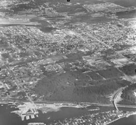
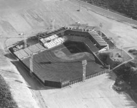
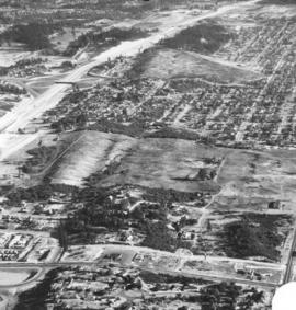
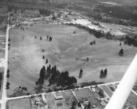
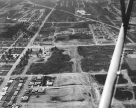
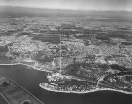
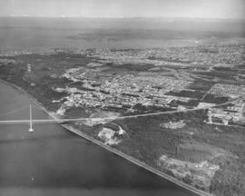
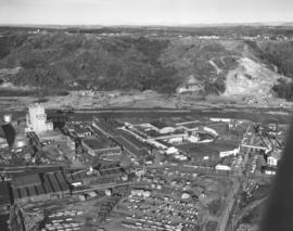
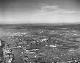
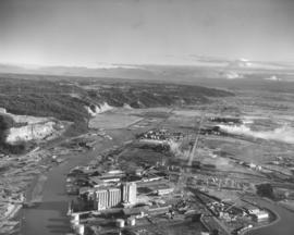
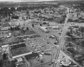
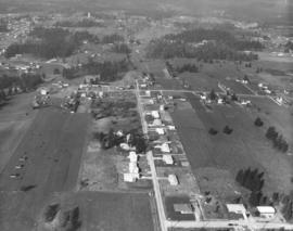
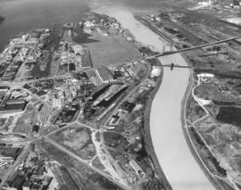
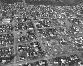
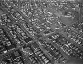
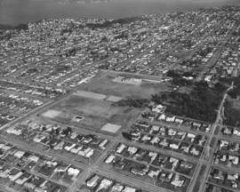
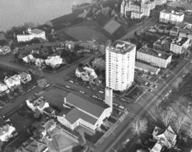
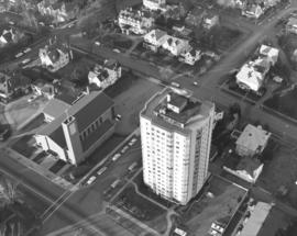
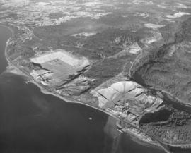
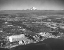
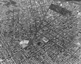
1970 aerial views of Tacoma neighborhoods around Sixth Avenue and Division. The long bending street is Sixth Avenue as it turns into Division. Jason Lee Junior High (now Middle) School is complex of light-colored buildings at Sixth & Sprague. Jason Lee, built on the site of the former College of Puget Sound, was the first and largest of six intermediate schools funded in 1923. Wright Park is the large wooded area about Sixth & "I." Photograph ordered by Puget Sound National Bank. TPL-9667


Aerial views; Wright Park (Tacoma); Jason Lee Junior High School (Tacoma); Neighborhoods--Tacoma--1970-1980;

D158000-19

ca. 1970. 1970 Richards stock footage. Aerial view of parking garage construction. To deal with the increasing parking problem in downtown Tacoma, approval was obtained to build two large public garages. Construction had begun in 1970 on the Commerce St. site across from the upcoming (National) Bank of Washington Plaza; the other garage would be built closer to 9th. Two of downtown's escalades are visible next to and near the site. The garage would be dubbed "Park Plaza South" and be built of precast and pre-stressed concrete. There would be room for 381 cars. The Park Plaza South garage would be officially opened on November 5, 1970.


Aerial views; Building construction--Tacoma--1970-1980; Parking garages--Tacoma--1970-1980; Conveying systems--Tacoma--1970-1980; Urban renewal;

D158294-15

Look by air of St. Regis Paper Co. Smoke billowing from St. Regis' stacks was a familiar sight for local residents. The company remained committed to the reduction of air and water pollution from their pulp and paper mills. Per its 1970 annual report, St. Regis spent a total 2.5 million dollars for pollution-abatement construction that year. Photograph ordered by Hylebos Industries, Inc. (1970 St. Regis Annual Report - p 3 - article)


Aerial views; St. Regis Paper Co. (Tacoma)--1970-1980;

A125600-65

ca. 1960. Aerial photograph of the Day Island and University Place community ca. 1960. Day Island at the bottom of the page with the new bridge connecting the island to S. 27th St. Tacoma Airport, a 75-acre facility, is to the extreme left corner.


Aerial photographs; Neighborhoods--University Place--1960-1970;

A125600-43

ca. 1960. Aerial photographs of the downtown business district, ca. 1960. The towering narrow structure of the Puget Sound National Bank is a focus point on Pacific Avenue. Peoples' department store is next door. Across the street from Peoples is the Washington Building along with the Bank of California. The Rust Building is also on Pacific, across from the Washington Building. The Tacoma Building, home to the Weyerhaeuser Company, and the Perkins Building, later to become the first home of the University of Washington-Tacoma, are on "A" St., flanking the 11th St. Bridge.


Commercial streets--Tacoma--1960-1970; Aerial photographs; Puget Sound National Bank (Tacoma); Peoples (Tacoma); Washington Building (Tacoma); Rust Building (Tacoma); Tacoma Building (Tacoma); Perkins Building (Tacoma);

A126738-2

The newly completed Ben Cheney Stadium stood empty on May 18, 1960 when this aerial photograph was taken. The Tacoma Giants, playing in the Pacific Coast League, were out of town playing the San Diego Padres. The $840,000 Cheney Stadium was completed in just three months, fourteen days. As shown above, the parking lots were not yet paved due to slight sinking but a temporary surface made of sand was being applied. Also planned were bleachers to seat another 650 fans on the left field side of the grandstand. Photograph ordered by Cheney Lumber. (TNT 5-27-60 p. 23) TPL-9727


Aerial photographs; Cheney Stadium (Tacoma);

A127907-2

Aerial photograph of 56th St. interchange taken on August 17, 1960. A portion of Wapato Lake is believed to be in the top left corner. So. 38th St. is road near the bottom. Large mostly undeveloped land in center is believed to be the future location of the Tacoma Mall. Ordered by Tacoma Freeway Mart of Seattle.


Aerial photographs; Express highways--Tacoma--1960-1970;

A128448-3

Aerial view of Annie Wright Seminary and north end neighborhood surrounding the school, taken on October 4, 1960. The private school's tennis courts and playing field are visible with thick forest acting as buffer. Also included is portion of Commencement Bay with large ship docked.


Aerial photographs; Annie Wright Seminary (Tacoma)--1960-1970;

A128445-2

Aerial view of newly completed Pacific Lutheran University administration building taken in early October, 1960. Designed by architects Lea, Pearson & Richards, the two-story U-shaped modern structure was dedicated on October 14, 1960. It had 55,000 square feet of floor space. Initially called the Tacoma-Pierce Administration Building, it was later re-named after Philip E. Hauge, Dean of the University who had spent 45 years with the school. (TNT 10-12-60, C-10)


Aerial photographs; Universities & colleges--Parkland--1960-1970; Pacific Lutheran University (Parkland) --1960-1970;

D129800-69

ca. 1961. Scenic views and stock footage, 1961. A closer aerial look at the Meadow Park Golf Course at 7108 Lakewood Dr. W. shows newly planted trees along with older firs and oaks. Meadow Park is now run under the auspices of Metro Parks. Shortly before Christmas, 1960, the wooden clubhouse at the golf course was destroyed by fire. According to Lakewood Fire Chief Bruce White, the loss totaled $50,000.


Aerial photographs; Meadow Park Golf Course (Lakewood); Golf--Lakewood--1960-1970;

D129800-64

ca. 1961. Scenic views and stock files, 1961. Aerial photograph of city's north end including the Sixth Avenue, Orchard and Bantz Blvd (now Hwy. 16) areas. Cheney Stadium in upper left corner. Horizontal center street is Sixth Avenue with Orchard running vertically. Bantz Blvd. (now part of Hwy 16) is upper portion of photo, intersecting with Orchard. Thickly wooded terrain on Sixth Avenue is now (2004) filled with shopping malls, Kmart is across the street. Building near Sixth & Orchard is believed to be the First Christian Church directly across the street from Busch's Drive -In.


Aerial photographs; Neighborhoods--Tacoma--1960-1970; Streets--Tacoma--1960-1970;

D129800-42

Scenic views and stock footage, 1961. Tacoma Airport is in center. Aerial photograph of Day Island with connecting bridge that leads to South 27th St. and showing fast growing University Place community. In February, 1961, the Day Island Yacht Club spent $30,000 in a moorage and dredging project. There would be moorage spaces for 80 boats for the club established in 1950. The project would consist of building of a bulkhead, dredging, and driving of piling. (TNT 2-16-61, A-2)


Aerial photographs; Neighborhoods--University Place--1960-1970; Neighborhoods--Day Island--1960-1970;

D129800-130

ca. 1961. Stock footage, 1961. Air view of the Tacoma Narrows Bridge in 1961; the second Narrows Bridge was eleven years old at that point. Much of the wooded area in the photograph has been replaced by homes 40 years later.


Aerial photographs; Tacoma Narrows Bridge (Tacoma); Suspension bridges--Tacoma; Bridges--Tacoma--1960-1970;

A129800-156

ca. 1961. Scenic view and stock footage, 1961. Smoke billowing, the American Smelting & Refining Co. (better known as ASARCO)'s smokestack was once the largest smokestack in the world at 571 feet when completed in 1917. Repairs shortened it to 562 feet twenty years later. ASARCO was a major employer in Tacoma for decades; it closed in 1985 due to economic and environmental reasons. The smelter stack was demolished on January 17, 1993.


Aerial photographs; American Smelting & Refining Co. (Tacoma); Smelters--Tacoma--1960-1970; Smokestacks--Tacoma; Industrial facilities--Tacoma;

A129800-111

ca. 1961. Stock footage, 1961. Aerial view of Yakima Avenue Bridge under construction in 1961. Northern Pacific railroad tracks below. The $1,300,000 bridge was scheduled to be completed by late spring and opened to traffic in April or May. The Yakima Avenue Bridge would give Tacoma a new route to the city's South End. (TNT 12-11-60, A-1)


Aerial photographs; Bridge construction--Tacoma--1960-1970; Bridges--Tacoma--1960-1970; Yakima Avenue Bridge (Tacoma);

A129800-112

ca. 1961. The $1,300,000 Yakima Avenue Bridge was scheduled to be completed by late April or early May 1961. It was part of Tacoma's six-year capital improvement program which began in 1959. This aerial view of the bridge while under construction clearly shows the Hood Street Reservoir (top center) to the southwest of the bridge, South Tacoma Way (bottom left to top right), and Center Street. (TNT 12-11-60, A-1)


Aerial photographs; Bridge construction--Tacoma--1960-1970; Bridges--Tacoma--1960-1970; Yakima Avenue Bridge (Tacoma); Streets--Tacoma--1960-1970; Reservoirs--Tacoma; Hood Street Reservoir (Tacoma);

C130947-1

ca. 1961. Aerial photograph of Rocky Ridge Ranch. Snow-capped Mount Rainier in background. There are at least two houses on the ranch with four outbuildings, two of them barns. Photograph ordered by Harold Allen Co. on May 16, 1961.


Aerial photographs; Ranches; Rainier, Mount (Wash.);

D133276-5

ca. 1961. Aerial view of Tideflats area featuring Western Farmers Assn. feed mill along the Hylebos Waterway and buildings believed to belong to Buffelen Woodworking on Lincoln Ave. Photographs were taken in late 1961 for inclusion in a sample book.


Aerial photographs; Industrial facilities--Tacoma--1960-1970;

D133281-5

Aerial views of Tideflats industrial area, City (now Thea Foss) Waterway, and 11th St. Bridge on a clear winter day in 1961. Smoke puffs from several stacks of the St. Regis Paper Co. plant. Also in view is the St. Paul lumber yard. Masses of logs are floating along the City Waterway. Photograph ordered by Malcolm McGhie, industrial consultant, New York.


Aerial photographs; Industrial facilities--Tacoma--1960-1970; City Waterway (Tacoma);

D133276-9

Aerial photograph of the Tideflats taken in early January, 1962, for inclusion in sample book. Overview indicates still plenty of land for expansion in the city's industrial area. Logs peacefully bob in the Hylebos Waterway across from the Western Farmers Assn.(formerly Washington Cooperative Egg & Poultry Association) feed mill. Other businesses in the general vicinity of Taylor and Lincoln Avenues include Buffelen Woodworking and Reichhold Chemicals. TPL-2954


Aerial photographs; Industrial facilities--Tacoma--1960-1970; Hylebos Waterway (Tacoma);

D133100-14

This aerial view of the Lakewood Center shopping area was taken on December 2, 1961. The Villa Plaza Development Company specifically requested photographs that would show the large number of cars parked at the shopping center. Although the lots were not as vast as the nearby Villa Plaza Shopping Center, there was plenty of room for customers. Businesses in the foreground were Albertson's supermarket and a Standard Oil service station, two of the twenty eight stores and services offered at the shopping center. The Lakewood Center bordered Gravelly Lake Drive, Mt. Tacoma Dr. and Bridgeport Way. It was among the first of the country's one-stop shopping centers, and conveniently located 15 minutes from downtown Tacoma, five minutes from McChord and ten minutes from Fort Lewis.


Aerial photographs; Lakewood Community Center (Lakewood); Shopping centers--Lakewood--1960-1970; Parking lots--Lakewood;

D137300-85

ca. 1963. Milton water tank in the distance and farmlands in the foreground in this 1963 aerial photograph of the Puyallup Valley. Small stands of timber dot the landscape.


Aerial photographs;

D137300-500

ca. 1963. Taken from a southern aerial view in 1963 is a portion of the Tacoma Tideflats industrial area. Large curving waterway is the Puyallup Waterway. Bridge is on East 11th Street and is called simply the "East 11th St. Bridge."


Aerial photographs; Bridges--Tacoma--1960-1970; Puyallup Waterway (Tacoma);

D137300-49

ca. 1963. Closer aerial view looking north of the No. 26th & Proctor District taken in 1963. Safeway's store in the 2400 block of No. Proctor provided a large parking lot for its customers. It was one of the many businesses and services in the neighborhood. School children in the area might have attended Washington Elementary School and Hoyt Primary School, on No. 26th and Union Ave., respectively. Books could be read at the McCormick Branch Library at the corner of No. 26th & Adams, part of the Tacoma Public Library system. The round building under construction on No. 26th would later become a bank. TPL-9199


Aerial photographs; Neighborhoods--Tacoma--1960-1970;

D137300-114

ca. 1963. Aerial photograph of Sixth Avenue with Jason Lee Junior High (now Middle) School nearby. Homes and businesses on either side of Sixth Avenue in 1963 were close-in with little available open land. Children in the neighborhood would probably have attended Jason Lee Junior High School on 6th & Sprague. The Tudor-styled school was built in 1924 at the site of the old campus of the College of Puget Sound. It was named in honor of early northwest missionary Jason Lee. Sixth Avenue would provide a vital connection of downtown Tacoma on the east with the Narrows Bridge and Titlow Beach on the west.


Aerial photographs; Neighborhoods--Tacoma--1960-1970; Jason Lee Junior High School (Tacoma);

D137300-40

Aerial photographs of the city's northend were taken on March 2, 1963. Street running vertically on right side of photograph is No. 21st St.; note many towers spaced in middle of street. Between No. 21st and No. 26th Sts. is Downing Elementary School at 2502 No. Orchard.


Aerial photographs; Neighborhoods--Tacoma--1960-1970; Mont Downing Elementary School (Tacoma);

D137300-141

ca. 1963. Aerial photographs looking from North 4th & Tacoma Avenue North towards Stadium Way. This 1963 picture shows the historic north end district with the State Historical Society Building overlooking Stadium Bowl and the turret and towered high school nearby. A ship is docked below the Stadium; name is possibly States Marine Lines. Central Lutheran Church with dark roof and 16-story Vista Manor Apartments are located on Tacoma Avenue North. TPL-867


Aerial photographs; Neighborhoods--Tacoma--1960-1970; Stadium High School (Tacoma); Stadium Bowl (Tacoma); Washington State Historical Building (Tacoma); Central Lutheran Church (Tacoma); Vista Manor Apartments (Tacoma);

D137300-140

ca. 1963. 1963 aerial photographs of Tacoma Avenue North with focus on Central Lutheran Church on left of photograph and 16-story white tower of Vista Manor Apartments across the street. The 133-unit apartment building was designed by architects Lance, McGuire & Muri and built by C.F. Davidson in 1950. Both it and Central Lutheran were designated as fallout shelters in 1962. TPL-866


Aerial photographs; Neighborhoods--Tacoma--1960-1970; Vista Manor Apartments (Tacoma); Central Lutheran Church (Tacoma);

D137615-1

February 11, 1963, view by helicopter of the Pioneer Sand & Gravel operations near Steilacoom. According to the 1962-63 Suburban Directory, Pioneer Sand & Gravel had its Pierce County offices at 5920 Grandview Dr. W. George D. Christensen was listed as its superintendent. The company specialized in sand, gravel, concrete and building materials. Photograph ordered by Pioneer Sand & Gravel, Seattle office. TPL-9239


Aerial photographs; Pioneer Sand & Gravel Co. (Steilacoom); Industrial facilities--Steilacoom; Sand--Steilacoom; Sandstone quarrying--Steilacoom;

D137615-3

This aerial photograph from February 1963 shows the Pioneer Sand and Gravel Company operation just northwest of Chambers Creek with Mt. Rainier looming in the background. Two gravel pits are separated by acres of trees and a private road. Steilacoom and Gravelly Lakes are center right. Western State is far right. Large aircraft appear minuscular in upper right center at McChord Field. The area south of Chambers Creek is now Lakewood; the area to the immediate north is University Place. A world-class 275-acre 27-hole Scottish links-style golf course has been proposed for part of the gravel pit land. (Photograph ordered by Pioneer Sand & Gravel Co.'s Seattle office.) TPL-8792


Aerial photographs; Pioneer Sand & Gravel Co. (Steilacoom); Sandstone quarrying--Steilacoom; Sand--Steilacoom;

Results 91 to 120 of 824