Aerial Photography

Taxonomy

Code

Scope note(s)

Source note(s)

Display note(s)

Hierarchical terms

Aerial Photography

Equivalent terms

Aerial Photography

Associated terms

Aerial Photography

824 Collections results for Aerial Photography

824 results directly related Exclude narrower terms

D81185-A

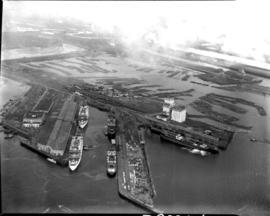
Aerial view of Tacoma industrial Tideflats in 1954 with major focus on the Port Industrial Waterway. Mothballed WWII flattops are positioned close to the U.S. Naval Station. A collection of log booms are amassed in the Sitcum Waterway. The tip of Mount Rainier can be spotted at the top of the photograph.


Aerial photographs; Port of Tacoma (Tacoma)--1950-1960; Sitcum Waterway (Tacoma); Port Industrial Waterway (Tacoma); Logs; Rainier, Mount (Wash.);

D8245-1

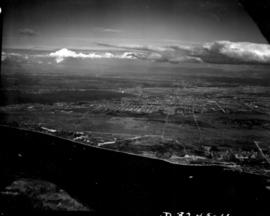
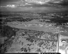
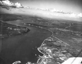
ca. 1939. Aerial view from the Narrows of Tacoma's West End with downtown and the Tideflats beyond. Running down the center of the photograph is Sixth Ave. as it veers off to Titlow Beach in the lower right hand. It is crossed by Pearl Street, where the excavation for (what is believed to be) a planned Tacoma airport forms a pattern on the ground. The area is largely undeveloped. Construction on the Narrows Bridge (Galloping Gertie) had begun but was far from completion. For a 1961 aerial view of the same location, see D129800, images 43 & 131. TPL-9156


Aerial photographs;

D8245-11

Associated Oil Company aerial view of Tacoma from The Narrows looking east. Ordered by George Martinac, North Pacific Bank Note Company.


Aerial photographs;

D8245-12

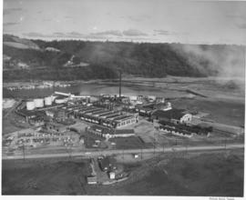
ca. 1939. Associated Oil Company aerial view of west side cement plant for first Narrows Bridge construction. Ordered by George Martinac, North Pacific Bank Note.


Aerial photographs; Tacoma Narrows Bridge (Tacoma); Bridges--Tacoma;

D8245-13

Associated Oil Company aerial view of west side cement plant and construction of west pier for first Narrows Bridge. Ordered by George Martinac, North Pacific Bank Note.


Aerial photographs; Tacoma Narrows Bridge (Tacoma); Bridges--Tacoma;

D8245-22

ca. 1939. Associated Oil Company aerial view of west side cement plant and construction of west pier for first Narrows Bridge. Ordered by George Martinac, North Pacific Bank Note. TPL-6712


Aerial photographs; Tacoma Narrows Bridge (Tacoma); Bridges--Tacoma;

D8245-3

Associated Oil Company aerial view of Northeast Tacoma, Vashon Island, and Commencement Bay. Ordered by George Martinac, North Pacific Bank Note Company.


Aerial photographs;

D8245-30

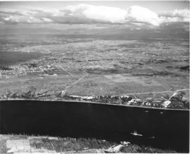
ca. 1939. Associated Oil Company aerial view of Tacoma West End showing area above Titlow Beach and Day Island. Photograph taken circa 1939. Ordered by George Martinac, North Pacific Bank Note Company.


Aerial photographs; Titlow Park (Tacoma);

D8245-4

Associated Oil Company aerial view looking south toward Lakewood. Cemetery and highway in foreground. Ordered by George Martinac, North Pacific Bank Note Company.


Aerial photographs;

D8245-5

ca. 1939. Associated Oil Company aerial view of Tacoma, West End to Downtown, tideflats and beyond. Piers for first Narrows Bridge under construction. Ordered by George Martinac, North Pacific Bank Note.


Aerial photographs; Tacoma Narrows Bridge (Tacoma); Bridges--Tacoma;

D8245-7

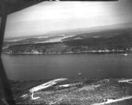
ca. 1939. Associated Oil Company aerial view of Tacoma West End from Day Island to Point Defiance and beyond. Piers for first Narrows Bridge under construction. Ordered by George Martinac, North Pacific Bank Note.


Aerial photographs; Tacoma Narrows Bridge (Tacoma); Bridges--Tacoma;

D85642-1

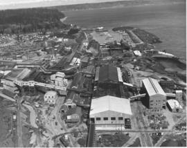
An aerial photograph of the sprawling Pennsylvania Salt Manufacturing Co. of Washington was taken in October, 1954. The Tacoma plant, whose parent company was founded over one hundred years ago in Natrona, Pennsylvania, has been at its 40 acre Tideflats location on the Hylebos waterway since 1929. Throughout the years, it has undergone rapid expansion of its facilities and also its product lines. Despite its name, it has no connection with the manufacture of table salt. Photograph ordered by Pennsylvania Salt Manufacturing Co. of Washington.


Aerial photographs; Pennsylvania Salt Manufacturing Co. of Washington (Tacoma); Chemical industry--Tacoma--1950-1960; Hylebos Waterway (Tacoma);

D87494-1

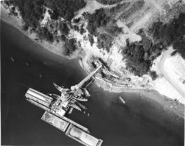
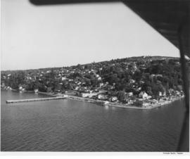
Aerial of Dash Point. Sky Harbor Airport. A pier juts out into the water. Several large residential homes can be seen at the water's edge. TPL-5564


Aerial photographs; Piers & wharves--Dash Point; Neighborhoods--Tacoma--1950-1960;

D9334-5

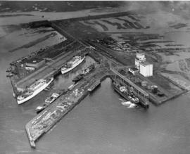
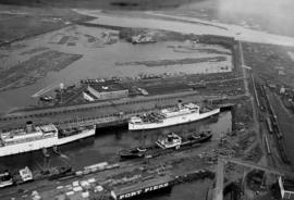
This aerial view, taken January 13, 1940, shows the Port of Tacoma piers with two docked, white transport ships. Three transport ships, the Hunter Liggett, Leonard Wood and St. Mihiel, were in Commencement Bay to transport over 7,500 soldiers from Fort Lewis to the biggest war games in US history. This is the biggest passenger embarkation in the history of the Tacoma port. The troops will invade the California coast from the sea. They will strike at an undisclosed location somewhere on the 400 mile coast between San Francisco and Santa Barbara. This will be the major offensive of the war games to be held January 15-22nd. Also in the photograph are the Co-op's white grain elevators; the waterway is crowded with log booms. The two other cargo vessels pictured are believed to be the South American freighter Coya and the Japanese freighter Koei Maru. ( T. Times 1-3-40, p. 1-article; 1-11-40, p.1-article; 1-13-40, p.1-article)


Aerial photographs; Bays--Washington (State); Commencement Bay (Wash.); Port of Tacoma (Tacoma)--1940-1950; Logs; Ships; Piers & wharves--Tacoma--1940-1950;

D9334-6

Aerial view of Port Piers on January 13, 1940, showing transport ships. Log booms in background. The three larger vessels are the military transport ships, the Hunter Liggett, Leonard Wood and St. Mihiel. They will be boarding 7500 soldiers from Fort Lewis and taking them to join the 3rd Division Black Army at sea. During the upcoming war games, the Black Army will invade the coast of California from the sea. The games are the largest in US history and involve both the Army and Navy. In 1940, the military was looking ahead to possible involvement in the European conflict which would become World War II. (T. Times 1/11/1940, pg. 1)


Aerial photographs; Bays--Washington (State); Commencement Bay (Wash.); Port of Tacoma (Tacoma)--1940-1950; Logs; Ships;

D9334-7

In this aerial photograph from January 1940, two white Navy transport ships sit at dock in Slip No. One of the Port Industrial Waterway waiting to take on soldiers from Fort Lewis. On Friday January 13th, 7,500 soldiers boarded three transport ships to be carried to California to take part in the largest Army-Navy "war games" exercise ever held on U.S. soil, to that date. When the ships pulled out Saturday morning, Fort Lewis was virtually deserted; only a maintenance staff of a few hundred men stayed behind. (T. Times 1/11/1940, pg. 1)


Aerial photographs; Bays--Washington (State); Commencement Bay (Wash.); Port of Tacoma (Tacoma)--1940-1950; Logs; Ships;

D9927-2

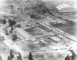
This aerial view of McChord Field from June of 1940 shows the U.S. Army's Northwest airbase shortly before it was dedicated on July 3rd. The massive building in the center is the new enlisted men's barracks which could house 1,200 men. In the upper right corner are two of the six-story tall hangers that housed the base's fleet of 24 Douglas B-18A "medium" bombers. The Army had already spent $7 million building the airbase, and millions more would be needed before it was completed. (T.Times 7/1/1940 p.1)


Aerial photographs; McChord Field (Tacoma);

G55.1-092

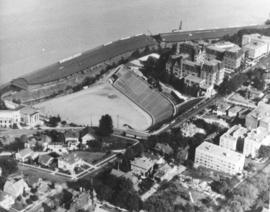
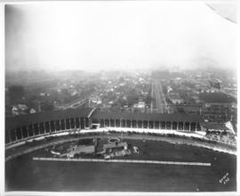
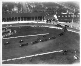
ca. 1971. This is an aerial view of the Stadium district as photographed circa 1971. Stadium Bowl is in the center with Stadium High School on the right and the Washington State Historical Society Museum on the left. Stadium Bowl, built in 1909, has been renovated circa 1980 and been subjected to several damaging mudslides in 1932, 1949, and 1981. It now has a modern capacity of 15,000, downsized from its original seating capacity of 23,486. Stadium Bowl was originally designed by Tacoma architect Frederick Heath. BU-11652


Aerial photographs; Aerial views; Neighborhoods--Tacoma--1970-1980; Stadium Bowl (Tacoma); Stadium High School (Tacoma); Washington State Historical Building (Tacoma);

G8.1-009

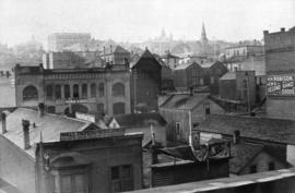
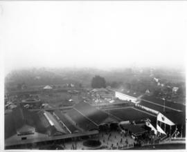
ca. 1894. Business district of Tacoma (copy of original), circa 1894. Many of the streets surrounding Pacific Avenue in the 1890s, even then the heart of the city's financial district, were filled with a hodgepodge of wood framed buildings and more substantial brick structures. At the foreground are the Pioneer Paint Store, sellers of wallpaper, mouldings, paints, and glass and W.H. Robison's, where new and second hand goods could be purchased. The Freeman & Boggs livery stable, near left center, stood near the corner of 13th & Pacific. George A. Boggs, who was City Treasurer before going into private business, had been sent away to the state pen in Walla Walla after auditors found a $109,000 shortage in the city books. Also in the far right background is the steeple of the original St. Leo's Church near So. 11th & "D" St. S7.2, TPL-378 (Researched by Murray Morgan)


Commercial streets--Tacoma--1890-1900; Business districts--Tacoma--1890-1900; Freeman & Boggs Livery (Tacoma); Pioneer Paint Store (Tacoma); W.H. Robison (Tacoma);
G8.1-070

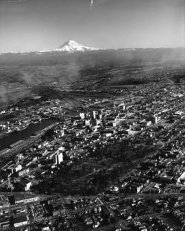
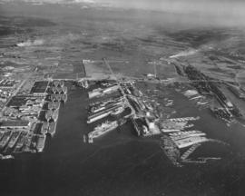
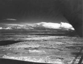
ca. 1960. Aerial view of Tideflats and downtown Tacoma area, including Wright Park and slices of Division Avenue, ca. 1960. Mount Rainier looms in the background, overlooking the industrial area of Tacoma, City (now Thea Foss) Waterway with its boats and log dumps, and the 11th St. Bridge. Familiar buildings such as the Puget Sound National Bank, Rust, and Washington buildings can be spotted on Pacific Avenue. The County-City Building with its two wings and the State Armory are in mid-photo. The wooded area is Wright Park with its meandering paths clearly marked. Adjoining the park at 9th & Division is the Greek Ionic styled First Church of Christ, Scientist. TPL-9664


Aerial photographs; Neighborhoods--Tacoma; Wright Park (Tacoma); Rainier, Mount (Wash.);

G9.1-084

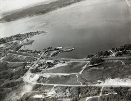
ca. 1948. Aerial view of ASARCO. Lying just beyond the smelter is the Tacoma Yacht Club, followed by the ferry dock. The residential area to the left top is Ruston and the wooded area beyond is Point Defiance Park. TPL-8656


Boathouses; Boats; Tacoma Yacht Club (Tacoma); Mooring; American Smelting & Refining Co. (Tacoma); Smelters--Tacoma--1950-1960; Point Defiance Park (Tacoma);

G9.1-085

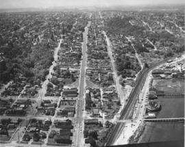
ca. 1958. Aerial view of No. 30th Street and Ruston Way. The largest street running vertically in the photograph is No. 30th Street. The street running along side of the water is Ruston Way. Just below the bottom of the picture is the intersection with Starr Street. The next street (that crosses the railroad tracks) is McCarver. The businesses running along Ruston Way (from the bottom up) are the Ocean Fish Mart, the Top of the Ocean nightclub, a small office building, Tacoma Boat Mart and the Dickman Lumber Mill (the largest group of buildings.) TPL-8657


Aerial photographs--Tacoma--1950-1960; Ocean Fish Mart (Tacoma); Top of the Ocean (Tacoma); Dickman Lumber Mill (Tacoma);
G9.1-112

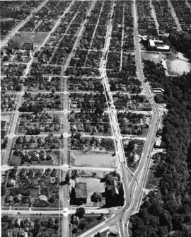
ca. 1961. Aerial looking south by Oswald Flying Service of the neighborhoods including the Lincoln district circa 1961. Lincoln High School (701 So. 37th) and Lincoln Bowl are near the top right adjacent to So. "G" St. Cartozian & Sons Rug Co., in the large old Bye Thompson Motors building at 3320 So. "G," is further north. The massive stand of trees is part of Lincoln Park. The street to the left of "G" is Tacoma Avenue. The big building in the upper center on Tacoma Avenue is the St. Joseph Catholic Church, at the corner of So. 34th & Tacoma Ave. Holy Rosary Catholic Church, school and rectory (in the 500 block of So. 30th) are near the bottom center of the photograph. Delin St. is at the very bottom of the picture. At the upper left corner of the photograph is Pacific Avenue. Mountain View General Hospital (later renamed Puget Sound General Hospital in 1969) is at 3572 Pacific Ave., the large set of buildings near the upper left corner. G9.1-112


Aerial photographs; Neighborhoods--Tacoma--1960-1970; Streets--Tacoma--1960-1970; Holy Rosary Church (Tacoma); Lincoln High School (Tacoma); Lincoln Bowl (Tacoma); Cartozian & Sons Rug Co. (Tacoma); St. Joseph's Catholic Church (Tacoma);

G9.1-136

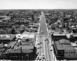
ca. 1970. This is how South 38th St. looking west appeared circa 1970. Yakima Ave. is at the bottom of the photograph. Identified businesses (from left) on Yakima are the Brad Bannon Insurance Co. (3808 Yakima) and the Oroweat Bakers (3802 Yakima). The Arctic Circle Drive-In is nearby at 820 So. 38th St. Also facing 38th St. is the Hartman Furniture store at 803 So. 38th (across the street from Oroweat). On the same side of So. 38th St. as Hartman's but further west is Failor's Pharmacy. The area has had a thriving business district for several decades.


Streets--Tacoma--1970-1980; Neighborhoods--Tacoma--1970-1980; Brad Bannon Insurance Co. (Tacoma); Oroweat Bakers (Tacoma); Arctic Circle Drive-In (Tacoma); Hartman Furniture (Tacoma); Business districts--Tacoma--1970-1980;

RD23-3

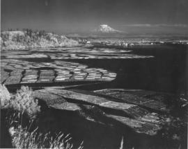
ca. 1943. Mount Rainier rises ghostlike above the Hylebos Waterway in this test photograph with the new infrared film. Log booms make designs in the water leading up to the Tideflats. Foliage has an eerie white glow. The photograph is believed to have been taken from the vicinity of the Cliff House.


Aerial photographs; Hylebos Waterway (Tacoma);

TPL-010

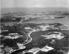
ca. 1939. Artistically modified aerial view of West Tacoma and the Tacoma Narrows. The bridge and the ship under it in the photo were painted in. The bridge was not yet complete in 1939. It would open for traffic on July 1, 1940 and go down in dramatic fashion on November 7, 1940.


Aerial views; Aerial photographs; Neighborhoods--Tacoma--1930-1940; Tacoma Narrows Bridge (Tacoma);

Results 781 to 810 of 824